Download
1 / 14
140 likes | 258 Views
The NASA Short-term Prediction Research and Transition (SPoRT) Center. GOES-R Proving Ground Update 6 May 2013. Contributions from: Kevin Fuell, Geoffrey Stano, Matt Smith, Gary Jedlovec. General Outline - SPoRT Status Report: Total Lightning

E N D
The NASA Short-term Prediction Research and Transition (SPoRT) Center GOES-R Proving Ground Update 6 May 2013 Contributions from:Kevin Fuell, Geoffrey Stano, Matt Smith, Gary Jedlovec
General Outline - SPoRT Status Report: • Total Lightning • GOES-R VSP Visit to Colorado LMA (BOU, CYS, CIRA) • HWT support • AWC Summer Experiment • Operations Proving Ground • RGB Imagery • Snow-Cloud RGB comparison • GOES-R VSP Visit to NHC for Tropical PG training • AWG Support • QPE (NESDIS) & Layer PW (CIRA) Transition/Evaluation • GOES-R CI Support • AWIPS II • EPDT Workshop summary and plans • JPSS • Users submitted examples • VIIRS night-time imagery evaluation during fire weather season
GOES-R Visiting Scientist Trip Pseudo-GLM • April 15-19 to WFOs Boulder and Cheyenne • Also CSU / CIRA • Objective: • Receive real-time Colorado LMA data for GOES-R • Coordinate with CIRA / CSU to transition these data to WFOs Source Densities • Discussions covered numerous topics • Fire and severe weather applications • Lightning safety • Available to both Boulder and Cheyenne • Boulder will go to AWIPS II soon
Total Lightning Activities for HWT • SPoRT collaborating with 8 LMAs • Langmuir available this summer • Provide PGLM suite • Use SPoRT AWIPS II plug-in • SPoRT / MDL tracking tool • Training provided Collaborating Networks Washington D.C. Colorado Oklahoma North Alabama Langmuir Laboratory West Texas Kennedy Space Center Houston
AWC Summer Experiment • Expand on last year’s Visiting Scientist visit to AWC / SPC • Providing all collaborating networks in the PGLM Mosaic • Available in N-AWIPS • Currently at AWC and SPC • Coordinating with Michael Folmer for additional use • Will be part of 2013 AWC Summer Experiment • Updating display to show network status bars • Developing national center specific training PGLM Mosaic in N-AWIPS for National Centers
Operations Proving Ground • SPoRT / MDL total lightning tracking tool selected for evaluation • AWIPS II tool • Will occur later in summer • Address #1 forecaster request • Time series of total lightning observations • Evaluate: • Manual tracker • Time impact • Utility
RGB ImagerySnow-Cloud Comparison Summary ABQ Feedback for March 23, 2013 • Providing CIRA and SPoRT products to Front Range users • Purpose is to work with users to develop single product • Brian Guyer of ABQ looked at 3 cases • Clouds more easily identified with CIRA’s color pallet • Snow cover change easier to identify in SPoRT version • Snow seen on peaks and between stratocumulus has more contrast w/ SPoRT version (value unclear) • Rebecca Mazur and Rob Cox of CYS working to ingest/display RGBs • Sent them data for 3 cases in April to do comparison • SPoRT to combine feedback with others and discuss on coordination call • CIRA (left) and SPoRT (right) versions of a Snow-Cloud RGB • User Input: Snow melt over TX/OX panhandle easier to see in SPoRT
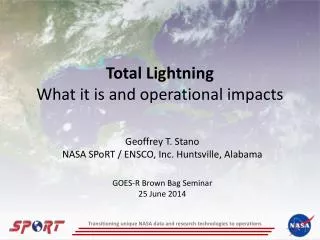
RGB Imagery – VSP Visit to NHC Hurricane Igor, 14 September 2010 • Thanks to: • Chris L. and Jack B. for hosting • CIRA for including SPoRT in Tropical PG activities • EUMETSAT for visit by JochenKerkmann • GOES VSP for trips to WMO RGB workshop (2012) and NHC (2013) • Kerkmann provided … • Insight to Air Mass and Dust RGBs (it’s more than just for dust) • Introduction to Day-time Microphysics and Convective Storms RGBs • Why microphysical information helps diagnose storms along with thermal and physical properties • Sun glint issues • Focus for use in TCs and testing • Fuell/Kerkman provided … • Case examples from 2004-11 • Disccusion of 2012 Hurricanes Leslie and Michael with comparisons to single channel imagery via stills and loops (Thanks to M. Folmer for help on this as well) Smaller ice particles in southwest eye wall Larger ice in S/SE area, even though 11um is similar to southwest area
AWG Support by SPoRT • QPE (NESDIS) • Ending Evaluation by W. Coast • Planning OCONUS Evaluation • AK, HI, San Juan (late June – Aug) • Presentation May 15 to AK Reg. • GOES-R CI • Supporting HWT • Ingest/Display to WFO partners • Supporting data to other groups QPE Alaska QPE Hawaii
UAH GOES-R CI Nowcasting Algorithm • Latest version uses RAP model data and satellite interest fields in a logistical regression framework to produce true probabilities of CI. • Coverage over CONUS • Includes a snow mask • To be evaluated at HWT-2013 • Ongoing 2013 Activities include the addition of a lightning initiation component • Proposed evaluation at the AWC testbed in August • Ongoing activities to support ESRL • Assimilate into experimental RAP model
Experimental Products Development Team (EPDT) 18-22 March 2013 Huntsville, AL @ NASA/SPoRT Presenters • Jason Burks (NASA/SPoRT) EDEX & Data plug-ins • Max Schenkelberg (Raytheon) Viz plug-ins • Ed Mandel (NWS OST/SEC) Software Governance • Ken Sperow (MDL) VLab • Matt Foster (NWS/CRHQ) GRIB ingest Presentations /documents are on VLab Hands-On Exercises • EDEX plug-in • Viz plug-in Brainstorming sessions • AWIPS II enhancements • data additions Next steps • Biweekly training telecons continue • Team composition TBD • Next Meeting tentatively Fall 2013
JPSS Proving Ground Activities VIIRS data in forecasters’ hands More partner WFOs (AWIPS) being added (8 done, 6 to go) AWIPS II partners on deck JPSS Monthly Science Seminar Series Feb. 19 SPoRT JPSS PG Activities with WFOs/National Centers Presented by Gary Jedlovec Feature article #4 from JPSS Program Science VIIRS Night-time Imagery Evaluations – being planned Front Range (ABQ, BOU, CYS, TFX) for fire weather season Include DNB, Night-time Microphysics, and IR single channels Coordinate with other Fire Wx PG efforts as needed Have sent Quick Guides on VIIRS and DNB to 10 WFO partners Presentation to HSU and TAFB (NHC) users April 25 Basics of VIIRS and DNB imagery Examples of Reflectance and RGB version To provide for use in NAWIPS Left “Quick Guide” training in laminated form with them (Hugh Cobb) and will send more NAWIPS Display High Level Clouds Low Level Clouds Or Sources
JPSS Proving Ground Activities • Wide World of SPoRT - Blog Posts • Day-Night Band (HUN) • http://nasasport.wordpress.com/2013/03/27/full-moonlight-observations-with-the-viirs-day-night-band-imagery/ • Dust RGB (ABQ) • http://nasasport.wordpress.com/2013/03/23/classic-mid-latitude-dynamic-dry-slot-event-for-new-mexico/ Extent of snow cover easily seen in DNB image VIIRS DNB Radiance RGB 0752 UTC 27 March 2013 ABQ WFO blog post graphic
End of Slides - Questions