Download
1 / 22
230 likes | 390 Views
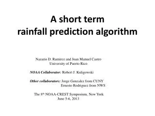
A short term rainfall prediction algorithm. Nazario D. Ramirez and Joan Manuel Castro University of Puerto Rico NOAA Collaborator: Robert J. Kuligowski Other collaborators: Jorge Gonzalez from CUNY Ernesto Rodriguez from NWS The 8 th NOAA-CREST Symposium, New York

E N D
A short term rainfall prediction algorithm Nazario D. Ramirez and Joan Manuel Castro University of Puerto Rico NOAA Collaborator: Robert J. Kuligowski Other collaborators: Jorge Gonzalez from CUNY Ernesto Rodriguez from NWS The 8th NOAA-CREST Symposium, New York June 5-6, 2013
Description of the problem • During the last decades there is a large motivation on determining the spatial variability of rainfall potentials with purpose of coupling a hydrological numerical model to predict flash flood. • There are physical and statistical models to predict the spatial rainfall distribution: • Mesoscale numerical models: • Base on dynamics and thermodynamic, balance of energy and momentum , etc. • Statistical methods: • Time series models, point processes, neural networks, Kalman Filter , and probability models.
Objectives • To develop a new algorithm for predicting one to two hours in advance the spatial distribution of rainfall rate. • To use time series models and radar (or satellite) data to predict rainfall rate. • Compare the performance of the proposed method with the performance of the WRF model.
General description • The introduced algorithm includes four major components: • Detecting rainy cloud cells • Estimating the cloud motion vector • Predicting rainy pixels (expected rainfall area) • Predicting rainfall rate (at the pixel level)
The cloud motion vector The motion vector for a rainfall event that occurred on October 27, 2007 (at 19:15 and 19:30 UTC)
Projecting rainy areas • Clouds are assumed to be rigid objects that move at constant velocity. • The cloud motion vector is used to project the rainy pixels. • Potential rainy pixels =projected area
Identification of the rainy pixel stages Prediction area Training area is the velocity of the rainfall cell at time t-1 • direction of the cell motion vector and the position vector of a given pixel at time t-1 • the difference of radar reflectivity for a given pixel between time t-1 and t-2. • effective radius at a given pixel at time t-1 (from GOES daytime) • the K-index at a given pixel at time t-1 (from WRF)
Lead time • Lead time = 30, 60, and 90 min t t -1 t-2 t+1 30 30 30
Prediction of rainy pixels (only radar data) 60 min Observed Predicted 90 min
Rainfall prediction model Spatial and Temporal Predictors (Pixels) 169 Neighbor Rainfall Pixels Indicators with one and two lags (106 possible predictors)
WRF Model Domain to simulate Rainfall Events Spatial Domains. • The Global Forecast System (GFS) is run four times a day and produces forecasts up to 16 days in advance, but with decreasing spatial and temporal resolution over time WRF Domain Configuration
Summary and future work • Summary • The algorithm includes a detection of rainy cloud cell and a cloud motion vector determination. • The cloud motion vector is used to predict rainy pixels area. • To properly represent the spatial variability the radar covered the radar area was divided into smaller regions and each region is used to develop a single regression model. • The predictors are collected from the previous two rainfall images and forward selection algorithm is used to determine the best predictors in each region. • The implemented lead time was 30, 60 and 90 minutes. • Future work • Optimize WRF for the Puerto Rico climate conditions and • Use a probabilistic approach to improve the detection of dissipating pixels
Albedo (3.9μm) (from GOES) • Albedo is estimated as follows: • where: • R3.9 is the observed radiance from band 2 • Re3.9is the equivalent black body emitted thermal radiation at 3.9 microns for cloud at temperature T • S is the solar irradiance of GOES 12 • α is the albedo at 3.9 microns Albedo from October 27, 2008 (18:35 UTC)
Effective radius and albedo computed from the lookup tables developed by Lindsey and Grass (2008).
Atmospheric instability K-Index • K < 15 near 0% Air mass thunderstorm probability • 15-20 <20% Air mass thunderstorm probability • 21-25 20-40% Air mass thunderstorm probability • 26-30 40-60% Air mass thunderstorm probability • 31-35 60-80% Air mass thunderstorm probability • 36-40 80-90% Air mass thunderstorm probability • K > 40 >90% Air mass thunderstorm probability
Acknowledgments • National Oceanic and Atmospheric Administration (NOAA) • Grant # NA08NW54680043 • Grant #NA06OAR4810162