Download
1 / 27
280 likes | 452 Views
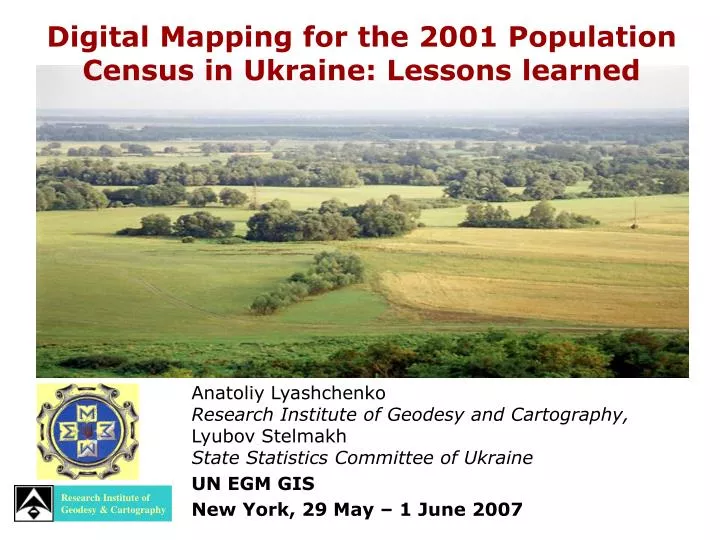
Research Institute of Geodesy & Cartography. Digital Mapping for the 2001 Population Census in Ukraine: Lessons learned. Anatoliy Lyashchenko Research Institute of Geodesy and Cartography, Lyubov Stelmakh State Statistics Committee of Ukraine UN EGM GIS New York, 29 May – 1 June 2007.

E N D
Research Institute of Geodesy & Cartography Digital Mapping for the 2001 Population Census in Ukraine: Lessons learned Anatoliy Lyashchenko Research Institute of Geodesy and Cartography, Lyubov Stelmakh State Statistics Committee of Ukraine UN EGM GIS New York, 29 May – 1 June 2007
Digital Mapping for the 2001 Population Census in Ukraine: Lessons learned • Specific features of the2001 census in Ukraine • Mapping and using GIS in the2001census • Lessons learned and prospective GIS solutions
Specificity of 2001census in Ukraine • It was the first national population census in independent Ukraine • The census object was the country with an area of more than 603 000 sq km, 30 000 cities and villages with a population about 50 million • For Ukraine, it was a transition period and a period of socio-economic reforms
Mapping and using the GIS in 2001 census A level of digital maps and GIS usage in All-Ukrainian population census could be consideredas transitional level
Transitional level of Mapping in All-Ukrainian2001 census • Using traditional methods, paper maps and plans to create schematic address plans and to delineate enumeration areas • Using the computer-aided system “Census-2001” for census data processing • Using GIS for mapping the census results, for creating statistical interactive electronic maps, and for distributing the results on CDs and on the Internet • Using the created maps to form geospatial database and to prepare the full usage of GIS in the next census
Cartographic supply of Ukraine • Topographical maps in standard scales: • 1:1 000 000 – 9 sheets • 1:500 000 – 26 sheets • 1:250 000 – 156 sheets • 1:100 000 – 538 sheets • 1:50 000 – 2000 sheets • 1:25 000 – 8000 sheets • 1:10 000 – 30 000 sheets Plans in the scales 1: 5 000 and 1: 2 000 for all the cities and towns – more than 350 000 sheets
Mapping in 2001 Census Using traditional methods, paper maps and plans to delineate enumeration areas was determined by the following reasons: • There were no necessary digital maps for the most of urban area • Most of the maps and plans they were created in the late 1980s • In the early 1990s, after the declaration of Ukrainian independence, a lot of administrative units and streets were renamed • Administrative and land reforms led to changes in borders of administrative units • Economical problems of the transition period and socio-economic reforms interfered with the process
Traditional Mapping in 2001 Census • 2 460 updated maps: • 1 971 plans of towns and villages • 489 maps of districts Specialists involved in updating plans and maps: in cities – 9 500 specialists in large villages – 1 300 specialists It took 20 work days
The computer-aided system “Census-2001” for census data processing • ensured the high-level computer data processing of the filled census forms: • scanning • making electronic copies of the forms • automatic recognition • verification • encoding • 2001 Census database formation • generalization the data for towns, villages, village communities, districts, regions and whole country
Using GIS for mapping the census results ! Using the unique Classifier for Administrative-Territorial Units of Ukraine (COАTUU code) in 2001 census datasets and digital maps of administrative units was essential for spatial reference of the census results digital map Statistical dataset Statistical geospatial dataset
Maps of the census results about 20 printed and electronic collections were published
Special website of All-Ukrainian population census‘2001 http://www.ukrcensus.gov.ua/
Using GIS and Statistical geospatial datasetin the modeling of administrative division
All-Ukrainian2001 census: lessonsLearned … • Census datasets integration with digital maps enables the statistical offices to increase the services capacity, to provide actual geospatial statistical data and represent them as interactive electronic maps on CDs and on the Internet
All-Ukrainian2001 census: lessons Learned … • 2. Cooperation of State Statistics Committee of Ukraine and State Service of Geodesy, Cartography and Cadastre in this area was useful for these both institutions as well as for users of their product. It determined by the following main factors: • geospatial statistical data turn into to one of the major informational resources for e-government systems, where GIS is a prime component • digital maps, integrated with statistical data, become geospatial database for spatial analysis and modeling within GIS rather than a simple background map • users obtain compatible geospatial datasets which could be used directly in their applications
All-Ukrainian2001 census: lessons Learned … Problems: With the growth of the number of users of geospatial statistical datasets, there arises a problem of maintenance of different software (different database systems and GIS tools). Solution: To solve the problem there should be developed standards for digital representation and formats of geospatial data exchange with the use of XML and GML specifications and international standards ISO 19100
All-Ukrainian2001 census: lessons Learned… 3. One of the most important conditions for successful application of GIS by statistical institutions in preparing and carrying out census is availability of updated digital address plans of the residential areas. For Ukraine it means about 1 342 cities and 28 562 villages To create and update the digital address plans it is necessary to establish the corresponding institutional, normative and technologic base
Possibl solution to the problems ! National SpatialData Infrastructure • Statistical institutionsare the key participants in the process of establishing NSDI and its stability functioning as they: • are interested in availability of high quality digital plans and maps, which can be used in GIS, for preparation and census conducting and other demo-social investigations • are the main suppliers of the official information concerning different aspects of the life of the society, the condition of the economy and the environment
Realizing the strategy of the full usage of GIS in the next census • A guide for creation of the geospatial data for census GIS, including digital address plans was developed • Digital maps of administrative units of the country were created, including the borders of all the town, villages, districts, and regions • An alpha-version of GIS for census delineation was developed • Digital address plans for biggest cities were created • Within the preparation work for 2011 census there was carried out a pilot project of GIS implementation in census delineation as a micro-census • Developed a software complex SIMAP for preparing and publishing the statistical electronic interactive maps in SVG format
Census areas delineation Spatial Data Base of Census Areas Address plan Instruction areas Address Registry Enumeration areas GIS for census delineation Kiyv, microdistrict “Beriazhiaky”
Complex SIMAP for publishing the statistical interactive SVG-maps
Complex SIMAP for publishing the statistical interactive SVG-maps Digital maps in GIS formats Geodata sets in GML format Project of SVG-maps and CSS GIS SVG-converter Web-server SVG maps Statistical Data Base SVG-map JavaScript function Data& metaData(XML) ? Query Data& metaData(XML) Client Internet Explorer +Adobe SVG-Viewer
Conclusion In the Ukrainian 2001 census, digital maps and GIS were used at the final stage of the census data processing for thematic maps creation and also their presentation and distribution in the form of interactive electronic maps. We gained good experience in the state statistics and mapping offices cooperation in applying GIS into statistical practices and integrating the statistical data into NSDI. The software complex SIMAP proved to be an effective means in formation and distribution of the statistical data in the form of interactive electronic maps in SVG format.