Download
1 / 42
440 likes | 592 Views
Mapping Eelgrass Beds Using Hyperspectral Airborne Imagery. Kelley Bostrom University of Connecticut NASA OCRT Meeting May 12, 2010. Acknowledgements. University of Connecticut. Heidi Dierssen Christopher Buonassissi Jeff Godfrey Dirk Aurin Kate Randolph.

E N D
Mapping Eelgrass Beds Using Hyperspectral Airborne Imagery Kelley Bostrom University of Connecticut NASA OCRT Meeting May 12, 2010
Acknowledgements • University of Connecticut • Heidi Dierssen • Christopher Buonassissi • Jeff Godfrey • Dirk Aurin • Kate Randolph • Florida Environmental Research Institute (FERI) • Paul Bissett and SAMSON imagery • NOAA GOES-R and CICORE programs • NASA Ocean Biology and Biogeochemistry Program • ITT Visual Information Solutions Technical Support
Value of seagrasses • 2nd most valuable aquatic resource (per area) • (Costanza et al., 1997) • Economic factors • Disturbance regulation • Stabilizing the sediments • Current moderation • Nutrient cycling • Food production • Nursery and habitat for commercially important species
Water clarity • Light limited Indicator species death Short, F. T. http://marine.unh.edu/jel/faculty/fred2/fredshort.htm
Monitoring seagrass • Current distributions need to be quantified • Monitoring changes is important for resource management • Carbon limited • Increasing atmospheric CO2 may be beneficial • Potential ecological winners • Precise, efficient measurement tools needed
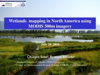
Seagrass distribution and diversity Global distribution Efficient mapping Short, F.T, W.C. Dennison, T.J.B. Carruthers, M. Waycott. 2007. Global Seagrass Distribution and Diversity: A Bioregional Model. Journal of Experimental Marine Biology and Ecology 350: 3-20.
Mapping methods • In situ surveys • Time and labor intensive • Lack spatial resolution • Aerial photography • Good for boundary mapping • Not quantitative data • Ocean color remote sensing • Quantitative data • High spatial and spectral resolution
Study Objectives • Quantify eelgrass distribution and density in a shallow, turbid estuary • Determine analysis methods that can be used successfully in this challenging environment
Distribution of Zostera marina (eelgrass) Green, E.P. and Short, F.T. (eds.). 2003. World Atlas of Seagrasses. University of California Press, Berkeley, USA. 324 pp.
Elkhorn Slough Buonassissi and Dierssen. Accepted. JGR
SAMSON imagery (FERI) • Flight on Sept 11, 2006 • 156 wavebands, 400nm to 900nm • Pixel size 1m2 • 200m wide • 2km long • Swath
Figure by Eric Louchard • AC-9 • Backscattering meter • HyperPro • Divespec • ASD and integrating sphere • LISST FERI
Data collection Heidi Dierssen
Particle Size Distribution Buonassissi and Dierssen. Accepted. JGR Station 2 Station 3
Transects • Sept 7, 2006 • 30m in length • 2 – 2.5 m deep Station 3 Station 1
Transects • 21 total stations • Counts of eelgrass shoot density taken at 5m intervals • Quadrat size: 20cm x 20 cm = 0.04m2 Thalassia in the Bahamas H. Dierssen
Leaf Area Index (LAI) Height * width * # of leaves (m2) Area of quadrat (m2)
Bahamas LAI ~3 Florida Bay LAI ~9 Bare sediment (7) Dense (6) Sparse (8)
Measured in situ (transects) Modeled (Hydrolight) Image spectra Modeled (Hydrolight) OR Spectral library Classification algorithm (ENVI) mapped image of eelgrass beds
Reflectance of eelgrass normalized to 555nm Hydrolight Image
Measured in situ (transects) Image spectra Modeled (Hydrolight) OR Spectral library Classification algorithm (ENVI) mapped image of eelgrass beds
Spectral Library: Transects Known bathymetry
Measured in situ (transects) Image spectra Modeled (Hydrolight) OR Spectral library Classification algorithm (ENVI) mapped image of eelgrass beds
Spectral Information Divergence Probabilistic approach to characterize spectral similarity and variability (C.-I Chang, 1999) • Useful in this environment • Accounts for mixed pixels • Hyperspectral pixels • Hundreds of bands • Unknown interferers • Advantage over other methods
Results, 3 endmembers(with bathymetry) Dense Eelgrass Sparse Eelgrass Bare Sediment
Results, 3 endmembers(with bathymetry) Dense Eelgrass Sparse Eelgrass Bare Sediment
Results, 4 endmembers(without bathymetry) Dense Eelgrass Sparse Eelgrass Bare Sediment Deep Water
Dense Eelgrass Sparse Eelgrass Bare Sediment Deep Water
Results, 3 endmembers(with bathymetry) Dense Eelgrass Sparse Eelgrass Bare Sediment
Accuracy of classification18 validation points from transects 50% accuracy 83% accuracy Transect point uncertainty More errors in calculating density than in distribution
Summary • Despite working in a dark, challenging environment, we were able to quantify the eelgrass distribution and density with relatively good accuracy • Measured endmembersnecessaryfor accurate classification • With the quantified classification method, estimates of LAI can be retrieved from image data
Future work • Improvement of classification and modeling • Retrieval of bathymetry from image • Two-step classification • Model spectral library • Applications • System net primary productivity estimates from LAI • Climate change scenarios • Monitor eelgrass ecosystem stability and health • Environmental damage assessment