Download
1 / 61
620 likes | 796 Views
Airborne Laser Swath Mapping of Landslides. Vernon R. Schaefer. 27 th Annual ASCE Geotechnical Conference Amana Holiday Inn, Williamsburg, Iowa March 6, 2003. Department of Civil and Construction Engineering Iowa State University Ames, Iowa. Acknowledgments.

E N D
Airborne Laser Swath Mapping of Landslides Vernon R. Schaefer 27th Annual ASCE Geotechnical Conference Amana Holiday Inn, Williamsburg, Iowa March 6, 2003 Department of Civil and Construction Engineering Iowa State University Ames, Iowa
Acknowledgments • South Dakota State University: Suzette Burckhard, Jason Boomer, Holly Boomsma • University of Florida: Dave Bloomquist, Ramesh Shrestha, Ryan Morrison • National Science Foundation • U.S. Army Corps of Engineers • SD Department of Transportation
Introduction • What is ALSM-Airborne Laser Swath Mapping? • Background on ALSM • What are its advantages? • What are its drawbacks? • Scope of our NSF SGER project, application to landslides • Field work • Office work • Lessons learned
What is ALSM:Airborne Laser Swath Mapping? • A pulsed laser ranging system is mounted in an aircraft with a precise kinematic Global Positioning System to position the aircraft and and an accurate inertial navigation system to monitor the orientation of the aircraft (roll, pitch & yaw). • Using this system the distance between the laser sensor and the illuminated spot on the ground can be measured. • The laser scanner consists of a laser ranging unit, an opto-mechanical scanner, and a processing unit.
Advantages of ALSM • Overlapping capabilities and applications with conventional photogrammetry • Laser swath mapping uses an active light source versus natural light • eliminates sun angle restrictions • laser can penetrate some vegetation • With LSM data is intrinsically digital and computer readable • automated operations and analysis of data • combine with new digital cameras • Bathymetric mapping capabilities
Disadvantages of ALSM • Emerging technology • Most data reduction is proprietary • Data storage is computer intensive • Data analysis is computer intensive • Cost - still in research stage, a few commercial applications
U of Florida System • Cessna 337 in-line twin engine aircraft • Optech Model ALTM 1210: • 10,000 laser pulses per second, now 33,000 p/s • 330 to 2000 meter operating height • Swath width- 0 to 0.68 times altitude • Starlink real time GPS navigation unit • Astech Z12 GPS unit on plane and on ground • Resolution of 15 to 30 cm horizontally and 3 to 15 cm vertically depending upon the characteristics of the surface
Scope of NSF Research • First Phase: collection of ALSM data and assessment of ALSM data quality • Second Phase: evaluation of suitability of data for use in landslide characterization
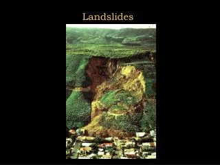
Scope of NSF Research • Map landslides along the Missouri River to evaluate ALSM capabilities • Have flown Oahe Dam and east downstream slope and Highway 212 bridge across Oahe Reservoir • Well instrumented landslides and known topography from Corps of Engineers and SD Department of Transportation • Compare ALSM results to traditional mapping methods for assessment
Forest City Oahe Dam South Dakota South Dakota
Oahe Dam Site • ALSM data collected at site of landslide downstream of east side of Oahe Dam-August 2000 and June 2002 • Corps data was haphazard in time and in accuracy • Total station used to obtain topographic expression of landslide-this spring • Data analysis using SURFER 7.0
Forest City Site • ALSM data collected at site of landslide along Highway 212 crossing Oahe Reservoir-August 2000 and June 2002 • SD DOT data was in NAVD 29 & NAD 27 rather than NAVD 88 and NAD 83 • Data analysis using ARC View with Spatial Analyst and 3-D Analyst