Download
1 / 25
250 likes | 259 Views
Regional Meeting on Transboundary Aquifers Cooperation in Africa Adaptation from NWSAS to others The Coordination Mechanism of the GICRESAIT “ Integrated and concerted management of the water resources of the aquifer systems of Iullemeden, Taoudéni / Tanezrouft and the Niger River ”

E N D
Regional Meeting on Transboundary Aquifers Cooperation in Africa Adaptation from NWSAS to others The Coordination Mechanism of the GICRESAIT “Integrated and concerted management of the water resources of the aquifer systems of Iullemeden, Taoudéni / Tanezrouft and the Niger River” 05 – 08 september 2017, Tunis - TUNISIA
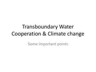
Adaptation of the SASS approach West Africa, East Africa Current Studies Projected studies Studies not initiated Studies carried out Lakes Limits of basins Rivers
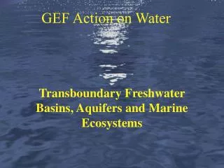
IULLEMEDEN – TAOUDENI / TANZEROUFT Aquifer System Legend Waterways Niger River Watershed ITAS limit City
GICRESAIT : Challenges & Consequences Challenges • Groundwater Potential Poorly Known • Tools for managing these insufficient resources (Database, Information System, Model) • Data and information not available in quantity or quality. • Transboundary management of groundwater until then carried out in a non-concerted manner (absence of a management framework) • CONSEQUENCES • Trend towards medium- and long-term overexploitation due to uncontrolled harvesting combined with the effects of climate change • Irreversible degradation of the quality of water resources that will affect human and animal health
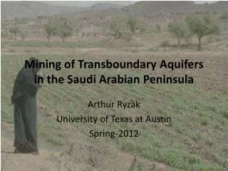
GICRESAIT : Origin of the project A first initiative was launched in 2004 (completed in 2009), with the study of "Hydrogeological Risk Management in the Aquifer System of Iullemeden (IAS)" shared mainly by Mali, Niger and Nigeria on 500,000 km2. • 2 aquifers: • Continental intercalaire • Continental Terminal
IAS: Iullemeden Aquifer System – Main Results • Topographic and geological maps digitized at 1 / million; • Transfrontier Diagnostic Analysis 3 major risks identified : • Risk n ° 1: decrease of the resource, • Risk n ° 2: degradation of water quality, • Risk n ° 3: Negative impacts of climate change. • Database with more than 17,200 water points; • Geographic Information System thematic maps: piezometry, distribution of water points by decade, hydrodynamic parameters; • Mathematical model : hydraulic relationships Aquifers - Niger River determined; • Remote sensing :Numerical model of ground, Maps of land use, dynamics of surface waters, Recharge of the nappes; • Protocol of agreement accompanied by a Roadmap for the IAS's Water Resources Management Coordination Mechanism; • Several documents have contributed to consolidate these achievements.
IAS: Risks identified 1st Risk : Decreased resource 3rd Risk: Human health problem due to fluoride excess (over 6 mg / l) 2nd Risk: Domestic pollution Overexploitation threshold since 1995 4th Risk: Negative Impacts Climate variability Need to invest in flood drainage to feed groundwater
Creation of a framework for consultation • CONVINCED of the need for a regional approach to the management of groundwater which they share in the face of these cross-border risks and for which the efforts of one country can not find a remediable and sustainable solution • CONSIDERING that the products and results obtained are common tools of decision support already available and operational at the level of the countries concerned The 3 countries have engaged on a process of setting up a consultative framework before the resources of the IAS are in a situation of water stress
Processus de Création d’un Cadre de concertation • National and Regional Consultations (in 2005) : State of play of legal and institutional instruments. • Regional Workshop (Niamey, May 29 - June 1 2005) : Identification of the type of consultation mechanism • Regional Workshop at FAO Headquarters (Rome, 19-20 October 2006): Development of the Canvas of the draft Memorandum of Understanding • Regional Workshop of the Directors of the three countries (Tunis, 23-28 June 2008, OSS): Preparation of a draft protocol agreement “Creation of the Consultative Mechanism for IAS Management” • Meeting of Ministers (Bamako, 20 June 2009) preceded by the Meeting of Experts (Bamako, 17-19 June 2009): Adoption of the Memorandum of Understanding(47 Articles) with a roadmap for its establishment
IAS Concertation Mechanism Meeting of Experts Meeting of Ministers 1st Meeting of Ministers held in Bamako (20 June 2009) to set up the Concertation Mechanism of the Iullemeden Aquifer System: A Memorandum of Understanding was unanimously adopted
Status, Objective & Organs of the IAS Coordination Mechanism STATUS:The Mechanism shall have legal personality with the capacity to contract, to call upon technical assistance, to institute legal proceedings. OBJECTIVE:Promote cooperation based on solidarity and reciprocity for sustainable, equitable and coordinated use of IAS water resources. Mechanism bodies: • The Council of Ministers ; • The Ad Hoc Technical Committee of Experts; • The National Technical and Scientific Committees; • The Executive Secretariat.
GICRESAIT SAI : 2ème phase (2011-2017) Algeria Benin Mauritania Burkina Mali Niger Nigeria 0.5 to 2.5 M km2 From 3 to 7 countries Regional Integration Membership of the 4 "River" countries due to: • Same agro-climatic context; • Hydraulic relations between the Niger River and the aquifers; • Hydraulic continuity in the same aquifers of the Taoudéni and Iullemedenbasins; • Identical cross-border risks that threaten these water resources;
Situation du Système Aquifère d’Iullemeden – Taoudéni/Tanezrouft (SAIT) Iullemeden – Taoudéni/Tanezrouft Aquifer System (ITAS) in relation to the Niger River Basin Countries concerned: Algeria, Benin, Burkina Faso, Mali, Mauritania, Niger, Nigeria Area: 2.500.000 km2; Population living in the basin: 30 million inhabitants Potential for arable land: over 137 million ha; Cultivated area: nearly 46 million ha
GICRESAIT : Objectives Goal: Significant improvement in the concerted and sustainable management of the water resources of Iullemeden and Taoudéni / Tanezrouft transboundary aquifer systems, in relation to the Niger River. Methods & Means: • Assess the water potential of the IAS-TAS taking into account the vulnerability of these systems to the climate, • To define the elements of monitoring of all the groundwater resources of the IAS-TAS and the River Niger, Assist countries in developing their future development framework.
Main results and outputs of the GICRESAIT project • Improved knowledge of the aquifer system and in particular: • Water potential assessed taking into account the vulnerability of the System to climate: • 355 m3/s (ie 11 billion m3/year) in the Taoudéni / Tanezrouft basin and 243 m3/s (ie 8 billion m3/year) for the Iullemeden basin • the Niger River supplies aquifers with more than 1.5 billion m3 / year in the Taoudéni / Tanezrouft basin and receives more than double (3.3 billion m3 per year) in the Iullemeden basin downstream • Elements of monitoring of all the groundwater resources of the IAS-TAS and the Niger River defined; • A shared database built with over 122,000 water points • Several thematic maps (hydrogeology, distribution of water points, land use, geometry of aquifers, recharge of aquifers, etc.) • Hydrogeological models developed • High potential areas identified • Strengthened capacities of 70 national management tools (BD, GIS, Model, Remote Sensing) • A Web Site & a Geoportal built • Memorandum of Understanding of the Coordination Mechanism (Management Framework) signed by Benin, Mali, Niger and Nigeria
GICRESAIT: vulnerability to climate variability Mapping Groundwater Vulnerability to the Decrease of Climate Change Piezometric Levels Very low vulnerability Not very vulnerable Vulnerable Moderately vulnerable Highly vulnerable Very highly vulnerable
GICRESAIT: risk of domestic pollution Mapping the risk of organic and fecal contamination of groundwater Very low risk Low risk Average risk Strong risk Very strong risk
A real potential ... but theoretical! Such water potential is not made available to countries because requiring: • adequate means of accessing it and transfer the resource where the needs are • a planned and optimized long-term management (15 years, 30 years) • capacities (technical, material, human) It is therefore necessary to Develop investment projects especially in areas with high groundwater potential & Reflect on a concerted exploitation to improve the quality and quantity of available water
Stage of Development of the Management Framework • National & Regional Consultation: • « Descriptive and analytical review of the legal and institutional frameworks of the 7 countries »; • « Preliminary proposals for the ITAS - wide Concertation Mechanism: Preliminary draft Memorandum of Understanding » • Regional workshop on restitution and validation (Abuja, 24-25 March 2014); • Meeting of Ministers (Abuja, 28 March 2014) preceded by the Meeting of Experts (Abuja, 27 March 2014): Adoption of : • « Declaration by the Ministers "on Establishing a Management Framework « MC »; • Memorandum of Understanding (54 Articles) with a roadmap for its implementation
GICRESAIT: Coordination mechanism Meeting of Ministers in Abuja on the setting up of the Consultation Mechanism for an optimal management of the shared resource Adoption of "The Abuja Declaration" & the "Memorandum of Understanding"
Status, Objective & Organs of the IAS Coordination Mechanism STATUS:The Mechanism shall have legal personality with the capacity to contract, to call upon technical assistance, to institute legal proceedings. OBJECTIVE:promote and encourage cooperation between the signatory states of the Memorandum of Understanding and those that adhere, based on solidarity and reciprocity for the sustainable, equitable, coordinated and concerted use of ITAS water resources. Mechanism bodies: • The Council of Ministers in charge of Water Resources; • The Executive Secretariat • The Permanent Technical and Scientific Committee; • National Committees; • A Coordination Unit, headed by a Coordinator (based at the OSS).
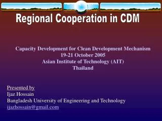
Adaptation of the SASS approach East Africa Current Studies Projected studies Studies not initiated Studies carried out Lakes Limits of basins Rivers
Duplication and improvement of the SASS approach– East Africa (IGAD Subregion) Since 2010, the approach has been adapted to the IGAD sub-region, using the same initial principle : • Improved knowledge • Construction of a Common Information System • Enhanced cooperation between countries A first phase was completed in 2013. The second is in preparation • 5.2 Million km2 • 80% of the subregion is arid and semi-arid • Population estimated at 206 million in 2010, 462 million in 2050 6 large river basins and 6 transboundary aquifer systems
Mapping, assessment and management of water resources in transboundary aquifers in the IGAD sub-region • Main achievements of the project: • An update of knowledge on water potential and development needs; • An understanding of water demand and its use for various purposes; • An assessment of key environmental issues; • A harmonized regional database, an operational information system; • Regional thematic maps produced at scales 1: 5,000,000 and 1: 1,000,000; • Elaboration of a roadmap towards enhanced cooperation for the setting-up of consultation mechanisms; • Strengthening the capacity of IGAD member countries; • A shared vision and strategic action plan for the sustainable development of water resources formulated; • A roadmap for the initiation of the process of developing a transboundary river basin organization.
Thank you for your kind attention ! www.oss-online.org https://twitter.com/OSS_Comms http://www.facebook.com/groups/osscommunity http://www.linkedin.com/groups/Sahara-Sahel-Observatory-OSS-4908101