Download
1 / 15
150 likes | 278 Views
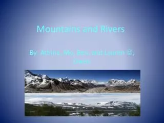
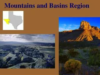
Mountains and basins. By: Lizzie, Emilie, Hannah, and Emily!. Big Ben National Park. Consists of1, 250 square miles. About the size of Rhode Island. Rio Grande flows 107 miles on southern border.

E N D
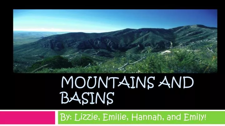
Mountains and basins By: Lizzie, Emilie, Hannah, and Emily!
Big Ben National Park • Consists of1, 250 square miles. About the size of Rhode Island. • Rio Grande flows 107 miles on southern border. • Many endangered species live there such as the Peregrine Falcon, the Black-Capped Vireo, the Mexican Long Nosed Bat, and the Big Bend Gambusia.
Guadalupe Mountains A view of the Guadalupe Mountains, midday. A scenic road into the Guadalupe Mountains. Inside the famous Carlsbad Caverns.
Davis Mountains The yellow-tinted Davis Mountains at sunset. The craggy shapes of the Davis Mountains jut into a purple sky, while the moon hovers overhead. Vegetation such as shrubs and cacti dot the landscape.
A back road leading into the Chisos Mountains The reddish landscape of the Chisos Mountains Although the Chisos Mountains are quite barren, grasses and small trees grow around the bases of the mountains. Chisos Mountains
Vegetation This is some vegetation around the mountains and basins area. Although most of the vegetation is bushes, the vegetation is pretty dense considering the trees and forests around the mountains. It is a desert.
El Paso! • 606,913 as a population in El Paso • 6th largest city. • Stands on the Rio Grande River.
Ciudad Juarez Ciudad Juarez was also known as El Paso del Norte. • As they approached the Rio Grande from the south, Spanish explorers in the colonial period viewed two mountain ranges rising out of the desert with a deep chasm between. This site they named El Paso del Norte (the Pass of the North), and it became the location of two future border cities, Ciudad Juárez on the south or right bank of the Rio Grande and El Paso, Texas, on the opposite side of the river. The arrival of the first Spanish expedition at the Pass of the North in 1581 marked the beginning of more than 400 years of history in the El Paso area. It was followed in 1598 by the colonizing expedition under Juan de Oñate. On April 30, 1598, in a ceremony at a site near present San Elizario, Oñate took formal possession of the entire territory drained by the Rio Grande and brought Spanish civilization to the Pass of the North.
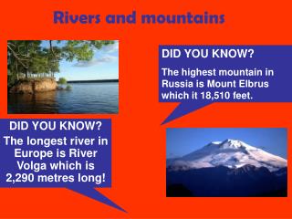
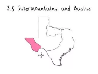
Summary • Canyons and mountain plateaus contrast with saucer-shaped basins • Almost every person in this region lives in El Paso • There are two rivers in our region, the Pecos and the Rio Grande • There are three major mountain ranges, the Guadalupe, Davis, and the Chisos • The Mountains and Basins region is part of the Rocky Mountain region
The Summary Continued • Our region is very dry • Our region has one of the states largest cities
(http://images.google.com/imgres?imgurl=http://science.nationalgeographic.com/staticfiles/NGS/Shared/StaticFiles/Science/Images/Content/guadalupe-mountains-jb012552-ga.jpg&imgrefurl=http://science.nationalgeographic.com/science/photos/permian-period/guadal) (http://images.google.com/imgres?imgurl=http://www.visitusa.com/texas/images/guadalupemountains-nationalpark/guadalupe-mountains.jpg&imgrefurl=http://www.visitusa.com/texas/national-parks/guadalupemountains-nationalpark.htm&usg=__tITadB58vRQIPpcqw1JegGoDex) (http://www.wayfaring.info/2006/12/03/carlsbad-caverns-in-guadalupe-mountains-is-maybe-the-most-colossal-cave-monument/) (http://images.google.com/imgres?imgurl=http://www.tpwd.state.tx.us/publications/parkguide/include/en/bigphoto_rgn_bb008.jpg&imgrefurl=http://www.tpwd.state.tx.us/publications/parkguide/rgn_bb_008.phtml&usg=__-DImms8hXd98wUKhfAKqCj0gN2w=&h=350&w=500&sz=35&) (http://images.google.com/imgres?imgurl=http://assets.texasmonthly.com/images/magazine/issues/2007-10-01/images_bigbend/2_davis_crop.jpg&imgrefurl=http://www.texasmonthly.com/2007-10-01/feature.php&usg=__Mq-YEIBFDSzmXK2ZedT7LqDSFY4=&h=325&w=470&sz=57&hl=en) (http://images.google.com/imgres?imgurl=http://www.stone-village.com/img30155.jpg&imgrefurl=http://www.texastrifles.blogspot.com/2003_11_01_archive.html&usg=__sHmanAXho8iblT4BkysLsViN_pw=&h=415&w=640&sz=22&hl=en&start=9&um=1&tbnid=9ct7M-wxTIgvQM:&tbnh=89&t)
(http://images.google.com/imgres?imgurl=http://media-2.web.britannica.com/eb-media/81/3081-004-A94E3EBB.jpg&imgrefurl=http://www.britannica.com/EBchecked/topic-art/113291/2639/The-Rio-Grande-flowing-through-the-desert-at-the-foot&usg=__1DqSnVtaGDDmjEOrti2t) (http://images.google.com/imgres?imgurl=http://www.calamitycreektraders.com/images/c/chisosmtns.jpg&imgrefurl=http://www.calamitycreektraders.com/new196110.html&usg=__-Z6ZqpBV-MJDTtSPl4qVVH0eMdg=&h=300&w=400&sz=47&hl=en&start=5&um=1&tbnid=WJK3fUbzfWLVfM:&t)(http://images.google.com/imgres?imgurl=http://www.comfychair.org/~cmbell/pics/chisos.jpg&imgrefurl=http://www.comfychair.org/~cmbell/people.html&usg=__MiepiJal6Js3r0BuKP21G-s5st4=&h=600&w=800&sz=104&hl=en&start=16&um=1&tbnid=9MwenPqR903mjM:&tbnh=107&tbnw=) (Anderson, 2003)(Bing.com)
Ranching • The ranching in EL Paso mainly consists of cattle and horses. The ranching is popular because there are vast areas to hold the animals. Ranching is the raising and breeding of one type of animal, such as cows. It is popular in the Mountains and Basins Region of Texas, or the western part of the state. This is because not very many crops can grow here, so the economy has to be made from ranching. Ranching in Texas has lasted for many years. The large herds of cattle are usually kept inside large fenced areas. Cowboys and sometimes farmers will keep watch over the cattle and make sure they get food and water. Sometimes if the cows are kept in an open area with no fences, the cowboys will ride up and down the field on horseback keeping an eye on all of the cattle. The herd and the cowboys will move from time to time, to different places across the Mountains and Basins region.
Precipitation in El Paso Average Rainfall Per Month in El Paso! • Jan. 0.5 cm. • Feb. 0.5 cm. • Mar. 0.4 cm. • Apr. 0.3 cm.cm. • May. 0.4 cm. • Jun. 0.8 cm. • Jul. 1.7 cm. • Aug.1.6 cm. • Sept. 1.4 cm. • Oct. 1.0 cm. • Nov. 0.50 cm. • Dec. 0.6 cm.