Download
1 / 31
320 likes | 573 Views
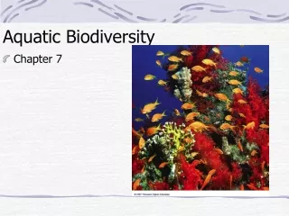
Ch. 6 Aquatic Biodiversity and Life Zones. 75% of Earth is covered with water 71% is Saltwater. Salinity of the water determines the type of life that can survive. Marine LIFE ZONES. ESTUARIES COASTAL MARSHES (WETLANDS) MANGROVE SWAMPS (FORESTS) CORAL REEFS COASTLINES OCEANS.

E N D
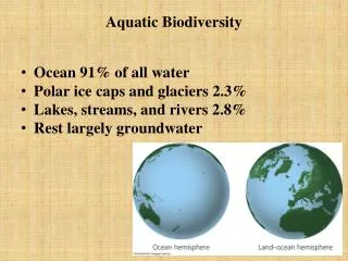
75% of Earth is covered with water71% is Saltwater • Salinity of the water determines the type of life that can survive
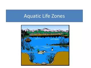
Marine LIFE ZONES • ESTUARIES • COASTAL MARSHES (WETLANDS) • MANGROVE SWAMPS (FORESTS) • CORAL REEFS • COASTLINES • OCEANS
Estuary and Coastal Wetlands • Estuaries are rivers that meet the sea where seawater mixes with freshwater (brackish water). • Coastal wetlands are land areas covered with water some or all of the year. • river mouths, inlets, bays, sounds, salt marshes=temperate zones • Mangrove forests=tropical zones
Estuaries and Coastal Wetlands: Centers of Productivity • Estuaries include river mouths, inlets, bays, sounds, salt marshes in temperate zones and mangrove forests in tropical zones. Figure 6-7
WETLANDS Fig. 6-7b, p. 131
Mangrove Forests • Are found along about 70% of gently sloping sandy and silty coastlines in tropical and subtropical regions. Figure 6-8
Estuaries and Coastal Wetlands: Centers of Productivity • Estuaries and coastal marshes provide ecological and economic services. • Filter toxic pollutants, excess plant nutrients, sediments, and other pollutants. • Reduce storm damage by absorbing waves and storing excess water produced by storms and tsunamis. • Provide food, habitats and nursery sites for many aquatic species.
CORAL REEFS • Where does the color of the coral come from? • Video- polyps and zooxanthellae
What are benefits of coral reefs? • Remove Carbon Dioxide from water (too much CO2 can form (carbonic acid) Ca2CO3!!) • Protects coastlines from waves=erosion • Habitat for marine life • Supports fishing and tourism
The Coastal Zone (COASTLINE): Where Most of the Action Is • The coastal zone: the warm, nutrient-rich, shallow water that extends from the high-tide mark on land to the gently sloping, shallow edge of the continental shelf. • The coastal zone makes up less than 10% of the world’s ocean area but contains 90% of all marine species. • Provides numerous ecological and economic services. • Subject to human disturbance.
High tide Sun Open Sea Coastal Zone Sea level Low tide Photosynthesis Euphotic Zone Estuarine Zone Continental shelf Bathyal Zone Twilight Abyssal Zone Darkness Fig. 6-5, p. 130
Rocky and Sandy Shores: Living with the Tides • Organisms experiencing daily low and high tides have evolved a number of ways to survive under harsh and changing conditions. • Gravitational pull by moon and sun causes tides. • Intertidal Zone: area of shoreline between low and high tides.
Rocky and Sandy Shores: Living with the Tides • Organisms in intertidal zone develop specialized niches to deal with daily changes in: • Temperature • Salinity • Wave action Figure 6-9
Levels of Open ocean feeders: • Plankton- 70% of primary productivity from • Phytoplankton • Zooplankton • Ultraplankton • Nekton • Turtles • fish • Benthos- bottom dwellers • Oysters, lobsters, crabs, worms • Decomposers • Specialized bacteria
Ocean Layers • Euphotic zone: brightly lit surface layer. • Nutrient levels low, dissolved O2 high, photosynthetic activity. • Bathyalzone: dimly lit middle layer. • No photosynthetic activity, zooplankton and fish live there and migrate to euphotic zone to feed at night. • Abyssal zone: dark bottom layer. • Very cold, little dissolved O2.
NPP is highest near surface where sun is abundant. • Nitrates and Phosphates are limiting factors in open oceans and limit NPP. • How do you think algal blooms affect NPP?
FRESHWATER LIFE ZONES • Freshwater life zones include: • Standing (lentic) water such as lakes, ponds, and inland wetlands. • Flowing (lotic) systems such as streams and rivers. Figure 6-14
Lakes: Water-Filled Depressions • Lakes are large natural bodies of standing freshwater formed from precipitation, runoff, and groundwater seepage consisting of: • Littoral zone (near shore, shallow, with rooted plants). • Limnetic zone (open, offshore area, sunlit). • Profundal zone (deep, open water, too dark for photosynthesis). • Benthic zone (bottom of lake, nourished by dead matter).
Lakes: Water-Filled Depressions Figure 6-15
Effects of Plant Nutrients on Lakes: • Plant nutrients from a lake’s environment affect the types and numbers of organisms it can support. • Oligotrophic(poorly nourished) lake: Usually newly formed lake with small supply of plant nutrient input. • Eutrophic (well nourished) lake: Over time, sediment, organic material, and inorganic nutrients wash into lakes causing excessive plant growth.
Effects of Plant Nutrients on Lakes:Too Much of a Good Thing • Plant nutrients from a lake’s environment affect the types and numbers of organisms it can support. Figure 6-16
Effects of Plant Nutrients on Lakes: • Cultural eutrophication: • Human inputs of nutrients from the atmosphere and urban and agricultural areas can accelerate the eutrophication process.
Freshwater Inland Wetlands: Vital Sponges • Inland wetlands act like natural sponges that absorb and store excess water from storms and provide a variety of wildlife habitats. Figure 6-18
Freshwater Inland Wetlands: Vital Sponges • Filter and degrade pollutants. • Reduce flooding and erosion by absorbing slowly releasing overflows. • Help replenish stream flows during dry periods. • Help recharge ground aquifers. • Provide economic resources and recreation.
River Zones • Source zone- cold water, clean, high DO (trout) • Transition zone- somewhat stagnant deep water, lower DO, warmer (bass) • Floodplain- algae, rooted aquatic plants, low DO, very warm, more stagnant water
Water flowing from mountains to the sea creates different aquatic conditions and habitats. Figure 6-17
Impacts of Human Activities on Freshwater Systems • Dams, cities, farmlands, and filled-in wetlands alter and degrade freshwater habitats. • Dams, diversions and canals have fragmented about 40% of the world’s 237 large rivers. • Flood control levees and dikes alter and destroy aquatic habitats. • Cities and farmlands add pollutants and excess plant nutrients to streams and rivers. • Many inland wetlands have been drained or filled for agriculture or (sub)urban development.