Download
1 / 16
160 likes | 227 Views
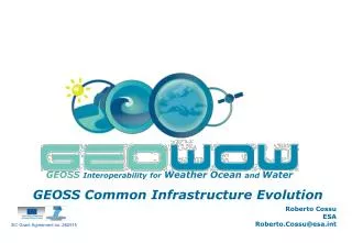
EC Grant Agreement no. 282915. GEOSS Interoperability for Weather Ocean and Water. GEOSS Common Infrastructure Evolution. Joost van Bemmelen ESA Joost.van.Bemmelen@esa.int. GEOWOW Partners. Technology Partners. Weather SBA. Ecosystem (Ocean) SBA. Water SBA.

E N D
EC Grant Agreement no. 282915 GEOSSInteroperability for Weather Ocean and Water GEOSS Common Infrastructure Evolution Joost van Bemmelen ESA Joost.van.Bemmelen@esa.int
GEOWOW Partners Technology Partners Weather SBA Ecosystem (Ocean) SBA Water SBA
High-level Project Information January 2013 April 2014 August 2012 June 2014 17/11/2011 GEO Plenary VIII - Istanbul 3
High-level Project Information GEO Ministerial 2013: ‘Initial evolved' architecture properly tested and demonstrated within GEOWOW SBA's January 2013 April 2014 August 2012 June 2014 17/11/2011 GEO Plenary VIII - Istanbul 4
High-level Project Information GEO Ministerial 2013: ‘Initial evolved' architecture properly tested and demonstrated within GEOWOW SBA's GEO Ministerial 2015: ‘Evolved' architecture properly tested and demonstrated within GEOWOW SBA's January 2013 April 2014 August 2012 June 2014 17/11/2011 GEO Plenary VIII - Istanbul 5
Objectives Facilitate geo-resources sharing Facilitate geo-resources access Distributed Architectural Model Contribute to GCI enhancement with Standardisation Interoperability Weather,Water, Ecosystem SBAs Other SBAs GCI operational capabilities for GEO Plenary VIII - Istanbul
A structuredsystemengineeringapproach User requirements Technology Base Constraints and recommendations From SBAs and GEOSS community From SBA systems and prior development efforts, including among others: From relevant initiatives and standardization bodies, including: AIP4, StP SIF, ADC Current GCI Thorpex GOOS GEO Plenary VIII - Istanbul
A structuredsystemengineeringapproach User requirements Technology Base Constraints and recommendations Requirements Analysis Functional Specification Design qualification Implementation acceptance validation and assessment GCI evolutions GEO Plenary VIII - Istanbul
The envisioned scenario Easy and simple discovery and access to geo-resources GEO Plenary VIII - Istanbul 9
The envisioned scenario:easy discovery and access to geo resources Geo-spatial and temporal search by predefined keywords and concepts Discovered geo-resources include… GEO Plenary VIII - Istanbul
The envisioned scenario:easy discovery and access to geo resources Websites, webportals, webgis Population Density GIS-map with borders Crustal Information GEO Plenary VIII - Istanbul
The envisioned scenario: easy discovery and access to geo resources Satellite and in-situ products Direct access to products GEO Plenary VIII - Istanbul
The envisioned scenario: easy discovery and access to geo resources Processing services to generate added value products WebProcessingServices, Grid, Cloud computing … Example: Earthquake Van, 23 October 2011 Input: satellite SAR products, auxiliary files, digital elevation models Interferograms, crustal deformation GEO Plenary VIII - Istanbul
The envisioned scenario: easy discovery and access to geo resources Processing services to generate added value products WebProcessingServices, Grid, Cloud computing … Example: Thailand flood, November 2011 Input: satellite SAR and optical products, digital elevation models Flood map GEO Plenary VIII - Istanbul
In a nutshell: access to… satellite data metadata airborne data documentation processing services in-situ data maps models GEO Plenary VIII - Istanbul
EC Grant Agreement no. 282915 Thankyou Project Web Site:http://www.geowow.eu/ Joost van Bemmelen Joost.van.Bemmelen@esa.int