Download
1 / 43
430 likes | 509 Views
Comparison of Tropical Cyclones Cindy (2005) and Ivan (2004). By: Michael L. Jurewicz, Sr. Northeast Regional Operational Workshop (NROW) Albany, NY November 1-2, 2005. Very Different Results for the Northeastern U.S. Cindy: Little or no significant impact

E N D
Comparison of Tropical Cyclones Cindy (2005) and Ivan (2004) By: Michael L. Jurewicz, Sr. Northeast Regional Operational Workshop (NROW) Albany, NY November 1-2, 2005
Very Different Results for the Northeastern U.S. • Cindy: Little or no significant impact • Mainly 1-3” rainfall amounts (locally 4-5”) across the Delmarva Region, PA, NJ, and Eastern NY within a 24 hour period • Dry antecedent conditions going into the event • Ivan: Major impact • Widespread 4-7” (locally up to 10”) rainfall amounts from the Ohio Valley / WV, across PA, Southern / Eastern NY, and Northern NJ in a 12-18 hour period • Already wet heading into this event
Both Cyclones Acquired Similar Structures during their ET • Increased frontal-wave structure with latitude at the surface • Upper-level jet cores were enhanced poleward of the cyclones • Due to warm outflow, rising upstream heights, increased shear • Bands of stratiform +RA developed north/west of the cyclone • Located where best combination of low-level fgen and elevated instability existed
Frontal-waves: Cindy Ivan
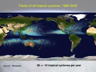
Why Such a Disparity in Rainfall ? • Contrast in degrees of interaction with the Westerlies • Time of year played a role • Ultimately affected each cyclone’s ability to transport deep moisture northward • Could either enhance / mitigate rainfall efficiency
Ivan and its Proximity to Mid-level Short-wave Energy (Frame #1)
Cindy and its Proximity to Mid-level Short-wave Energy (Frame #1)
Temperature / RH Cross-section and Sounding analysis (Ivan) Warm Cloud Layer of 4+ km
Temperature / RH Cross-section and OKX Sounding analysis (Cindy) Warm Cloud Depth of 2.5 to 3 km Warm Cloud Layer of 2.5 to 3 km
Consequences of Influx of Tropical Air (or lack thereof) • In the case of Ivan: • Stronger Upper-level jet (around 160 kt) lead to more pronounced lower-level response (850 mb flow of 45-50 kt) and more backed flow into the jet-entrance region • Higher PW air / elevated freezing levels were transported northward into regions affected by stratiform rain bands • Greater Rainfall Efficiency / Accumulation Rates resulted
Consequences of Influx of Tropical Air (or lack thereof) - Continued • In the case of Cindy: • Relatively weaker Upper-level jet (around 90 kt) lead to less pronounced lower-level response (850 mb flow of 30-35 kt) and less backing of the flow • Highest PW air / freezing levels were thus shunted northeastward off the Mid-Atlantic coast; never reaching areas of NY / PA / NJ affected by stratiform rain bands • Lack of Tropical Rainfall Rates
Conclusions • Tropical cyclones Cindy (2005) and Ivan (2004) had several common elements • Fairly similar paths from the Gulf Coast region to the Mid-Atlantic states • They took on some of the same structures during their ET • Frontal-wave appearance at the surface • Enhanced upper-level jet cores poleward of the cyclones • Banded heavy rainfall north/west of the cyclone centers, within low-level fgen maxima
Conclusions (Continued) • Despite these similarities, rainfall and subsequent impacts were far different • Accumulation efficiency much greater with Ivan due to influx of tropical air / rainfall rates • Tropical rain rates were never ingested into the banded rainfall over NY / PA / NJ with Cindy
In the Interest of Keeping Up with Current Events : A Quick Look at Katrina • A Band of Heavy Rain occurred generally along its track during ET • 3-6” (locally up to 8”) of rain fell from the Ohio Valley to Upstate NY / Northern VT / Parts of Southern Ontario and Quebec within a 24 hour period
Temperature / RH Cross-section and Sounding analysis (ALY) Warm Cloud Depth of 3.5 to 4 km Warm Cloud Layer of 3.5 to 4 km
Final Thoughts • Katrina was, perhaps, a moderate example of a +RA event associated with ET Transition over the Northeastern U.S. (in between Cindy and Ivan) • Decent Westerly interaction (Some PV coupling / well developed jet circulation) with 120 kt / 40-50 kt upper and lower-level jet cores • Polar jet not quite as far south, or as strong as was the case with Ivan (late August vs. mid to late September) • Allowed tropical air / rainfall rates to be ingested into regions affected by more persistent, stratiform type banding • Rapid system movement / dry antecedent conditions prevented an excessive flooding event
Future Possibilities • Magnitude of Heavy Rainfall with Transitioning Tropical Cyclones seems contingent on 3 main factors : • Strength of remnant cyclone itself • Strength of synoptic-scale fronts / jets • Degree of interaction between the above mentioned systems • Modulating factors for any given area : • Warm cloud depth / rainfall efficiency • Progressiveness of overall system • Is there a way to categorize / package all of this information to better inform / serve the public ??