Download
1 / 13
140 likes | 277 Views
Bryan Alegria 6th. HONDURAS. FLAG, Map, Capital, And Population. Population:5,797,000 Capital City:Tegucigalpa. Continent, Currency, Official Languages. North America Lempira Spanish. Religions, Head of State, Famous. President: Porfirio Lobo Sosa

E N D
Bryan Alegria 6th HONDURAS
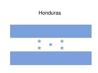
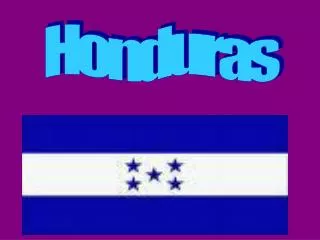
FLAG, Map, Capital,And Population • Population:5,797,000 • Capital City:Tegucigalpa
Continent, Currency, Official Languages • North America • Lempira • Spanish
Religions, Head of State, Famous • President: Porfirio Lobo Sosa • Religions: Maya religion was an important religion in Copan (Honduras), between fourth and seventh century. In the twenty century he principal religious group is Catholic.
Famous Food • The famous food In Honduras is Tamalas. Also Tortias they include meat roasted with chimol carne asada, chicken with rice and corn, and fried fish with pickled onions and jalapeños. There famous drink is coconut water.
Famous Places1st Place: • Guanaja Island • It is known as the island of pines as Guanaja is the only island where conifers dominate the vegetation. The Michael Rock Peak makes Guanaja island the tallest of the Bay Islands and it offers great scenic views of the Caribbean Sea as well as hiking opportunities.
2nd Place:The Copan Mayan Ruins • The country of Honduras in Central America served as the dwelling to the Mayan tribes dating back to as early as 1000 BC. When they arrived in the area, they reached the beautiful Copan River and built the city of Copan. Before it became an attractive tourist spot, it went through stages and historical events that shaped the area, which tourists see today.
3rd Place: Helene • The easternmost quarter of the island is separated by a convoluted channel through the mangroves that is 15 meters wide on the average. This section is called Helene
Short History • More than 1,000 years ago, Maya Indians built stone palaces, pyramids, and temples at Copán in what is now western Honduras. Christopher Columbus arrived at Honduras in 1502. Columbus or a later explorer called the land Honduras, a Spanish word meaning depths, because of the deep waters off the northern coast of the country. • More than 1,000 years ago, Maya Indians built stone palaces, pyramids, and temples at Copán in what is now western Honduras. Christopher Columbus arrived at Honduras in 1502.
Continue… • Honduras became part of a Spanish colony. In 1821, Spanish rule ended. Honduras then became part of other, larger Central American states. In 1838, it became a separate country. • In the 1980's, there was a lot of fighting in Honduras. There was a war going on in Nicaragua, which is next to Honduras, and the people fighting the war set up bases in Honduras and sometimes fought each other there. The fighting ended in 1990.
My Hometown :EL CARMEN • EL CARMEN WAS A SMALL ISLAND THAT WAS TORPICAL AND THER ARE LOTS OF PLAM TREES. ALSO THE BEACH IS CLEAR WATER.
Why I Moved From My Country • I moved from Honduras because there was some people killing in my town and the people were going inside the houses. That is way I moved from my town.
BIBLIOGRAPHY • http://www.worldbookonline.com/wb/Login?ed=wb • http://en.wikipedia.org/wiki/Honduras