Download
1 / 33
330 likes | 464 Views
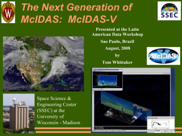
McIDAS-X Software Development and Demonstration. Rick Kohrs and Jay Heinzelman 7 May 2012. Overview. McIDAS-X 2010.2, 2011.1 McIDAS-XRD 2010.2, 2011.1 McIDAS-XCD 2010.2, 2011.1, 2012.1 Software development and plans for version 2012.1 and beyond…. McIDAS-X 2010.2 and 2011.1.

E N D
McIDAS-X Software Development and Demonstration Rick Kohrs and Jay Heinzelman 7 May 2012
Overview • McIDAS-X 2010.2, 2011.1 • McIDAS-XRD 2010.2, 2011.1 • McIDAS-XCD 2010.2, 2011.1, 2012.1 • Software development and plans for version 2012.1 and beyond…
McIDAS-X 2010.2 and 2011.1 • POES server LINELE= with TIME= • Radar • Kalpana updates • IMGPROBE enhancements • EU TAB expanded listing • Specify sigma levels with grids • IMGRGB BASETHRESHOLD=
POES Server • Previously: The real-time POES server would use TIME= to search all files for that scanline time within. It did not have to correspond to the start time of the file. • Now: LINELE= can be used with TIME=. In this case, the time specified is matched to the start time of a file; beginning line from file extracted based on LINELE= value.
Radar • NEXRAD dataset went away in December 2010 • Replaced by WSR and TDWR datasets • Higher bit depth and geographic resolution for some products • 45 new TDWR sites • Sites continue to be updated.
Kalpana • HDF5 ADDE server • Uses grid of latitude/longitude for navigation • Updated for multi-banded data
IMGPROBE • Provide more information from STAT, HIST and PLOT options • Corrected scan line time for MTSAT and added for MSG
EU TAB • RGB values for each brightness value • Portable to other software packages - AWIPS
IMGRGB • New keyword BASETHRESHOLD= specifies a brightness threshold for pixels to be considered a map outline. Transparency of satellite image decreased by 50%. Before After
McIDAS-XCD 2010.1 • Added support for WSR-88D and TDWR radar products • Updated the station database, STNDB.CORE • 20 new METAR stations • 18 oil platforms in the Gulf of Mexico • Updated the Ship/Buoy/CMAN decoder: Properly decode MISSING wind direction
McIDAS-XCD 2011.1 • Added support for the NAM Fire Weather / IMET nest GRIB files (CONDUIT only) • Updated the GRIB decoder for NDFD grids • Updated the SAO/METAR decoder for wind gusts with VRB (variable) designation • Update the Pilot Report (PIREP) decoder for errors with icing reports • Updated the station database, STNDB.CORE: • 11 new TAF stations • Corrected errors in database
McIDAS-XCD 2012.1 • NWS has renamed the Rapid Update Cycle (RUC) forecast model to the Rapid Refresh (RAP) Analysis and Forecast System • Since RAP and RUC have same model ID numbers, current versions of –XCD will continue to work • There is an update to the navigation parameters to allow data to be correctly filed into the RTGRIB2/RAP-USLC20KM dataset
McIDAS-XRD Current and Future • IMGPARM • COMP_ALLBAND • Canada radar decoder • TAFLIST • ADDE Servers
IMGPARM • Multi-banded file containing quantities at each pixel: • 1. Gray scale values • 2. Time difference from a nominal time (sec) • 3. Distance from satellite subpoint (km) • 4. Pixel area (km*km) • 5. Satellite Sensor (SS) • 6. Wavelength • 7. Parallax distance (km*10) • 8. Parallax direction (degrees)
COMP_ALLBAND • Composite satellite image of the highest resolution pixels • Retains all eight bands from IMGPARM
Canada Radar Decoder • Decode text data on the ldm • Converted to McIDAS Area format served via ADDE
TAFLIST • Decodes Terminal Aerodrome Forecast (TAF) • Graphical depiction of expected conditions • PDA Animated Weather
ADDE Servers • Clouds from AVHRR Extended (CLAVR-x) products • Cloud type • SST • Volcanic Ash • GEOCAT products • Cloud type • Fog mask, probability, and depth
ADDE Servers • Additional MODIS products from GEOCAT • Fog product • Volcanic ash
McIDAS-X 2012.1 • Tracking real-time satellite data • Access pre-KLM AVHRR Level 1b files • NAV=LALO for AVHRR Level 1b files • MODIS with bow tie correction • Updates for COMS data
McIDAS-X 2012.1 • ADDE with ssh tunneling • Updated map files • Dual polarization radar
Tracking • User configurable for GVAR and MTSAT • Only from SDI-104 ingestor or when reading raw files locally • TRACKING= YES/NO; default is set by server administrator with MCTRACK environment variable • Initially done for McIDAS-V
Pre-KLM AVHRR Level 1b NOAA-11 3 January 1989
NAV=LALO for Level 1b files • NAV=LALO keyword will be valid in IMG* commands to access the lat/lon navigation of AVHRR Level 1b files
Bow Tie Correction(correction for MODIS scanning using MRTswath) IMGREMAP Bow tie corrected
COMS Based on MTSAT HRIT server
SSH Tunneling with ADDE • User configurable through DATALOC • Keywords SSHADD, SSHLIST, SSHDEL used when servers are in a secure environment • Funded by JSC who has a two factor authentication requirement
Updated Map Files • USCOUNTY.MAP, USZONE.MAP, USSTATE.MAP • Better WWDISP & WWLIST performance
…..and beyond • VIIRS ADDE Server • Prototype: very limited functionality • MS2GT (3rd party package) will be used to remove bow tie and store in a reprojected Area file. • Next generation ADDE servers
VIIRS ADDE Server Left half of VIIRS granule with bowtie deletion
Next Generation ADDE • Still in the planning stage • Expecting the servers to based on Java: • Make use of McIDAS-V file adapters • Interface to the netCDF 4 library • All data formats that McIDAS-V can read locally, will also work remotely