Download

1 / 34
350 likes | 437 Views
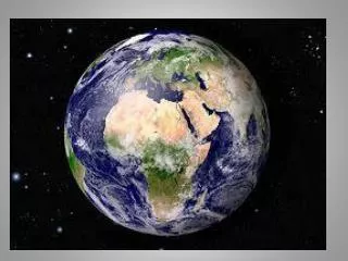
University of New Brunswick. Geodesy and Geomatics Engineering. Geodesy — study of the size and shape of the earth and the nature of the earth’s gravity field. Geomatics — encompassing the art, science, and technology involved in collecting and managing geospatially-referenced information.

E N D
Geodesyand Geomatics Engineering Geodesy — study of the size and shape of the earth and the nature of the earth’s gravity field. Geomatics — encompassing the art, science, and technology involved in collecting and managing geospatially-referenced information
For what kinds of things do we need geospatial information? • Municipal Engineering • Highway Design and Construction • Environmental studies; • Management of land and marine resources; • Monitoring of dams, oil fields, and mines for subsidence or movement; • Navigation of ships and aircraft; • Oceanography; • Real estate transactions; • Tourism ... Market Research … and lots more!
Geomatics Engineers... • ...use advanced instrumentation for precise positioning and measurements on engineering, mining, property development, and boundary determination projects.
Geomatics Engineers employ airborne and satellite data from state-of-the-art computerized imaging systems for topographic, environmental, and resource mapping.
Geomatics Engineers... • integrate position, time, and movement into sophisticated transportation, navigation, and management information systems;
Geomatics Engineers... ...develop software to depict measurements and analyses of the earth's surface, both on land and in the oceans.
Geomatics Engineers... • ...use their interest in math, science, computers, and the environment to find answers to the questions: what is it? where is it? and how much is there?
Ocean Mapping at UNB Ocean Mapping at UNB
Geomatics Engineers Solving Global and Community Problems Earthquake Prediction Participatory Planning
Measuring, Modelling, and Predicting Climate Change Promoting Democracy and Development Through Land Reform and Information Technologies
Global Warming and the Greenhouse Effect
Measuring and Modelling Sea Level Rise
Mapping and Modelling Holes in The Ozone Layer
Using GPS Signals to Measure Sea Level Changes
Geomatics in Economic and Social Development
Creating the Infrastructure * property systems * mapping systems *spatial information systems So that ALL CITIZENS can participate in development
Wealth Power Status Property as the Basis for Land Reform Helps to Create a More Equitable Distribution of Property in Society Better Democracy
Poland Ukraine Russia Kazakstan Mongolia Land Privatization To Support Democracy
Focus Surveys Ltd. Oil Pipeline Rights of Way In Northern Africa Sida
The Information Highway
WWW-Based Mapping and Data Distribution CARIS and Service New Brunswick
Is There an Exciting Geomatics Profession In Your Career Future?
Geomatics EngineeringMore than just measurements Persons Programs Communities Society DEFINING REQUIREMENTS Improved Technologies Integrated Systems & Processes New Policies, Procedures & Indicators DESIGNING, TESTING and IMPLEMENTING SOLUTIONS
The GGE Program at UNB • Small Classes -- Strong combination of scientific foundation, hands-on projects, problem-solving and engineering design • Program & people recognized world-wide • International exchange opportunities in Australia • Extended co-op experience through UNB PEP program • “Double-degree” Option with Computer Science
Geodesy & Geomatics Engineering Interested? Check us out ….http://www.unb.ca/GGE