Download
1 / 33
370 likes | 755 Views
International Organization for Standardization Technical Committee 211. ISO/TC 211. Geographic information/Geomatics. November 2001. What is ISO/TC 211?. Standardization in the field of digital geographic information.

E N D
International Organization for Standardization Technical Committee 211 ISO/TC 211 Geographic information/Geomatics November 2001
What is ISO/TC 211? • Standardization in the field of digital geographic information. • This work aims to establish a structured set of standards for information concerning objects or phenomena that are directly or indirectly associated with a location relative to the Earth. • These standards may specify, for geographic information, methods, tools and services for data management (including definition and description), acquiring, processing, analyzing, accessing, presenting and transferring such data in digital/electronic form between different users, systems and locations. • This work shall link to appropriate standards for information technology and data where possible, and provide a framework for the development of sector-specific applications using geographic data.
Some objectives ... • increase the understanding and usage of geographic information • increase the availability, access, integration, and sharing of geographic information • promote the efficient, effective, and economic use of digital geographic information and associated hardware and software systems • contribute to a unified approach to addressing global ecological and humanitarian problems
Chairman Olaf ØstensenNorway New ISO/TC 211 organizationafter 13th plenary AG Strategy AG WSI AG Outreach TMG MHT TF 211/204 WG 9 *) WG 8 *) WG 7 *) WG 6 *) WG 4 Morten Borrebæk Norway Geospatial services Locationbasedservices Informationmanagment Imagery Informationcommunities *) convenors to be determined
Chairman Olaf ØstensenNorway Old ISO/TC 211 organization Adv.G-Strat AG WSI MHT AG Registry SWG-QC AG LBS Other projects WG 5Doug O’BrienCanada WG 4Morten BorrebækNorway WG 3Robert WalkerUK WG 2Antony CooperSouth Africa WG 1Norman AndersenUSA Framework and reference model Geospatial services Profiles and functional standards Geospatial models and operators Geospatial data admini-stration
NTS ISO/TC 211 Chairman and secretariat ISO/TC 211 Geographic information/ Geomatics ISO/TC 211 will develop a family of standards : ISO 19100 series Chairman : Olaf Østensen, Norwegian Mapping Authority Secretary : Bjørnhild Sæterøy, Norwegian Technology Centre
WG 1 Norman C. Andersen NIST USA WG 1 - Framework and reference model- disbanded • ISO 19101 - Reference model • ISO 19102 - Overview • ISO/TS 19103 - Conceptual schema language • ISO 19104 - Terminology • ISO 19105 - Conformance and testing • ISO/TR 19121 Imagery and gridded data • ISO 19124 - Imagery and gridded data components • ISO 19129 - Imagery, gridded and coverage data framework • ISO 19130 - Sensor and data model for imagery and gridded data
WG 2 - Geospatial models and operators - disbanded WG 2 Antony Cooper CSIR - ICOMTEK South Africa • ISO 19107 - Spatial schema • ISO 19108 - Temporal schema • ISO 19109 - Rules for application schema • ISO 19123 - Schema for coverage geometry and functions
WG 3 Robert Walker AGI UK WG 3 - Geospatial data administration - disbanded • ISO 19110 - Feature cataloguing methodology • ISO 19111 - Spatial referencing by coordinates • ISO 19112 - Spatial referencing by geographic identifiers • ISO 19113 - Quality principles • ISO 19114 - Quality evaluation procedures • ISO 19115 - Metadata • ISO 19126 - Profile - FACC data dictionary • ISO 19127 - Geodetic codes and parameters
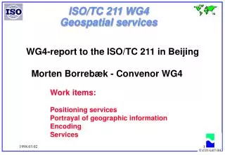
WG 4 Morten Borrebæk Norwegian Mapping Authority Norway WG 4 - Geospatial services • ISO 19128 – Web map server interfaceprevious work: • ISO 19116 - Positioning services • ISO 19117 - Portrayal • ISO 19118 - Encoding • ISO 19119 - Services • ISO 19125-1 - Simple feature access - Common architecture • ISO 19125-2 - Simple feature access - SQL option • ISO 19125-3 - Simple feature access - COM/OLE option
WG 5 - Profiles and functional standards- disbanded WG 5 Doug O’Brien Idon Corp.Canada • ISO 19106 - Profiles • ISO/TR 19120 - Functional standards • ISO/TR 19120 AMD. 1 - Functional standard - Amendment 1
WG 6 - Imagery WG 6 Proposed Doug O’Brien Canada • ISO 19129 - Imagery, gridded and coverage data framework • ISO 19130 - Sensor and data model for imagery and gridded data
WG 7 – Information communities WG 7 Proposed Antony Cooper South Africa • ISO/TR 19120 AMD. 1 - Functional standard - Amendment 1 • ISO/TR 19122 - Qualifications and certification of personnel • ISO 19126 - Profile - FACC data dictionary
WG 8 – Location based services WG 8 Proposed?? John Herring USA • ISO 19132 - Location based services possible standards • ISO 19133 - Location based services tracking and navigation • ISO 19134 - Multimodal location based services for routing and navigation
WG 9 – Information management WG 9 Proposed Hiroshi Imai Japan • ISO 19127 - Geodetic codes and parameters • ISO 19131 - Data product specifications • ISO 19135 - Procedures for registration of geographical information items
Overview • ISO 19118 - Encoding • ISO 19119 - Services • ISO/TR 19120 - Functional standards+ new rev • ISO/TR 19121 Imagery and gridded data • ISO/TR 19122 - Qualifications and certification of personnel • ISO 19123 - Schema for coverage geometry and functions • ISO 19124 - Imagery and gridded data components • ISO 19125 - Simple feature access – Part 1-3 • ISO 19126 - Profile - FACC Data Dictionary • ISO 19127 - Geodetic codes and parameters • ISO 19128 - Web Map Server Interface • ISO 19129 - Imagery, gridded and coverage data framework • ISO 19130 - Sensor and data model for imagery and gridded data • ISO 19131 - Data product specification • ISO 19132 - Location based services possible standards • ISO 19133 - Location based services tracking and navigation • ISO 19134 - Multimodal location based services for routing and navigation • ISO 19135 - Procedures for registration of geographic information items • ISO 19101 - Reference model • ISO 19102 - Overview • ISO 19103 - Conceptual schema language • ISO 19104 - Terminology • ISO 19105 - Conformance and testing • ISO 19106 - Profiles • ISO 19107 - Spatial schema • ISO 19108 - Temporal schema • ISO 19109 - Rules for application schema • ISO 19110 - Feature cataloguing methodology • ISO 19111 - Spatial referencing by coordinates • ISO 19112 - Spatial referencing by geographic identifiers • ISO 19113 - Quality principles • ISO 19114 - Quality evaluation procedures • ISO 19115 - Metadata • ISO 19116 - Positioning services • ISO 19117 - Portrayal
International Standards and Technical Reports • ISO 19105:2000 Geographic information - Conformance and testing • ISO/TR 19120:2001 Geographic information - Functionalstandards • ISO/TR 19121:2000 Geographic information - Imagery andgridded data
DraftInternationalStandards • ISO/DIS 19101 Geographic information - Reference model • ISO/DIS 19106 Geographic information - Profiles • ISO/DIS 19107 Geographic information - Spatial schema • ISO/DIS 19108 Geographic information - Temporal schema • ISO/DIS 19109 Geographic information – Rules for application schema • ISO/DIS 19110 Geographic information - Methodology for feature cataloguing • ISO/DIS 19111 Geographic information - Spatial referencing by coordinates • ISO/DIS 19113 Geographic information - Quality procedures • ISO/DIS 19114 Geographic information - Quality evaluation procedures • ISO/DIS 19115 Geographic information – Metadata • ISO/DIS 19117 Geographic information - Portrayal • ISO/DIS 19119 Geographic information - Services • ISO/DIS 19125 Geographic information - Simple feature access Part 1: Common architecture Part 2: SQL option
NWIP • Switzerland : Commonly used spatial data types • OGC : GML
Advisory group on strategy MHT - Model Harmonization Team- harmonization of UML models Advisory group on outreach Advisory group on web server interface for geographic information TMG - Terminology maintenance group Task force to support convergence between relevant ISO/TC 204 and ISO/TC 211 projects Special groups
Who are we ? ...member listActive members (P-members), 30 countries Australia Austria Belgium Canada China Czech Rep. Denmark Finland Germany Hungary Italy Jamaica Japan Republic of Korea Malaysia Morocco New Zealand Norway Portugal Russian Federation Saudi Arabia South Africa Spain Sweden Switzerland Thailand Turkey United Kingdom United States of America Yugoslavia
Member listObserving members 24 (20 O-members, 4 corresponding members) Argentina Bahrain (corr.) Brunei Darussalam (corr.) Colombia Cuba Estonia (corr.) France Greece Hong Kong (corr.) Iceland India Isl. Rep. of Iran Mauritius Netherlands Oman Pakistan Philippines Poland Slovakia Slovenia Tanzania Ukraine Uruguay Zimbabwe
External liaisons • CEOS, Committee on Earth Observation Satellites • DGIWG, Digital Geographic Information Working Group • EPSG, European Petroleum Survey Group • FIG, International Federation of Surveyors • GSDI, Global Spatial Data Infrastructure • IAG, International Association of Geodesy • ICA, International Cartographic Association • ICAO, International Civil Aviation Organization • IEEE Geoscience and Remote Sensing Society • IHB, International Hydrographic Bureau • ISCGM, International Steering Committee for Global Mapping • ISPRS, International Society for Photogrammetry and Remote Sensing • JRC, Joint Research Centre, European Commission • OGC, Open GIS Consortium, Incorporated • PCGIAP, The Permanent Committee on GIS Infrastructure for Asia and the Pacific • UN Economic Commission for Europe, Statistical Division • UNGIWG, United Nations Geographic Information Working Group • WMO, World Metereological Organization • CEN/TC 287, Geographic information
Internal liaisons • ISO/IEC JTC 1/SC 2 Coded character sets • ISO/IEC JTC 1/SC 24 Computer graphics and image processing • ISO/IEC JTC 1/SC 32 Data Management and Interchange • ISO/IEC JTC 1/SC 35 User interfaces • ISO/TC 20 /SC 13 Space data and information transfer systems • ISO/TC 23/SC 19 Agricultural electronics • ISO/TC 46/WG 2 - Coding of country names and related entities • ISO/TC 82 - Mining • ISO/TC 184/SC 4 Industrial data and global manufacturing languages • ISO/TC 204 Transport Information and Control Systems
ISO/TC 211 statistics • More than 500 persons involved since start • WG 1 – approx. 80 persons • WG 2 - approx. 55 persons • WG 3 - approx. 115 persons • WG 4 - approx. 60 persons • WG 5 - approx. 55 persons • Other projects: 90 persons • 400 have attended one or more plenaries • 12 plenary meetings have been convened in 11 different countries on 5 continents NB! Figures are approximate and vary over time
Project leaders, i) Norman Andersen, USA Chris Gower, UK Arne-Jørgen Berre, Norway Martin Ford, UK Hiroshi Imai, Japan Douglas O'Brien, Canada David Parker, UK Charles Roswell,, USA Steinar Høseggen, Norway Robert Rugg, USA Hermann Seeger, Germany Robert Walker, UK Joel Morrison, USA • Reference model • Overview • Conceptual schema language • Terminology • Conformance and testing • Profiles • Spatial schema • Temporal schema • Rules for application schema • Feature cataloguing methodology • Spatial referencing bycoordinates • Spatial referencing bygeographic identifiers • Quality principles
Project leaders, ii) Ryosuke Shibasaki, Japan David Danko, USA Thad Mauney, USA Ronald Toppe, Norway David Skogan, Norway Arne-Jørgen Berre, Norway Charles Roswell, USA John Rowley, OGC (UK) Ian Spencer, DGIWG (UK) Julie Binder Maitra, USA John Rolwey, OGC (UK) Kian Fadaie, Canada Liping Di, USA • Quality evaluation procedures • Metadata • Positioning services • Portrayal • Encoding • Services • Coverage geometry and functions • Simple feature access • Profile – FACC Data Dictionary • Geodetic codes and parameters • Web Map server interface • Imagery, gridded and coverage data framework • Sensor and data models for imagery and gridded data
Project leaders, iii) João de Matos, Portugal John R. Herring, USA Tschangho Kim, Rep. of Korea Charles Roswell, USA Debra LaMarque, DGIWG (UK) † Mike Harbaugh, DGIWG (USA) Kian Fadaie, Canada Robert Maher, Canada Martin Ford, UK • Data product specifications • Location based services tracking and navigation • Multimodal location based services for routing and navigation • Procedures for registration of geographical information items REPORTS : • Functional standards • Amendment 1 • Imagery and gridded data • Qualifications and Certificationof personnel • Location based services possible standards
Meeting schedule Place Oslo, Norway Reston, VA, USA Seoul, Rep. of Korea Sydney, Australia Oxford, UK Victoria, Canada Beijing, China Vienna, Austria Kyoto, Japan Cape Town, South-Africa Reston, USA Lisbon, Portugal Adelaide, Australia Bangkok, Thailand Meeting 1st plenary 2nd plenary 3rd plenary 4th plenary 5th plenary 6th plenary 7th plenary 8th plenary 9th plenary 10th plenary 11th plenary 12th plenary 13th plenary 14th plenary Date November 10-11, 1994 August 30-31, 1995 May 30-31, 1996 January 23-24, 1997 October 2-3, 1997 March 5-6, 1998 September 24-25, 1998 March 4-5, 1999 September 29-30, 1999 March 9-10, 2000 September 7-8, 2000 March 8-9, 2001 October 25-26, 2001 May 23-24, 2002
Secretariat • Document list • Organization • Scope and work programme • Calendar • Mail to secretariat • About... • News and information • Resolutions • Presentations (slides) ISO/TC 211 on Internet - the WWW server You will find updated information on ISO/TC 211 on the following World Wide Web-server : WWW http://www. isotc211.org containing :
Conclusion The goal of ISO/TC 211 is to develop a family of international standards that will • support the understanding and usage of geographic information • increase the availability, access, integration, and sharing of geographic information, enable inter-operability of geospatially enabled computer systems • and ease the establishment of geospatial infrastructures on local, regional and global level. … and cooperate with others in achieving this !
Thank you ! ISO/TC 211 ...… building the foundation of the geospatial infrastructure, brick by brick ...