Download
1 / 27
280 likes | 496 Views
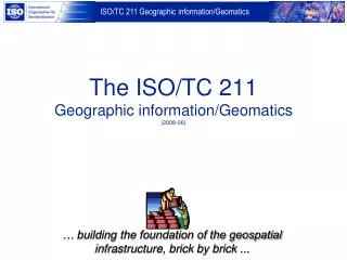
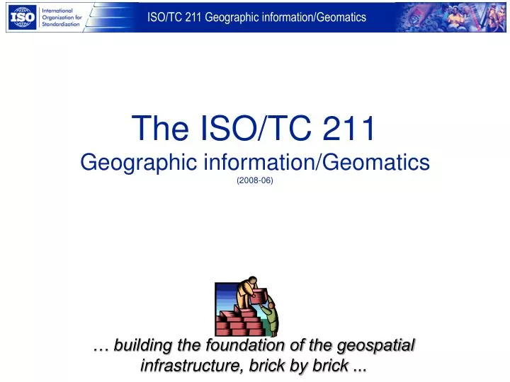
The ISO/TC 211 Geographic information/Geomatics (2008-06). … building the foundation of the geospatial infrastructure, brick by brick . The goal of ISO/TC 211. ... is to develop a family of international standards that will support the understanding and usage of geographic information

E N D
The ISO/TC 211Geographic information/Geomatics(2008-06) … building the foundation of the geospatial infrastructure, brick by brick ...
The goal of ISO/TC 211... ... is to develop a family of international standards that will • support the understanding and usage of geographic information • increase the availability, access, integration, and sharing of geographic information, enable inter-operability of geospatially enabled computer systems • contribute to a unified approach to addressing global ecological and humanitarian problems • ease the establishment of geospatial infrastructures on local, regional and global level • contribute to sustainable development
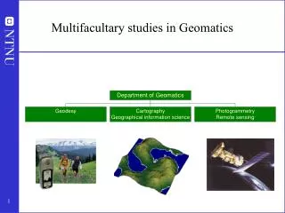
Scope of ISO/TC 211 • Standardization in the field of digital geographic information. • This work aims to establish a structured set of standards for information concerning objects or phenomena that are directly or indirectly associated with a location relative to the Earth. • These standards may specify, for geographic information, methods, tools and services for data management (including definition and description), acquiring, processing, analyzing, accessing, presenting and transferring such data in digital/electronic form between different users, systems and locations. • This work shall link to appropriate standards for information technology and data where possible, and provide a framework for the development of sector-specific applications using geographic data.
ISO/TC 211 organization Chairman Olaf ØstensenSecretaryBjørnhild SæterøyNorway AG Strategy Chairman Jinsoo YouPaul Smits JAG AG Outreach Henry Tom, Hans Knoop TMG Andrew Jones HMMG TF 211/204 John Herring Jinsoo You PMG TF 211/SC 24 Serena Coetzee Vacant WG 10 Sang-Ki HongKorea WG 9Hiroshi ImaiJapan WG 7Antony CooperSouth Africa WG 6 Douglas O’BrienCanada WG 4Morten BorrebækNorway Geospatial services Informationmanagement Imagery Informationcommunities UbiquitousPublic Access
Who are we ? ...member listActive members (P-members), 31 countries Australia Austria Belgium Canada China Czech Rep. Denmark Ecuador Finland Germany Hungary Italy Japan Rep. of Korea Malaysia Morocco Netherlands New Zealand Norway Peru Portugal RussianFederation Saudi Arabia Serbia South Africa Spain Sweden Switzerland Thailand United Kingdom United States of America
Member listObserving members 30 Argentina Bahrain Brunei Darussalam Colombia Croatia Cuba Estonia France Greece Hong Kong Iceland India Indonesia Isl. Rep. of Iran Ireland Jamaica Kenya Mauritius Oman Pakistan Philippines Poland Romania Slovakia Slovenia Tanzania Turkey Ukraine Uruguay Zimbabwe
External liaisons, 1 of 2 • CEOS, Committee on Earth Observation Satellites • DGIWG, Digital Geographic Information Working Group • EuroGeographics • EuroSDR, European Commission Joint Research Centre • ESA, European Space Agency • FIG, International Federation of Surveyors • GSDI, Global Spatial Data Infrastructure • IAG, International Association of Geodesy • ICA, International Cartographic Association • ICAO, International Civil Aviation Organization • IEEE Geoscience and Remote Sensing Society • IHB, International Hydrographic Bureau • ISCGM, International Steering Committee for Global Mapping • ISPRS, International Society for Photogrammetry and Remote Sensing • JRC, Joint Research Centre, European Commission • OGC, Open Geospatial Consortium, Inc. • OGP, International Association of Oil and Gas Producers • PAIGH, Panamerican Institute of Geography and History
External liaisons, 2 of 2 • PCGIAP, The Permanent Committee on GIS Infrastructure for Asia and the Pacific • PC IDEA, Permanent Committee on Spatial Data Infrastructure for the Americas • SCAR, Scientific Committee on Antarctic Research • UN Economic Commission for Africa • UN Economic Commission for Europe, Statistical Division • UNGEGN, United Nations Group of Experts on Geographical Names • UNGIWG, United Nations Geographic Information Working Group • UN FAO, Food & Aggriculture Organization of the United Nations • WMO, World Meteorological Organization • CEN/TC 287, Geographic information • CEN/ISSS Workshop on Metadata for Multimedia Information - Dublin Core • CEN/TC 278, Road Transport and Traffic Telematics
Internal liaisons • ISO/IEC JTC 1/SC 24 Computer graphics and image processing • ISO/IEC JTC 1/SC 31 Automatic identification and data capture techniques • ISO/IEC JTC 1/SC 32 Data Management and Interchange • ISO/IEC JTC 1/SC 36 Information technology for learning, education and training • ISO/TC 20 /SC 13 Space data and information transfer systems • ISO/TC 46/WG 2 - Coding of country names and related entities • ISO/TC 59/SC 13 Organization of information about construction works • ISO/TC 69 – Applications of statistical methods • ISO/TC 154 Processes, data elements and documents in commerce, industry and administration • ISO/TC 184/SC 4 Industrial data and global manufacturing languages • ISO/TC 204 Transport Information and Control Systems • ISO/TC 207 Environmental management • ISO/TC 241 Project Committee: Road-Traffic Safety Management System • SCIT, The ISO Steering Committee for Image Technology • The Study Group on Sensor Networks
Deliverables of ISO • ISO standard • ISO/PAS – ISO Publicly Available Specification • ISO/TS – ISO Technical Specification • ISO/TR – ISO Technical Report • IWA – International Workshop Agreement
ISO standardisation procedure • Proposal stage; New Work Item Proposal (NWIP) • Preparatory stage: Working Draft (WD) • Committee stage: Committee Draft (CD) • Enquiry stage: Draft International Standard (DIS) • Approval stage: Final Draft International Standard (FDIS) • Publication stage: International Standard (IS)
ISO/TC 211 Publications (1) • ISO 6709:1983 – Standard representation of latitude, longitude and altitude for geographic point locations (under revision) • ISO 19101:2002 – Reference model • ISO 19101-2:2008 – Reference model – Part 2: Imagery • ISO/TS 19103:2005 - Conceptual schema language (under revision) • ISO 19105:2000 – Conformance and testing • ISO 19106:2004 – Profiles • ISO 19107:2003 – Spatial schema • ISO 19108:2002 – Temporal schema • ISO 19109:2005 – Rules for application schema • ISO 19110:2005 – Feature cataloguing methodology • ISO 19111:2007 – Spatial referencing by coordinates • ISO 19112:2003 – Spatial referencing by geographic identifiers • ISO 19113:2003 – Quality principles (under revision) • ISO 19114:2003 – Quality evaluation procedures • ISO 19115:2003 – Metadata • ISO 19116:2004 – Positioning services • ISO 19117:2005 – Portrayal (under revision)
ISO/TC 211 Publications (2) • ISO 19118:2005 – Encoding (under revision) • ISO 19119:2005 – Services • ISO/TR 19120:2001 – Functional standards • ISO/TR 19121:2000 – Imagery and gridded data • ISO/TR 19122:2004 – Qualification and certification of personnel • ISO 19123:2005 – Schema for coverage geometry and functions • ISO 19125-1:2004 – Simple feature access – Part 1: Common architecture (under revision) • ISO 19125-2:2004 – Simple feature access – Part 2: SQL Option (under revision) • ISO/TS 19127:2005 – Geodetic codes and parameters • ISO 19128:2005 – Web Map Server Interface • ISO 19131:2007 – Data product specification • ISO 19132:2007 – Location-based services – Reference model • ISO 19133:2005 – Location-based services – Tracking and navigation • ISO 19134:2007 – Location-based services – Multimodal routing and navigation • ISO 19135:2005 – Procedures for item registration • ISO 19136:2007 – Geography Markup Language (GML) • ISO 19137:2007 – Core profile of the spatial schema • ISO/TS 19138:2006 – Data quality measures • ISO/TS 19139:2007 – Metadata – Implementation specification • ISO 19141:2008 – Schema for moving features
WG 4 Morten Borrebæk Norway WG 4 - Geospatial services • ISO 19117 – Portrayal (revision) • ISO 19118 – Encoding (revision) • ISO 19125-1 – Simple feature access – Part 1: Common architecture (revision) • ISO 19125-2 – Simple feature access – Part 2: SQL Option (revision) • ISO 19142 – Web Map Server • ISO 19143 – Filter encoding • ISO 19149 – GeoREL
WG 6 - Imagery WG 6 Douglas O’Brien Canada • ISO 19115-2 – Metadata – Part 2: Extensions for imagery and gridded data • ISO 19129 –Imagery, gridded and coverage data framework • ISO 19130 – Imagery sensor models for geopositioning
WG 7 – Information communities WG 7 Antony Cooper South Africa • ISO 19110 Amd. 1 - Methodology for feature cataloguing – Amd 1 • ISO 19126 – Feature concept dictionaries and registers • ISO 19144-1 – Classification Systems – Part 1: Classification system structure • ISO 19144-2 – Classification Systems – Part 2: Land Cover Classification System LCCS • ISO 19150 – Ontology • ISO 19152 – Land Administration Domain Model (LADM)
WG 9 – Information management WG 9 Hiroshi Imai Japan • ISO 6709 – Standard repr. of geographic point location by coordinates • ISO 19103 – Conceptual Schema language (revision) • ISO 19111-2 – Spatial referencing by coordinates – Part 2: Ext. for parametric value • ISO 19113 – Quality principles (revision) • ISO 19131 Amd. 1 – Data product specification • ISO 19145 – Registry of representations of geographic point location • ISO 19146 – Cross-domain vocabularies • ISO 19153 –Geospatial Digital Rights Management Reference Model (GeoDRM RM)
WG 10 – Ubiquitous public access WG 10 Sang-Ki Hong Korea • ISO 19147 – Location-Based Services - Transfer Nodes • ISO 19148 – Location-Based Services - Linear Referencing System • ISO 19151 – Dynamic Position Identification Scheme for Ubiquitous Space (u-Position)
Advisory group on strategy HMMG – Harmonized Model Maintenance Group- harmonization of UML models Advisory group on outreach JAG – ISO/TC 211 / OGC Joint Advisory Group TMG – Terminology maintenance group PMG – Programme Maintenance Group Task force to support convergence between relevant ISO/TC 204 and ISO/TC 211 projects Task force to support convergence between relevant JTC 1/SC 24 and ISO/TC 211 projects Special groups
Additional groups Finished work • Ad hoc group for Catalogue Services • Ad hoc group on Registry Establishment and Management • Ad hoc group to review land cover classification • Ad hoc group on outreach funding • Ad hoc group for ubiquitous geographic information (UBGI) • Ad hoc group on evaluation of registry for geodetic codes and parameters • Focus group on data producer use of geographic information standards
ISO/TC 211 Advisory group on outreach Mission: Promote the adoption of ISO/TC 211 standards in user communities • Terms of reference • Create awareness • Enable education and training • Facilitate adoption and implementation • Capture user requirements and feedback • Generate outreach resources • Maintain Business Plan
ISO/TC 211 statistics • More than1200 persons involved internationally since start • More than 750 have attended one ormore plenaries • 26 plenary meetings have been convened in 19 different countries on 5 continents NB! Figures are approximate and vary over time
Meeting schedule, 1 of 2 Meeting 1st plenary 2nd plenary 3rd plenary 4th plenary 5th plenary 6th plenary 7th plenary 8th plenary 9th plenary 10th plenary 11th plenary 12th plenary 13th plenary 14th plenary Date November 10-11, 1994 August 30-31, 1995 May 30-31, 1996 January 23-24, 1997 October 2-3, 1997 March 5-6, 1998 September 24-25, 1998 March 4-5, 1999 September 29-30, 1999 March 9-10, 2000 September 7-8, 2000 March 8-9, 2001 October 25-26, 2001 May 23-24, 2002 Place Oslo, Norway Reston, VA, USA Seoul, Rep. of Korea Sydney, Australia Oxford, UK Victoria, Canada Beijing, China Vienna, Austria Kyoto, Japan Cape Town, South-Africa Reston, VA, USA Lisbon, Portugal Adelaide, Australia Bangkok, Thailand
Meeting schedule, 2 of 2 Date November 14-15, 2002 May 22-23, 2003 October 29-30, 2003 May 24-25, 2004 October 7-8, 2004 June 9-10, 2005 September 15-16, 2005 May 25-26, 2006 November 14-15, 2006 May 31 – June 1,2007 November 1-2, 2007 May 29-30, 2008 December 4-5, 2008 May/June 2009 Place Gyeongju, Rep. of Korea Thun, Switzerland Berlin. Germany Kuala Lumpur, Malaysia Pallanza, Italy Stockholm, Sweden Montreal. Canada Orlando, FL, USA Riyadh, Saudi Arabia Rome, Italy Xi’an, China Copenhagen, Denmark Tsukuba, Japan Norway Meeting 15th plenary 16th plenary 17th plenary 18th plenary 19th plenary 20th plenary 21st plenary 22nd plenary 23rd plenary 24th plenary 25th plenary 26th plenary 27th plenary 28th plenary
ISO/TC 211 web-site You will find updated information on ISO/TC 211 on the following World Wide Web-server : http://www. isotc211.org containing : • Organization • Scope and work programme • Resolutions • Document register • Newsletters • Calendar • News and information • Presentations (slides) • List of events
Thank you ! ISO/TC 211 ...… building the foundation of the geospatial infrastructure, brick by brick ...