Download
1 / 83
830 likes | 1.03k Views
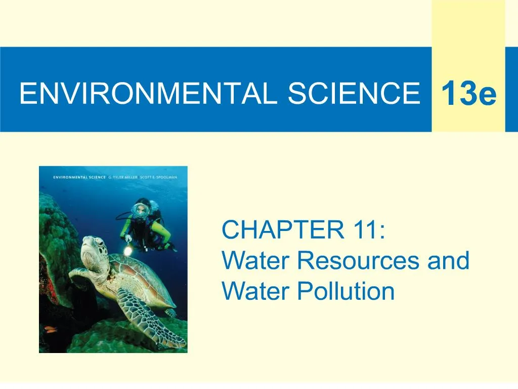
Core Case Study: The Colorado River Story. 1400 miles through 7 states14 dams and reservoirsElectricity for 30 million peopleWater for 15% of U.S. crops and livestockWater for desert citiesVery little water reaches the Gulf of California. Fig. 11-1, p. 238. Fig. 11-2, p. 238. 11-1 Will We Have Enough Usable Water?.

E N D
1. ENVIRONMENTAL SCIENCE
6. Importance and Availability of Water (1) Earth as a watery world � 71%
Poorly managed resource
Water access is a global health issue
3900 children under 5 die every day from waterborne disease
Water is an economic issue
7. Importance and Availability of Water (2) National and global security issue
Environmental issue
Freshwater availability � 0.024%
Groundwater
Lakes
Rivers
Streams
11. Surface Water Surface runoff
Watershed (drainage) basin
Reliable runoff � 1/3 of total
Runoff use
Domestic � 10%
Agriculture � 70%
Industrial � 20%
12. Case Study: Freshwater Resources in the United States (1) Uneven distribution
Contamination by agriculture and industry
Eastern U.S.
Western U.S.
Groundwater withdrawal: ~50% of total use
Drought
13. Case Study: Freshwater Resources in the United States (2) Arid and semiarid West:
85% of water to irrigate thirsty crops
Water hot spots
Southwest: �permanent drying� by 2050
Water tables dropping
36 states to face water shortages by 2013
15. Figure 11.5: Water hotspots in 17 western states that, by 2025, could face intense conflicts over scarce water needed for urban
growth, irrigation, recreation, and wildlife. Some analysts suggest that this is a map of places not to live in the foreseeable future.
Question: Which, if any, of these areas are found in the Colorado River basin (Figure 11-1)? (Data from U.S. Department of the Interior)Figure 11.5: Water hotspots in 17 western states that, by 2025, could face intense conflicts over scarce water needed for urban
growth, irrigation, recreation, and wildlife. Some analysts suggest that this is a map of places not to live in the foreseeable future.
Question: Which, if any, of these areas are found in the Colorado River basin (Figure 11-1)? (Data from U.S. Department of the Interior)
17. Figure 11.6: Natural capital degradation: stress on the world�s major river basins, based on a comparison of the
amount of water available with the amount used by humans (Concept 11-1B). Questions: If you live in a water-stressed
area, what signs of stress have you noticed? In what ways, if any, has it affected your life? (Data from
World Commission on Water Use in the 21st century)Figure 11.6: Natural capital degradation: stress on the world�s major river basins, based on a comparison of the
amount of water available with the amount used by humans (Concept 11-1B). Questions: If you live in a water-stressed
area, what signs of stress have you noticed? In what ways, if any, has it affected your life? (Data from
World Commission on Water Use in the 21st century)
19. 11-2 How Can We Increase Water Supplies? Concept 11-2C We can convert salty ocean water to freshwater, but the cost is high, and the resulting salty brine must be disposed of without harming aquatic or terrestrial ecosystems.
20. Increasing Freshwater Supplies Withdrawing groundwater
Dams and reservoirs
Transporting surface water
Desalination
Water conservation
21. Figure 11.7: Advantages and disadvantages of withdrawing groundwater. Questions: Which two advantages and which two disadvantages do you think
are the most important? Why?Figure 11.7: Advantages and disadvantages of withdrawing groundwater. Questions: Which two advantages and which two disadvantages do you think
are the most important? Why?
23. Active Figure 11.8: Natural capital degradation: areas of greatest aquifer depletion from groundwater overdraft
in the continental United States (Concept 11-2A). Aquifer depletion is also high in Hawaii and Puerto Rico (not shown on
map). See an animation based on this figure at CengageNOW. Question: If you live in the United States, how is your lifestyle
affected directly or indirectly by water withdrawn from the essentially nonrenewable Ogallala aquifer? (Data from U.S. Water
Resources Council and U.S. Geological Survey)Active Figure 11.8: Natural capital degradation: areas of greatest aquifer depletion from groundwater overdraft
in the continental United States (Concept 11-2A). Aquifer depletion is also high in Hawaii and Puerto Rico (not shown on
map). See an animation based on this figure at CengageNOW. Question: If you live in the United States, how is your lifestyle
affected directly or indirectly by water withdrawn from the essentially nonrenewable Ogallala aquifer? (Data from U.S. Water
Resources Council and U.S. Geological Survey)
24. Figure 11.9: Ways to prevent or slow groundwater depletion by using water more sustainably. Questions: Which two of these solutions do you think are the most important?
Why?Figure 11.9: Ways to prevent or slow groundwater depletion by using water more sustainably. Questions: Which two of these solutions do you think are the most important?
Why?
27. Figure 11.10: Trade-offs: advantages (green) and disadvantages (orange) of large dams and reservoirs (Concept 11-2B). The world�s
45,000 large dams (higher than 15 meters, or 49 feet) capture and store about 14% of the world�s surface runoff, provide water
for almost half of all irrigated cropland, and supply more than half the electricity used by 65 countries. The United States has more
than 70,000 large and small dams, capable of capturing and storing half of the country�s entire river flow. Questions: Which single
advantage and which single disadvantage do you think are the most important? Why?Figure 11.10: Trade-offs: advantages (green) and disadvantages (orange) of large dams and reservoirs (Concept 11-2B). The world�s
45,000 large dams (higher than 15 meters, or 49 feet) capture and store about 14% of the world�s surface runoff, provide water
for almost half of all irrigated cropland, and supply more than half the electricity used by 65 countries. The United States has more
than 70,000 large and small dams, capable of capturing and storing half of the country�s entire river flow. Questions: Which single
advantage and which single disadvantage do you think are the most important? Why?
29. Figure 11.11: The measured flow of the Colorado River at its mouth has dropped sharply since 1905 as a result of multiple dams, water
withdrawals for agriculture and urban areas, and prolonged drought (Data from U.S. Geological Survey).Figure 11.11: The measured flow of the Colorado River at its mouth has dropped sharply since 1905 as a result of multiple dams, water
withdrawals for agriculture and urban areas, and prolonged drought (Data from U.S. Geological Survey).
33. Aral Sea Disaster (2) Wind-blown salt
Water pollution
Climatic changes
Restoration efforts
36. Figure 11.13: Natural capital degradation: the Aral Sea was one of the world�s largest saline lakes. Since 1960, it has been shrinking
and getting saltier because most of the water from the rivers that replenish it has been diverted to grow cotton and food crops.
These satellite photos show the sea in 1976 and in 2006. As the lake shrank, it split into two lakes and left behind a salty desert,
economic ruin, increasing health problems, and severe ecological disruption. Question: What are three things that you think could
be done to help prevent further shrinkage of the Aral Sea?Figure 11.13: Natural capital degradation: the Aral Sea was one of the world�s largest saline lakes. Since 1960, it has been shrinking
and getting saltier because most of the water from the rivers that replenish it has been diverted to grow cotton and food crops.
These satellite photos show the sea in 1976 and in 2006. As the lake shrank, it split into two lakes and left behind a salty desert,
economic ruin, increasing health problems, and severe ecological disruption. Question: What are three things that you think could
be done to help prevent further shrinkage of the Aral Sea?
38. Major Problems with Desalination High cost
Death of marine organisms
Large quantity of brine wastes
39. 11-3 How Can We Use Water More Sustainably? Concept 11-3 We can use water more sustainably by cutting water waste, raising water prices, slowing population growth, and protecting aquifers, forests, and other ecosystems that store and release water.
40. Reducing Water Waste (1) Benefits of water conservation
Worldwide � 65-70% loss
Evaporation, leaks
Can be reduced to 15%
Increase the cost of water use
End subsidies for wasteful water use
Provide subsidies for efficient water use
41. Reducing Water Waste (2) Improve irrigation efficiency
Center pivot
Low-pressure sprinkler
Precision sprinklers
Drip irrigation
Use less in homes and businesses
42. Figure 11.14: Major irrigation systems. Because of high initial costs, center-pivot irrigation and drip irrigation are
not widely used. The development of new, low-cost, drip-irrigation systems may change this situation.Figure 11.14: Major irrigation systems. Because of high initial costs, center-pivot irrigation and drip irrigation are
not widely used. The development of new, low-cost, drip-irrigation systems may change this situation.
45. Figure 11.17: Methods for achieving more sustainable use of the earth�s water resources (Concept 11-3). Questions: Which two of
these solutions do you think are the most important? Why?Figure 11.17: Methods for achieving more sustainable use of the earth�s water resources (Concept 11-3). Questions: Which two of
these solutions do you think are the most important? Why?
48. Benefits of Floodplains Highly productive wetlands
Provide natural flood and erosion control
Maintain high water quality
Recharge groundwater
Fertile soils
Nearby rivers for use and recreation
Flatlands for urbanization and farming
49. Floods Deposit rich soils on floodplains
Deadly and destructive
Human activities worsen floods
Failing dams and water diversion
Hurricane Katrina and the Gulf Coast
Climate change will increase coastal flooding
51. Figure 11.19: Natural capital degradation: hillside before and after deforestation. Once a hillside has been deforested for timber, fuelwood, livestock grazing, or unsustainable farming,
water from precipitation rushes down the denuded slopes, erodes precious topsoil, and can increase flooding and pollution
in local streams. Such deforestation can also increase landslides and mudflows. A 3,000-year-old Chinese proverb says,
�To protect your rivers, protect your mountains.� See an animation based on this figure at CengageNOW.
Question: How might a drought in this area make these effects even worse?Figure 11.19: Natural capital degradation: hillside before and after deforestation. Once a hillside has been deforested for timber, fuelwood, livestock grazing, or unsustainable farming,
water from precipitation rushes down the denuded slopes, erodes precious topsoil, and can increase flooding and pollution
in local streams. Such deforestation can also increase landslides and mudflows. A 3,000-year-old Chinese proverb says,
�To protect your rivers, protect your mountains.� See an animation based on this figure at CengageNOW.
Question: How might a drought in this area make these effects even worse?
52. Figure 11.19: Natural capital degradation: hillside before and after deforestation. Once a hillside has been deforested for timber, fuelwood, livestock grazing, or unsustainable farming,
water from precipitation rushes down the denuded slopes, erodes precious topsoil, and can increase flooding and pollution
in local streams. Such deforestation can also increase landslides and mudflows. A 3,000-year-old Chinese proverb says,
�To protect your rivers, protect your mountains.� See an animation based on this figure at CengageNOW.
Question: How might a drought in this area make these effects even worse?Figure 11.19: Natural capital degradation: hillside before and after deforestation. Once a hillside has been deforested for timber, fuelwood, livestock grazing, or unsustainable farming,
water from precipitation rushes down the denuded slopes, erodes precious topsoil, and can increase flooding and pollution
in local streams. Such deforestation can also increase landslides and mudflows. A 3,000-year-old Chinese proverb says,
�To protect your rivers, protect your mountains.� See an animation based on this figure at CengageNOW.
Question: How might a drought in this area make these effects even worse?
53. Figure 11.19: Natural capital degradation: hillside before and after deforestation. Once a hillside has been deforested for timber, fuelwood, livestock grazing, or unsustainable farming,
water from precipitation rushes down the denuded slopes, erodes precious topsoil, and can increase flooding and pollution
in local streams. Such deforestation can also increase landslides and mudflows. A 3,000-year-old Chinese proverb says,
�To protect your rivers, protect your mountains.� See an animation based on this figure at CengageNOW.
Question: How might a drought in this area make these effects even worse?Figure 11.19: Natural capital degradation: hillside before and after deforestation. Once a hillside has been deforested for timber, fuelwood, livestock grazing, or unsustainable farming,
water from precipitation rushes down the denuded slopes, erodes precious topsoil, and can increase flooding and pollution
in local streams. Such deforestation can also increase landslides and mudflows. A 3,000-year-old Chinese proverb says,
�To protect your rivers, protect your mountains.� See an animation based on this figure at CengageNOW.
Question: How might a drought in this area make these effects even worse?
55. Figure 11.20: Methods for reducing the harmful effects of flooding (Concept 11-4). Questions: Which two of these solutions do you think are the most important? Why?Figure 11.20: Methods for reducing the harmful effects of flooding (Concept 11-4). Questions: Which two of these solutions do you think are the most important? Why?
57. Water Pollution Sources Point sources
Discharge at specific locations
Easier to identify, monitor, regulate
Nonpoint sources
Broad, diffuse areas
Runoff of chemicals and sediment
Agriculture
Control is difficult and expensive
60. Figure 11.21: Natural capital: dilution and decay of degradable, oxygen-demanding
wastes (or heated water) in a stream, showing the oxygen sag curve (blue) and the curve of oxygen demand (red).
Depending on flow rates and the amount of biodegradable pollutants, streams recover from injection of oxygen-demanding
wastes or heated water if they are given enough time and are not overloaded (Concept 11-5A). See
an animation based on this figure at CengageNOW�. Question: What would be the effect of putting another
discharge pipe for biodegradable wastes to the right of the one in this picture?Figure 11.21: Natural capital: dilution and decay of degradable, oxygen-demanding
wastes (or heated water) in a stream, showing the oxygen sag curve (blue) and the curve of oxygen demand (red).
Depending on flow rates and the amount of biodegradable pollutants, streams recover from injection of oxygen-demanding
wastes or heated water if they are given enough time and are not overloaded (Concept 11-5A). See
an animation based on this figure at CengageNOW�. Question: What would be the effect of putting another
discharge pipe for biodegradable wastes to the right of the one in this picture?
63. Lake Pollution Dilution less effective than with streams
Stratification
Low flow
Lakes are more vulnerable than streams
Eutrophication � natural aging process
Oligotrophic
64. Cultural Eutrophication Nitrate- and phosphate-containing effluents
Dense colonies of plants, algae, cyanobacteria
Can lead to die-off of fish and other animals
Prevent by limiting phosphate and nitrate use
Lakes can be cleaned, and can recover
65. Groundwater Pollution (1) Pollution sources
Slow flow, dilution, dispersion
Low dissolved oxygen
Fewer bacteria
Cooler temperatures
66. Groundwater Pollution (2) Long time scale for natural cleansing
Degradable wastes � organic matter
Slowly degradable wastes � DDT
Nondegradable wastes � lead, arsenic
67. Figure 11.25: Natural capital degradation: principal sources of groundwater contamination in the United States. Another source is saltwater intrusion from excessive groundwater withdrawal.
Question: What are three sources shown in this picture that might be affecting groundwater in the area where you live? (Figure is not drawn to scale.)Figure 11.25: Natural capital degradation: principal sources of groundwater contamination in the United States. Another source is saltwater intrusion from excessive groundwater withdrawal.
Question: What are three sources shown in this picture that might be affecting groundwater in the area where you live? (Figure is not drawn to scale.)
69. Figure 11.24: Methods for preventing and cleaning up contamination of groundwater. Questions: Which two of the preventive solutions do you think are the best ones? Why?Figure 11.24: Methods for preventing and cleaning up contamination of groundwater. Questions: Which two of the preventive solutions do you think are the best ones? Why?
73. Ocean Pollution Coastal areas � highly productive ecosystems
Occupied by 40% of population
Coastal populations will double by 2050
About 80% marine pollution originates on land
Ocean dumping controversies
Algal blooms
Oxygen-depleted zones
74. Figure 11.26: Natural capital degradation: Residential areas, factories, and farms all contribute to the pollution
of coastal waters and bays. According to the U.N. Environment Programme, ill health and premature death from
coastal water pollution costs the world more than $30,000 a minute. Question: What are three changes you could
make in your lifestyle that might help to prevent this pollution?Figure 11.26: Natural capital degradation: Residential areas, factories, and farms all contribute to the pollution
of coastal waters and bays. According to the U.N. Environment Programme, ill health and premature death from
coastal water pollution costs the world more than $30,000 a minute. Question: What are three changes you could
make in your lifestyle that might help to prevent this pollution?
76. Figure 11.A: Natural capital degradation: a large zone of oxygen-depleted water (containing less than 2 ppm dissolved oxygen) forms each year during the spring and summer in the Gulf of Mexico as a result of oxygen-depleting algal blooms. Evidence indicates that it is created mostly by huge inputs of nitrate (NO3 �) plant nutrients from farms, cities, factories, and sewage treatment plants in the vast Mississippi River basin. The drawing (bottom left) based on a satellite image, shows the inputs of such nutrients into the Gulf of Mexico during the summer of 2006. In the image, reds and greens represent high concentrations of phytoplankton and river sediment. This problem is worsened by loss of coastal wetlands, which would have filtered some of these plant nutrients. Question: Can you think of a product you used today that was
directly connected to this sort of pollution? (NASA)Figure 11.A: Natural capital degradation: a large zone of oxygen-depleted water (containing less than 2 ppm dissolved oxygen) forms each year during the spring and summer in the Gulf of Mexico as a result of oxygen-depleting algal blooms. Evidence indicates that it is created mostly by huge inputs of nitrate (NO3 �) plant nutrients from farms, cities, factories, and sewage treatment plants in the vast Mississippi River basin. The drawing (bottom left) based on a satellite image, shows the inputs of such nutrients into the Gulf of Mexico during the summer of 2006. In the image, reds and greens represent high concentrations of phytoplankton and river sediment. This problem is worsened by loss of coastal wetlands, which would have filtered some of these plant nutrients. Question: Can you think of a product you used today that was
directly connected to this sort of pollution? (NASA)
78. Effects of Oil Pollution on Ocean Ecosystems Volatile organic hydrocarbons
Kill larvae
Destroy natural insulation and buoyancy of birds and mammals
Heavy oil
Sinks and kills bottom organisms
Coral reefs die
79. Oil Cleanup Methods Current methods recover no more than 15%
Prevention is most effective method
Control runoff
Double-hull tankers
80. Figure 11.27: Methods for preventing and cleaning up excessive pollution of coastal waters.
Questions: Which two of these solutions do you think are the most important? Why?Figure 11.27: Methods for preventing and cleaning up excessive pollution of coastal waters.
Questions: Which two of these solutions do you think are the most important? Why?
82. Preventing Nonpoint Source Pollution (2) Use plant buffer zones around fields and animal feedlots
Keep feedlots away from slopes, surface water, and flood zones
Integrated pest management
Organic farming methods
83. Laws for Reducing Point Source Pollution Clean Water Act
Water Quality Act
Discharge trading controversies
Cap-and-trade of pollutants
84. Case Study: Reducing Water Pollution from Point Sources in the U.S. Impressive achievements since 1972 law
Bad news � 2006 survey
45% of lakes and 40% of streams too polluted for fishing and swimming
Runoff polluting 7 of 10 rivers
Fish caught in 1/4 of waterways unsafe to eat
Gasoline storage tanks: tens of thousands leaking
85. Sewage Treatment Systems Rural and suburban areas � septic tanks
Urban areas � wastewater treatment plants
Primary sewage treatment � physical process
Secondary sewage treatment � biological process
Chlorination � bleaching and disinfection
86. Figure 11.28: Solutions: primary and secondary sewage treatment. Question: What do you think should be done
with the sludge produced by sewage treatment plants?Figure 11.28: Solutions: primary and secondary sewage treatment. Question: What do you think should be done
with the sludge produced by sewage treatment plants?
88. Science Focus: Treating Sewage by Working with Nature Living machines
Tanks with increasingly complex organisms
Artificially created wetlands
Scientific principles of sustainability
92. Three Big Ideas from This Chapter - #2 We can use water more sustainably by cutting water waste, raising water prices, slowing population growth, and protecting aquifers, forests, and other ecosystems that store and release water.
93. Three Big Ideas from This Chapter - #3 Reducing water pollution requires preventing it, working with nature in treating sewage, cutting resource use and waste, reducing poverty, and slowing population growth.