Download
1 / 9
90 likes | 232 Views
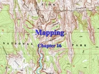
Mapping. What is a Map?. A flat drawing that shows the Earth or features in an area All maps have 4 parts Legend – tells what symbols and colors mean Scale – relates distances on the Earth to the distance on the map Compass – indicates true North

E N D
What is a Map? • A flat drawing that shows the Earth or features in an area • All maps have 4 parts • Legend – tells what symbols and colors mean • Scale – relates distances on the Earth to the distance on the map • Compass – indicates true North • Label – title, date, and features names
Latitude and Longitude • Used to locate a place on the map • Horizontal lines are called Latitude Lines or parallels – these run East and West – but measure North and South • Vertical lines are called Longitude Lines or meridians – these run North and South – but measure East and West
Latitude and Longitude • All locations have both a latitude and a longitude • Latitude is always written first and Longitude is always written second • Degrees is the unit of measure used for latitude and longitude
Latitude • The Equator divides the Earth into the Northern Hemisphere and the Southern hemisphere • The Equator has a latitude of 0 degrees • Locations North and South of the Equator are indicated by using an N or S • Ex: Charlotte’s latitude is 35° N – indicates North of the Equator • There are 90 degrees North and South of the Equator
Longitude • The Prime Meridian divides the Earth into Eastern and Western Hemisphere • The Prime Meridian has a longitude of 0 degrees • Locations East or West of the Prime Meridian are indicated by using an E or W • Ex: Charlotte’s longitude is 80° W – indicates west of the prime meridian • There are 180° East and West of the Prime meridian
Topographic Maps • Show elevation and the shape of the land • Show man made structures – such as buildings and roads • Use contour lines to show elevation • Each line represents one elevation • Every 4th or 5th line is darker and labeled - these are called index contours • The difference between 2 contour lines is called the contour interval
Rules for making topo maps • A contour line of one elevation never crosses or divides a contour line of another elevation. • Closely spaced contour lines represent a steep slope. The lines are closely spaced because the elevation of a steep slope changes greatly over a very short distance. • Contour lines spaced far apart represent a gentle slope. The lines are far apart because the elevation of a gentle slope changes only slightly from one point to another.
Rules (con’t) • Contour lines form closed loops around hilltops and depressions. • Hachure (HASH-oorz) are used to indicate a depression. Hachures are drawn perpendicular to the contour line that loops around a depression. The hachures point to the inside of the loop. • Contour lines that cross a valley are V shaped. If a stream flows through the valley, the V will point upstream, or in the direction opposite to the flow of the stream.