Download
1 / 12
120 likes | 238 Views
Bathymetric Product Specification. TSMAD 20 Rostock, May 2010 CHS and NAVO. Overview. Context of Bathymetric Product Specification Proposed Drafts S10x/S102 Specifications as initiated by TSMAD 18 S10x Guidelines and Considerations as initiated by TSMAD 19 Proposed next steps.

E N D
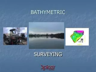
Bathymetric Product Specification TSMAD 20 Rostock, May 2010 CHS and NAVO
Overview • Context of Bathymetric Product Specification • Proposed Drafts S10x/S102 Specifications as initiated by TSMAD 18 • S10x Guidelines and Considerations as initiated by TSMAD 19 • Proposed next steps
Context of Bathymetric Product Specification • Original proposals to TSMAD 18 from : • NAVO (S.102) – Ref. Open Navigation surface project • Objective: common bathymetric standard for multipurposes data sharing and dissemination • CHS (S.10x) • Objective: to meet navigation needs with high definition bathymetry and integrate with other data types • (Note that this original objective changed after the HSSC meeting in October 2009) • CHS and NAVO worked on convergence of the two proposals • Investigate and build on strengths of both proposals
S102 and S10x De-confliction • CHS and NAVO agreed to: • Separate the encoding of carrier and data content • A need for common content model for bathymetric data fitting S.100 and carrying appropriate metadata • Metadata of S.102 already fits S.100 • Consider a few different encoding scheme • HDF5 (already used in BAG) • GeoTIFF32 (widely used) • JPEG2000 (interesting potential) • Prepare for the venue of auxiliary information
S102 and S10x De-confliction • An initial draft version of S.10x was prepared to be more general structure for Auxiliary Information Layers using different coverages • Specifically the draft of S.10x provides a structure for tiling, common metadata, digital security and common referencing that is used by S.102 • This draft has been made available as a discussion document (Proposed Specification for Auxiliary Information Layer Integration for use with ENC S.10x) • A revised S.102 was prepared built on top of S.10x to be specific for bathymetry using a gridded coverage
S10x components to support S102 • In parallel, CHS developed an initial draft version of S.10x (as a separate product specification from S.100) that supports the proposed the S.102 document. • This document was built directly upon the S.100 and the ISO 19100 models. • It allows: • Allows different coverage (uniform grid, quad tree grid, TIN, point coverage, vector field point) • Partitioning (Tiling) Model • Metadata Model • Data Certification and Rights management • Multiple encodings • As needed in S.102
S10x Guidelines and Considerations as initiated by TSMAD 19 • Action 4.1.1 TSMAD 19 to “... develop a paper outlining how how multiple Layers of S-100 compliant Auxiliary Navigational Information can be integrated with S-101 ENC data...” • Discussion Paper “Requirements for the Integration of S-100 compliant Auxiliary Navigational Information with S-101 ENC data”. • This document sets out metadata requirements and issues for linking data products in layers including addressing updating scenarios, query precedence, and presentation issues.
S10x Meta Data Requirements • Abstract • Intended Use (route planning, safety, security, navigation,…) • Intended usage Start • Intended usage End • Minimum Scale • Maximum Scale • Information Type (Overlay, Extension, new product) • Intended interaction (Overlay, interleaved, supersedes) • Dependencies • Identification of feature catalogue • Identification of portrayal catalogue • Product category - (HD data, Tides, Aids, ….) • Product query precedence • C-Square location identification
S10x Considerations • Links between data across products, Geo-Referencing • Updating Scenarios and Implications • Query Precedence logic for pick report • Display Priority • Presentation • Compatible Reference Models
Proposed Next Steps • Development of S10x use cases • Simple overlay • Extension to existing product spec. (e.g. AML) • Additional PLA with integrated vertical data column • IMO submission – proposal to allow auxiliary information to adjust the water column dynamically
Proposed Next Steps • Need to review S.102 to assure independence, but assure S.10x considerations have been addressed. • The draft of S.102 is proposed to be circulated for review, suggestions, recommendations. • Additional encodings need to be provided for S.102 and testing needs to be done. • The draft discussion paper of S.10x needs to be enhanced to address the requirements as outlined in the S.10x requirements paper and scope modified as deemed necessary by TSMAD. • Follow-on meetings need to be arranged to discuss the guidelines for Auxiliary layers and the proposed approach given in the S.10x document.
Recommendations • S10x specification is more suited to an annex to S100 as users need to take into consideration S10X when building product specifications. • Appoint a person/group to look at portrayal issues for interdependent product specifications before entry into the registry