Download
1 / 15
150 likes | 257 Views
FOREST PLANNING AND INTEGRATED REGIONAL WATER MANAGEMENT PARTNERSHIPS. Sierra Water Workgroup Water Summit Kings Beach, California June 11, 2013 Barry Hill, Hydrologist Pacific Southwest Region USDA Forest Service. CALIFORNIA’S NATIONAL FORESTS.

E N D
FOREST PLANNING AND INTEGRATED REGIONAL WATER MANAGEMENT PARTNERSHIPS Sierra Water Workgroup Water Summit Kings Beach, California June 11, 2013 Barry Hill, Hydrologist Pacific Southwest Region USDA Forest Service
CALIFORNIA’S NATIONAL FORESTS • 18 National Forest units in the Pacific Southwest Region • 21 million acres • Headwaters of most major rivers • About 50% of the runoff in the state • Affected by climate change
FOREST PLAN COMPONENTS, 2012 RULE • Assessment • Plan development • Desired Conditions • Objectives • Standards/Guidelines • Suitability of lands—priority watersheds • Monitoring
FOREST PLAN RULE, 2012 GUIDELINES • Multiple use of renewable resources in perpetuity • Maintain long-term health and productivity of land • Sustainable, integrated resource management • Watersheds with ecological integrity • Capacity to provide ecosystem services • These benefits include…clean water…. • Compliance with Clean Water Act • Best available science
FOREST PLAN RULE, 2012 , PUBLIC PARTICIPATION • Required for all phases of plan development • Outreach required to tribes, Federal and State agencies, local governments, individuals, public and private organizations • Consultation with tribes if requested • Incorporation of native knowledge and land ethics • Coordination with other planning efforts
REGIONAL LEADERSHIP INTENT, ECOLOGICAL RESTORATION From this point forward, Ecological Restoration will be the central driver of wildland and forest stewardship in the Pacific Southwest Region, across all program areas and activities. Future Land and Resource Management Plans, other strategic plans and project plans will identify Ecological Restoration as a core objective. Our Ecological Restoration work will include coordination and support for all wildlands and forests in the Region to promote an “all lands” approach to restoration. It will lead to a new way of doing business with our partners and neighbors, to coordinate work and priorities across forests and wildlands regardless of ownership.
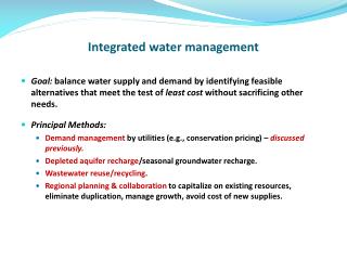
IRWMP Plans 4. Resource Management Strategies The IRWM Plan must document the range of RMS considered to meet the IRWM objectives and identify which RMS were incorporated into the IRWM Plan. The effects of climate change on the IRWM region must factor into the consideration of RMS. RMS to be considered must include the RMS found in Volume 2 of the CWP Update 2009. At the time of issuance of these 2012 Guidelines, DWR is in the process of developing CWP Update 2013. Update 2013 may include additional or different RMS. Consideration of such alternate RMS is encouraged, but not mandated.
FOREST MANAGEMENT STRATEGY, CWP UPDATE 2009 • Meadow restoration • Fire and vegetation management • Riparian forests • Forest roads • Urban forests
IRWMP PLANS 13. Relation to Local Land Use Planning IRWM Plans must contain processes that foster communication between land use managers and RWMGs with the intent of effectively integrating water management and land use planning. IRWM Plans must document: Current relationship between local land use planning, regional water issues, and water management objectives. Future plans to further a collaborative, proactive relationship between land use planners and water managers.
IRWMP PLANS The IRWM Plan must contain the following items: A public process that provides outreach and an opportunity to participate in IRWM Plan development and implementation to the appropriate local agencies and stakeholders, as applicable to the region, including the following: • Wholesale and retail water purveyors andwastewater agencies • Flood control agencies • Municipal and county governments and special districts • Electrical corporations • Native American tribes • Self-supplied water users • Environmental stewardship organizations • Community organizations • Industry organizations • State, federal, and regional agencies or universities • DAC members • Any other interested group appropriate to the region
IRWMP GRANT CRITERIA (1/2) • Include regional projects or programs • Effectively integrate water management programs and projects within a hydrologic region • Effectively resolve significant water-related conflicts within or between regions • Contribute to attainment of one or more of the objectives of the CALFED Bay-Delta Program • Address critical water supply or water quality needs of DACs within the region • Effectively integrate water management with land use planning
IRWMP GRANT CRITERIA (2/2) Address statewide priorities (partial list): • Expand Environmental Stewardship • Practice Integrated Flood Management • Protect Surface Water and Groundwater Quality • Improve Tribal Water and Natural Resources • Ensure Equitable Distribution of Benefits
SUMMARY • Both National Forest and IRWMP planning efforts strive to improve water resources • Both planning processes require public involvement • The scales of National Forest and IRMWP plans are similar • Coincident development of National Forest and IRWMP plans presents a major opportunity
EXAMPLE: TROENDLE AND OTHERS, 2007, Northern Sierra Nevada • 12 acres of thinning, 20% basal area reduction 1 ac-ft/yr of water • Repeated every 15 years for continued effect • Effects may not be measurable Thank you