Download
1 / 36
360 likes | 362 Views
This article explores the history and modernization of spatial data usage in Denmark, highlighting the benefits and accessibility of data from the National Survey and Cadastre. It discusses the government's financial model for obtaining access to spatial data, as well as the wide range of products available for free or for a charge. The article also covers the various themes and types of spatial data provided by the National Survey and Cadastre, and how it is used in official statistics and for other purposes.

E N D
Access to and use of spatial data from the National Survey and Cadastre in Denmark by Michael Berg Rasmussen Statistics Denmark
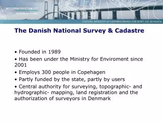
Spatial data from the National Survey and Cadastre • Rational and methodical mapping have been carried out in Denmark since 1757 • In 1989 all mapping activities were gathered together in the newly established Danish National Survey and Cadastre (KMS) • In the middle of 1990’s KMS started to digitalized their spatial data
Statistics Denmark use of spatial data from the National Survey and Cadastre 2000-2008(1) • In 2000 Statistics Denmark (DSt) got digitalized administrative maps (counties, municipalities and parishes) on payment of a yearly charge to KMS - mostly used for promotion purposes. • In 2006 DSt started a particular cooperation free of charge with KMS concerning the census on urban areas. KMS delivers the demarcations of the built-up areas every year.
Statistics Denmark use of spatial data from the National Survey and Cadastre 2000-2008(2) • …but to use other form of spatial data from KMS was very expensive!!
Statistics Denmark use of spatial data from the National Survey and Cadastre 2009 (1) • But the Danish Government wanted to modernize and digitize the public sector… • …so a new financial model for obtaining access to the spatial data was made. • On January 1 2009 a new governmental agreement came into force, which… • …means, that governmental authorities, educational institutions, state museums and common public portals are secured freely access to use spatial data and related services from KMS.
Statistics Denmark use of spatial data from the National Survey and Cadastre 2009 (2) • Access to a wide range of KMS’ products • The products can be used free of charge, when the purpose are internal affairs and official statistics imposed by the authorities • For external purposes (e.g. customised tasks) a charge must be paid to KMS
Spatial data in DSt from KMS(1) • DAGI-maps = Danish administrative borders • Regions, provinces and counties • Municipalities • Postal areas and parishes • Constituencies
Spatial data in DSt from KMS(2) • Detailed topographical vector spatial data in 1:10,000 - Kort10 (Map10) • Built-up areas • Buildings • Hydrographical conditions • Culture • Nature • Technique • Traffic • Place names
Themes in Map10 (1) Built-up areas • Town centre • High built-up areas • Low built-up areas • Industry
Themes in Map10 (2) Buildings • Buildings • Greenhouses • Tank/silo
Themes in Map10 (3) Hydrographical conditions • Bathing jetty • Ditches • Harbours • Groynes • Coast lines • Lakes • Stream banks • Streams • Pipe fitted streams • Land
Themes in Map10 (4) Culture • Relics of the past • Cemeteries • Recreational areas • Sport centres
Themes in Map10 (5) Technique • Reservoirs • Fence • High-voltage transmission lines • Parking areas • Technically areas • Television pylons • Windmills
Themes in Map10 (6) Nature • Boundaries of use • Dams and embankments • Dikes • Market gardens and nurseries • Moor • Quickset hedge • Triangulation point • Gravel pits • Sand and dunes • Forests and woods • Cliffs • Groves • Wetland
Themes in Map10 (7) Traffic • Bus lane • Railroad • Motorway • Stops and halts • Paths • Roads (3-6 m broad) • Roads (>6 m broad) • Other roads
Spatial data in DSt from KMS(3) • Another generalized topographical vector spatial data in 1:10,000 in accordance with FOT • Spatial data made as combination of data from KMS and the local municipalities • Same themes as in Kort10(Map10)
Spatial data in DSt from KMS(4) • Generalized topographical vector spatial data in 1:500,000 • Cities and towns • Main roads • Forests • Streams
Spatial data in DSt from KMS(5) • The Danish Cadastre • The basis for all land registration in Denmark consisting of: • An official cadastral register • A countrywide cadastral map
Spatial data in DSt from KMS(6) Addresses and their x,y-coordinates
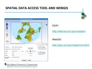
Spatial data in DSt from KMS(7) • The Digital Map Supply • Receipt of topographical maps via internet servers • WMS-service • WFS-service
All received spatial KMS-data are stored in both shape-format for ArcGIS and in an Oracle-database Official statistics Areas of parishes Census and areas on the Danish islands Statistics for sale Use of KMS-data in DSt
Renewed statistics of the parish areas (1) • For many years the area-statistics was built on a surveying made by KMS in the 1950’s • Lack of areas in the old market towns • Other places the areas were published as the sum of more parishes together • Every year the areas of some parishes are changed. Information about that are given from the Ministry of Ecclesiastical Affairs and manual changed in DSt’s calculation errors were made and accumulated through the years • A renewal of this statistics were needed
Renewed statistics of the parish areas (2) • The Danish Cadastre contains an information about parish membership • A statistics of the parish areas can be made by writing a simple SQL-expression up against the Oracle database:
…to be put in the periodical and the databank. An easy and quick way to make a statistic… Renewed statistics of the parish areas (3)
Some things to be aware of when using the Danish Cadastre (1) • A great deal of parishes are partial parishes – i.e. they are situated in more then one municipality • The SQL-expression takes allowance for these special conditions
Some things to be aware of when using the Danish Cadastre (2) • Some places the lakes are registered in the Danish Cadastra and some places they are not!
Some things to be aware of when using the Danish Cadastre (3) • The municipality of Copenhagen doesn’t register certain areas as streets, railway tracks, newly reclaimed land and graveyards as cadastre The parish areas in Copenhagen are underestimated.
Some things to be aware of when using the Danish Cadastre (4) • In south-western part of Denmark are the Wadden Sea – a tidal area. These areas are already registered as cadastres although half time under seawater The parish areas in these areas are overestimated.
Some things to be aware of when using the Danish Cadastre (5) • In creating the new statistics some parish areas may show a markedly difference from the old calculation • In some cases the cause are an adjustment of the border between two parishes • In other cases it can simply not been explained!
Renewed statistics of the Danish islands (1) • Population on the islands have been counted regularly since 1901 • Since 1976 the population on the Danish islands have been calculated by: • manual demarcating the parishes that belongs to the islands • manual demarcating which roads, that are belonging to the islands… • …and then in the Central Population Register (CPR) find out how many person are living on these roads • A comparatively safe method but… • From 2011 this method is supplied by GIS
Renewed statistics of the Danish islands (2) • The land-theme from Kort10 can be subdivided into single island-polygons • Every inhabited access address are provided with x,y-coordinates and placed relative to the island-polygons • Number of persons on the access-addresses are sum up The population on the islands • New method has not completely replaced the old because also here there can be some mistakes in the x,y-coordinates
Renewed statistics of the Danish islands (3) • A couple of new inhabited island were found and put into the census! • For the moment the island-census is therefore a combination of a register-method and a GIS-method.
Renewed statistics of the Danish islands (4) • The area-statistics of the islands was built on a surveying made by KMS in the 1950’s • Perhaps not a big problem but… • Some places land is reclaimed from the sea e.g. • expansion of a harbour • building of a new bridge • Coastal processes are active • The coast lines are undermined • Calm sea areas are sanded up • A new area estimation for the islands were needed
Renewed statistics of the Danish islands (5) • From the land-theme in Kort10 the islands were isolated and their areas were calculated…
…and in a quick and easy way a new statistics of the islands have been created. Renewed statistics of the Danish islands (6)
Future work in DSt involving KMS-data • A new estimation of the Danish coastline distributed over Danish provinces • Peoples proximity to nature (forests, parks, beaches etc.)