Download
1 / 23
230 likes | 329 Views
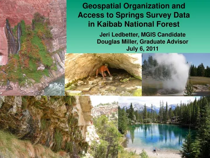
Geospatial Organization and Access to Springs Survey Data in Kaibab National Forest. Jeri Ledbetter, MGIS Candidate Douglas Miller, Graduate Advisor July 6, 2011. Why Study Springs?. 17% of endangered animals, and many rare species are springs- specialists

E N D
Geospatial Organization and Access to Springs Survey Data in Kaibab National Forest Jeri Ledbetter, MGIS CandidateDouglas Miller, Graduate AdvisorJuly 6, 2011
Why Study Springs? • 17% of endangered animals, and many rare species are springs- specialists • Particularly in arid climates, ecologically vital islands of habitat that support high biodiversity and endemism • Enormous cultural and economic significance • Little inventory, assessment, or understanding of springs ecology and conservation
Inadequate Protection • Groundwater depletion and pollution • Invasive species • Mining • Development • Diversions • Recreational use • Grazing and trampling • Climate change
Grand Canyon Wildlands Council Study in 2005Springs Impairment
Incomplete Mapping • Arizona likely has the highest density of springs in the country • Clustered along escarpments • NHD Database, AZ State Land Office layers incomplete • 10,330 + ?
Inadequate Study • Springs ecosystems are extremely complex • Until recently, no consistent methodology for survey and assessment of springs ecology–researchers looking at their own versions of an elephant • Very little comprehensive research of springs ecology across a landscape • What little information exists is fragmented and largely inaccessible to land managers and researchers
Springs Inventory Protocols Stevens, Springer, and Ledbetter 2010
Project Objectives • 1) Develop a technological framework that will support collaborative scientific efforts and conservation planning among local watershed and conservation groups, Indigenous Tribes, researchers, & agencies • Complete development of and publish database based on protocols developed by Stevens et al (2010) • Develop portal with robust information about springs ecology and research • Design interfaces with geospatial tools for contribution and exploration of springs data • 2) Develop North Kaibab Ranger District as a prototype to demonstrate how this technology will be applied to other landscapes • Compile springs datasets into geodatabase • Compile survey data into springs database through collaboration and data mining • Survey additional springs and locate unmapped springs • Make data accessible through portal and geospatial tools
Portal at springstewardship.org 1. Provide information about springs ecology 2. Publish survey protocols to encourage use of standard methodology 3. Share data online 4. Provide community- building technology (forums, networking tools, news updates) to coordinate research efforts
Online Geocollaboration • Interactive maps • Spatial query of data • Contribution of data Current Study Areas • Content Management System (Expression Engine) • Facilitates online collaboration and sharing of data • Controls access to data • Allows multiple collaborators to edit content
Prototype - Kaibab National Forest, North Kaibab Ranger District >1000 square miles of rugged terrain on the North Rim of Grand Canyon, with >1300 meters vertical relief Previously unmapped spring
Compilation of Location Data Sources Agencies US Forest Service Bureau of Land Management National Park Service Arizona State Land Office USGS studies, NHD Database Maps DRGs Forest Service Maps USGS Topographic Maps Previous Studies Brown and Moran 1979 Grand Canyon Wildlands Council 2004 Grand Canyon Trust Other Researchers Glenn Rink, Botanist Andrew Mouro, GIS Analyst Larry Stevens Steve Monroe, National Park Service Robert Dye, backcountry hiker
Compilation of Data from Previous SurveysCollected Using Different Protocols Collaboration &Partnerships Agencies Public documents – Environmental Impact StatementsOther Researchers – current work, past publications & theses
Springs Surveys May and June 2011 • Site selection from 114 springs • Cluster analysis • Elevational histogram +/- 1850 meters • Applied random numbers • Prioritized sites with little or no data • Prioritized representation in each cluster • Located 6 unmapped springs and unmapped aquifer. Full survey data for 70 springs.
Kaibab National Forest Interactive Map Currently—WMS using GeoServer and OpenLayersFuture development—WFS with enhanced capabilities
Timeline Peer-ReviewedArticle Develop Portal Geospatial tools Database 6/11 7/11 8/11 9/11 10/11 11/11 12/11 1/12 2/12 3/12 Surveys/compilation Launch prototype
Anticipated Results Accessibility of comprehensive springs data Community building through collaborative geospatial tools Land Agencies Predict impacts of events (fire, invasive species) using online maps Predict impacts of management decisions Researchers Reduce duplication of effort through collaboration Query data to analyze complex relationships of springs characteristics Develop a better understanding of springs ecology Predict effects of climate change Conservation organizations Predict potential impacts Reduce duplication, increase collaboration North Kaibab Ranger District Prioritize springs restoration projects Robust dataset of springs across a landscape
Applications – Impacts from Nonnative Species Photo by Jessica Pope
Geospatial Organization and Access to Springs Survey Data in Kaibab National Forest Jeri Ledbetter, MGIS CandidateDoug Miller, Graduate Advisormore information and references atspringstewardship.org