Download
1 / 17
170 likes | 294 Views
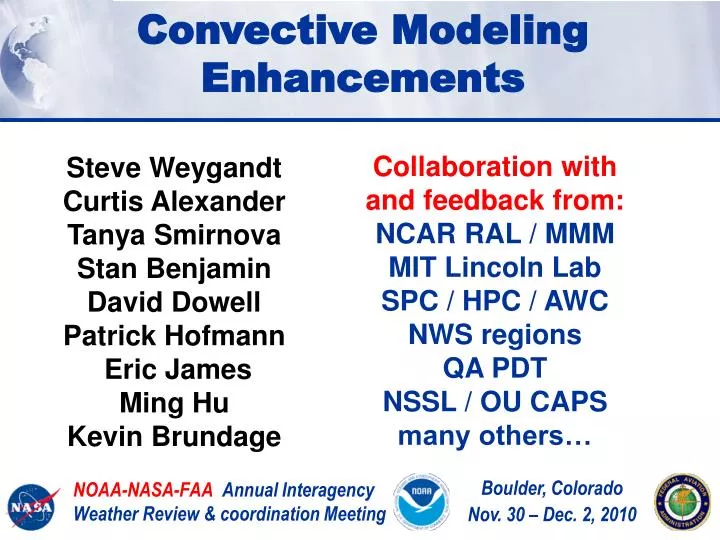
Convective Modeling Enhancements. Collaboration with and feedback from: NCAR RAL / MMM MIT Lincoln Lab SPC / HPC / AWC NWS regions QA PDT NSSL / OU CAPS many others…. Steve Weygandt Curtis Alexander Tanya Smirnova Stan Benjamin David Dowell Patrick Hofmann Eric James Ming Hu

E N D
Convective Modeling Enhancements Collaboration with and feedback from: NCAR RAL / MMM MIT Lincoln Lab SPC / HPC / AWC NWS regions QA PDT NSSL / OU CAPS many others… Steve Weygandt Curtis Alexander Tanya Smirnova Stan Benjamin David Dowell Patrick Hofmann Eric James Ming Hu Kevin Brundage NOAA-NASA-FAA Annual Interagency Weather Review & coordination Meeting Boulder, Colorado Nov. 30 – Dec. 2, 2010
Generation and use of model guidance Data Assimilation Observations Model Prediction Use of guidance information Model Post-Processing Boulder, Colorado Nov. 30 – Dec. 2, 2010
Importance of Meso- and Storm-scale DA Data Assimilation Observations - Rapid updating cycling using mix of ALL observations is crucial to obtain accurate mesoscale environment - Assimilation of radar data critical for short-range forecasts and for weakly forced convection - New advanced DA techniques (EnKF, hybrid) big improvements, but computationally expensive - Improvements from new observing systems (dual-pol, MPAR, aircraft moisture), Observations of PBL top??
Models – Ensembles – Post-processing • - Crucial importance of model • physics, especially microphysics • - Optimized ensemble members • using perturbed model physics, • initial / lateral boundary conditions • Adaptive post-processing • to create optimal • probabilistic guidance • - System configurations • designed to meet • short-fuse user needs • (perishable information) Data Assimilation Model Post- Processing Model Prediction
Hourly HRRR Initialization from RUC/RR 15-h fcst 15-h fcst Hourly HRRR Initial Condition Fields 18-h fcst 18-h fcst Interp to 3 km grid Lateral Boundary Conditions 18-h fcst Interp to 3 km grid Use 1-h old LBC to reduce latency 1-hr fcst DDFI DDFI 1-hr fcst 1-hr fcst Back- ground Fields Use most recent IC (post-DFI) to get latest radar info Analysis Fields 3DVAR 3DVAR Hourly RUC or RR Obs Obs Time (UTC) 11 z 12 z 13 z
Hourly HRRR Initialization from RUC/RR 15-h fcst 15-h fcst Hourly HRRR Initial Condition Fields 18-h fcst 18-h fcst Interp to 3 km grid Lateral Boundary Conditions 18-h fcst Interp to 3 km grid Use 1-h old LBC to reduce latency 1-hr fcst DDFI DDFI 1-hr fcst 1-hr fcst Back- ground Fields Use most recent IC (post-DFI) to get latest radar info Analysis Fields 3DVAR 3DVAR Reduced Latency: ~2h for 2011 Hourly RUC or RR Obs Obs Time (UTC) 11 z 12 z 13 z
Use of HRRR in CoSPA 8 h Forecast 8-h Forecast CoSPA 11-h HRRR fcst init 10z At longer lead times CoSPA based mostly on HRRR guidance 16 September 2010 Observation at 21Z
HRRR - 10z+11h Used in CoSPA HRRR 09z+12h fcst Not used in CoSPA Better guidance from earlier HRRR runs on 16 Sept Obs radar 21z Sept 16 HRRR 08z+13h fcst Not used in CoSPA
Analyzing HRRR VIL bias 15z 12z+3h HRRR-adj Valid time Observed 20z 12z+8h HRRR-adj (plots from James Pinto, NCAR-RAL)
Analyzing model performance HRRR Multi-Scale reflectivity verification 10 June – 26 Sept 2010 25 dBZ 8-h fcst East verif observed storm coverage valid (GMT) valid (EDT) init (EDT)
Analyzing model performance HRRR Multi-Scale reflectivity verification 10 June – 26 Sept 2010 25 dBZ 8-h fcst East verif “neighborhood” skill for CI and early evolution observed storm coverage valid (GMT) valid (EDT) init (EDT)
1-km nesting experiments Key differences between 133 km nest and 31 km nest 13 3 km 13-km DA system crucial for accurate storm environment Parameterized convection on 13-km, poor depiction of storm details Place 3-km lateral boundaries far from region of interest 1-way nest, can use 1-h old lateral boundary conditions Frequency of lateral BCs less critical 3 1 km Explicit convection on 3-km, good depiction of storm details Can have closer proximity lateral boundaries for 1-km domain (and need to do this because of computer limitations) High frequency lateral BCs more important Run one or more 2-way nests within parent 3-km domain
21 UTC 4 August 2010 (6-h forecasts) Much improved MCS forecast 1-km nest 3-km only (no nest) 3-km with 1-km nest
HRRR hydrology applications 12z 24 July 2010 NSSL accumulated rainfall 24 July 2010 00z+12h HRRR forecast rainfall
Severe Weather Application HRRR Time-lagged Ensemble Tornado Outbreak KS/OK 10 May 2010 Updraft helicity from four consecutive HRRR runs 13-16 UTC (color coded by run) Tornado Reports Up to valid time (red dots)
Planned HRRR Upgrades for 2011 1. Switch parent model from RUC to Rapid Refresh 2. Improved mapping of radar reflectivity in RUC / RR (no-echo area, latent heating magnitude) 3. Modifications to WRF model physics to improve MCS forecasts 4. Reduce HRRR model latency by ~30 min to attain ~2 hr latency 5. Radar assimilation on HRRR 3-km grid -- Reflectivity via DDFI (include hydrometeor specification? Use time dependent reflectivity fields? in addition to 13-km reflect assim?) -- Add “SatCast” data as proxy reflectivity to help early evolution -- Radial velocity assimilation via GSI 3DVAR with short length scales
Future plans for advanced NWP and DA 2011 – Rapid Refresh operational at NCEP 2013 – Ensemble Rapid Refresh – NARRE 2014 – High Resolution Rapid Refresh operational at NCEP for CONUS 2015 – Add operational Alaska HRRR 2016 – CONUS Ensemble HRRR - HRRRE 2017 – Global Rapid Refresh (GRR) HRRR - Alaska • NEMS-based NMM, ARW cores • Hourly updating with GSI • Initially 6 members, 3 each core • Forecasts to 24-h • NMM to 84-h 4x per day HRRR-CONUS Rapid Refresh North American Rapid Refresh Ensemble • Other improvements • Add inline chem, chem DA • EnKF or hybrid 4dvar/EnKF • Storm-scale radar assimilation • Sub-hourly DA