Download
1 / 18
180 likes | 333 Views
Remote Sensing of Precipitation A Look at Radar Now and in the Future. Darren R. Clabo Institute of Atmospheric Sciences, South Dakota School of Mines and Technology. Western South Dakota Hydrology Conference 23 April 2009. Outline. What is weather radar? How does it work?

E N D
Remote Sensing of PrecipitationA Look at Radar Now and in the Future Darren R. Clabo Institute of Atmospheric Sciences, South Dakota School of Mines and Technology Western South Dakota Hydrology Conference 23 April 2009
Outline • What is weather radar? • How does it work? • How is precipitation measured? • Case study • Limitations of radar • The future http://radar.weather.gov/index.htm NWS WSR-88D Radars Weather Surveillance Radar – 1988 Doppler
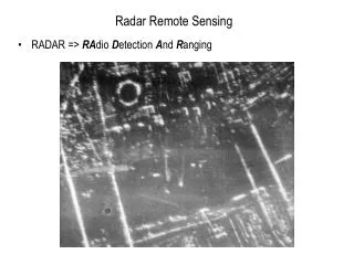
What IS Weather Radar? • Radar- Radio Detection and Ranging • Radio spectrum of electromagnetic (EM) radiation • Wavelength ~ 10 cm • Coherent • Known signal phase and amplitude • EM wave polarized in the horizontal
How Does Radar Work? • Emits timed pulses (~2 μs) of EM energy in a beam • Scattered by dust, planes, telephone poles, birds, insects, you, precipitation, etc. • Some energy returned to radar- backscatter • Retrieve • FREQUENCY- Note Doppler shift (tornado detection) • AMPLITUDE- Strength of signal, power returned
How Does Radar Work? “Radar Volume” x r = 1 mm Distance is function of time!
How Does Radar Work? • Two main products: Reflectivity Doppler Velocity And spectrum width…
How is Precipitation Measured? • Returned power converted to total reflectivity- z (mm6 m-3) • Drop number concentration times sixth power of the particle diameter • Radar Reflectivity Factor (Z) in units of [dBZ] as displayed on weather radar
How is Precipitation Measured? • Reflectivity is HEAVILY weighted to the LARGEST particles in the radar volume • How does this affect precipitation measurements? • CASE STUDY
Case Study- Radar Volumes Cloud B Large Raindrops Cloud A Small Raindrops Rain shafts have equal VOLUMEof water but vastly different drop SIZE characteristics 500 drops/m3 r = 1 mm 63 drops/m3 r = 2 mm
Case Study- Radar Volumes Cloud B Large Raindrops Cloud A Small Raindrops 500 drops/m3 r = 1 mm 63 drops/m3 r = 2 mm Z = 45.1 dBZ Z = 54.1 dBZ
How is Precipitation Measured? • Total reflectivityused to estimate precipitation • R-z Relationships (Marshall-Palmer) • R is rainfall rate (mm/hr), z is total reflectivity • Cool stratiform- z = 130*R^2 • Summer Convective- z = 300*R^1.4
How is Precipitation Measured? • Our case, If z = 300*R^1.4 • Small drop cloud (z = 32000), R = 5.51 mm/hr • Large drop cloud (z = 258048), R = 24.5 mm/hr • 4.5X difference in radar derived rainfall rate for SAMEVOLUME of water
Reflectivity One Hour Precipitation How accurate is this? What do we know about the drops themselves? And what if there are a few LARGE hailstones?
Limitations of Current Radar • Knowledge of Drop Size Distribution (DSD) is critical http://ga.water.usgs.gov/edu/raindropshape.html “Drippy” the unofficial USGS water icon!
Limitations of Current Radar • What can give us insight into the DSD? • Dual-Polarimetric radar (NEW) • TWO orthogonal EM waves • “Two-Dimensional” view of particle y y x x 1 mm 2-3 mm http://cimms.ou.edu/~schuur/radar.html
Limitations of Current Radar • Other problems • Beam blockage (those mountains are in the way!) • Attenuation (“rain fade”) • Curvature Effects • Beam broadening/Non-uniform beam filling • Dual-Polarimetric Radarcan help with these too! • Slated for upgrades in 2010-2012
Conclusions • Conventional radar has inherent problems • Hail identification • Knowledge of DSDs • “Beam Effects” • Dual-Polarimetric radar solves many of these problems • Sold on premise of better QPE
Questions • Contact information: • Darren.Clabo@mines.sdsmt.edu • Institute of Atmospheric Sciences (605) 394-2291