Download
1 / 30
360 likes | 918 Views
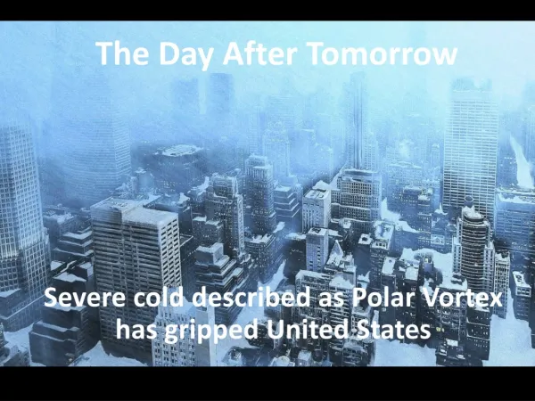
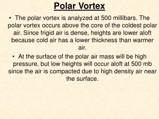
Polar Vortex. The polar vortex is analyzed at 500 millibars. The polar vortex occurs above the core of the coldest polar air. Since frigid air is dense, heights are lower aloft because cold air has a lower thickness than warmer air.

E N D
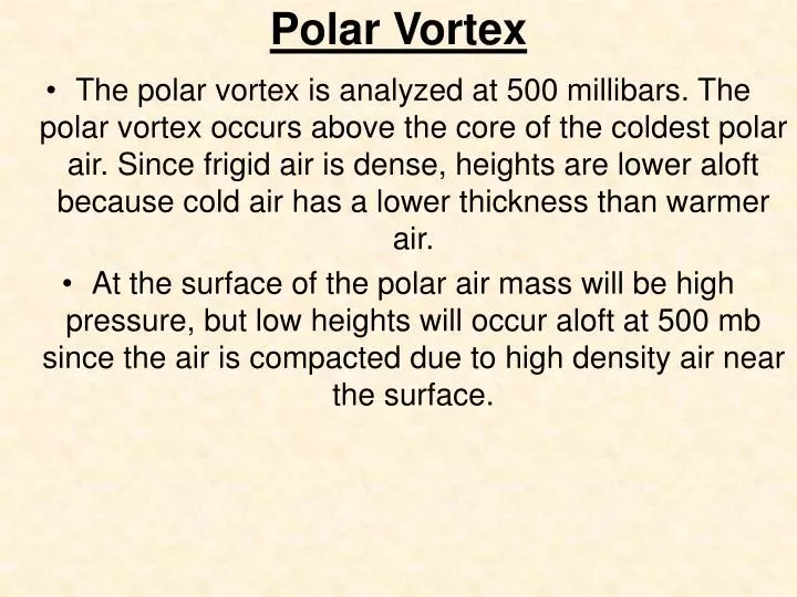
Polar Vortex • The polar vortex is analyzed at 500 millibars. The polar vortex occurs above the core of the coldest polar air. Since frigid air is dense, heights are lower aloft because cold air has a lower thickness than warmer air. • At the surface of the polar air mass will be high pressure, but low heights will occur aloft at 500 mb since the air is compacted due to high density air near the surface.
Polar Vortex cont. • The polar vortex can often be located over Canada since the coldest surface air is often found over high latitude icy/land locations. The polar vortex aloft propagates toward where the polar air mass moves. The vortex often moves very slowly or is stationary, and its position determines what part of the USA the Arctic air will invade. • When the vortex is centered over the Hudson Bay, as shown above, arctic air usually plunges south over the Dakotas and the northern Plains. If the vortex center shifts to the east, the core of the Arctic air invasion usually shifts east with it.
Polar Vortex cont. There are many regions where the polar vortex can be located for it to be marginally conducive for East coast snowstorms. Most important is that the PV is on our side of the northern hemisphere and away from the pole (displaced). December 2006: Trace of snow in Philadelphia. Temperatures were 5.3 degrees above normal.
Polar Vortex cont. • However, in my opinion, the polar vortex is best situated in southeastern Canada just prior to an East Coast snowstorm. However, for a storm to come up the coast the PV needs to weaken and/or move out of the way (northward,northwestward, or backwards diving south and east of the pumping PNA ridge). Otherwise the storm will be suppressed to the south. North Hudson Bay, Canada is also a favorable position just prior to a snowstorm. • Just keep it away from the Great Lakes region or just above it. In this position, short waves have trouble slowing down and digging (thoughts courtesy of Dave Tolleris).
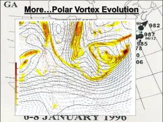
Polar Vortex Evolution Get that PV out of the way! Now we are finally open for business.
Hooking Up: Combining Energy (Moving Air Meets Moisture) I absolutely love the position of this 850 mb low. It is to the south of PHL but not too far away…and it’s moving ENE or NE. Very good sign if this model comes to fruition.
Hooking Up: Combining Energy (Moving Air Meets Moisture) Good snowstorm dynamics. Comma head and dry slot. Keep that dry slot south. We would need a WSW to ENE dynamic to keep the comma head on us for the maximum amount of time minimizing the impact of the dry slot.
HM (Polar Vortex-January 28, 2007 Post) When the PV enters Canada and drops into lower Canada in early FEB there are going to be some rules to consider....1) Do not be fooled that the PV will easily race back out of here the following week. As long as the PACIFIC pattern remains favorable, the PV cannot escape. This is explained in the next point.2) AS the PV continues to revolve around, remember that AJ and PJ s/w will continue to also pivot around like pendulums. They also affect the PV position significantly so. Well think about it. If AJ s/w off the PV continue to amplify down on the west side, and amplify b/c of the continued PNA ridge (they slide down) then it will pull the PV down. So essentially what happens is, the PV continues to revolve. She is stuck!
HM (Polar Vortex-January 28, 2007 Post) 3) The CLOSE PVs of N. hemisphere dont cut it! OR I should say..they do CUT IT! A block that is! What will happen is a block will pinch off into the NW territories / alaska and perhaps even lobe into the north pole. This feature will put a lid on any movement back into the pole, where the pv likes to be ideally! A period to watch for SECS would be FEB 10-12 when the PV moves into east canada (the revolution sequence brings it here but soon retrograding) ... this setup of the PV allows any mid latitude s/w to amplify but move off the east coast rather than cut inland. Depending upon how exactly things shape up this period will determine the severity of the storm, what type and if it even exists. But this is an early heads up...A post coming soon about the threat at DAY 5-6...
JB On The Polar Vortex and Setting Up the East Coast for a Snowstorm (Jan 30, 2007) Bust the southern stream comes through from the west, build pressures in Canada and get the vortex to pull away and you have a chance for storms that can go to town. IF YOU WANT DEEPENING SURFACE AND ALOFT, THERE HAS TO BE SOME KIND OF PRESSURE RISE SURFACE AND ALOFT FIRST SO THERE CAN BE THE CHANGE NEEDED TO PRODUCE A STORM THAT DOESN'T JUST RUN AWAY AT 50 MPH LIKE THIS ONE IS GOING TO.
HM (February 2, 2007) Where exactly the PV(s) set up and how exactly the pacific behaves will make all the difference for what happens in the FEB 9-11 period and thereafter. You cannot expect a huge displaced PV to hang around forever... it either has to reload or go away eventually b/c it is not in it's natural environment to just "chill" ... So it will be common to hear the avg joe forecast milder wx as we progress into mid feb... well duh.... but that doesnt mean DEC 06 into early JAN 07 wx again... and it may just increase our snow chances, removing that shearing PV out.
HM (February 2, 2007) FIRST ticket item would be FEB 9-11 period as the PV splits and moves east. Once piece settling in the "50-50" position (potentially, although it will be moving in and out) and another moving back into the north/greenland. This is called reload and it's a signal for potential east coast storm. The key player is the PV in SE canada and how much pacific energy undercuts the ridge and moves into the SW USA/plains. For now, I keep the SECS alert on for this period b/c the stj s/w can easily move east---and if GIVEN THE RIGHT ROOM and TIMING w/ the PV--- could yield a significant winter storm for many east of the rockies. If the PV is slow to move, it will crush it (ie 00z EURO) ... if the STJ s/w is too slow and the PV zips out of here, it could be a rainstorm. You get the idea... plenty of ideas.
Polar Vortex, 50-50 Low, and the NAO As stated on my last two posts this snowstorm threat comes about because the West Coast Ridge is fracturing as it gets battered by energy coming in from the Pacific. The northern end of the Ridge over northwestern Canada breaks off as a bubble of positive height anomalies -- high pressure in the jet stream-- which moves into north central Canada. This forces the huge PV to move into southeastern Canada and to stays in place. The PV which typically is situated over Hudson's Bay is now displaced to the south. Because the vortex is displaced over southeastern Canada it acts JUST as the 50/50 Low would in setting up a strong confluence zone in the PJ. It is the confluence zone which allows the cold High pressure over Eastern and Central Canada to build.
Polar Vortex, 50-50 Low, and the NAO Without the blocking features somewhere over Greenland or eastern Canada--- such as a - NAO or 50/50 Low -the cold HIGH pressure area over the Great Lakes or southeastern Canada will often slide out to sea during the East coast storm which is one reasons why in the big cities of the Northeast snow changes to rain. BUT in major snowstorms however the blocking does exist over eastern Canada and High pressure is trapped so the cold air is held in place and mostly precipitation over the Northeast even the big cities falls the snow.
Jets and Vortex (Feb 8, 2007) Now that we have the synoptic pattern down... we have another problem. In order to get this system to come further N up the coast so the best / heavy snows get into the northern Mid Atlantic and New England....
Jets and Vortex (Feb 8, 2007) …the northern branch of the Jet stream that is to say the PJ -- is going to have to drop in and PHASE with the short wave in the southern branch or the STJ. The problem is that none of the medium-range models over the last several days are showing this happening.
Jets and Vortex (Feb 8, 2007) The vortex over southeastern Canada is so big and so powerful that the winds are very strong circulating around it. It is these strong winds In the PJ which creates the confluence zone and allows the cold High pressure to move across the West Canada border or just to the north. But on the other hand these very strong wings around the vortex are prohibiting any sort of phasing by the northern branch. The velocities are simply to strong to allow the PJ to phase.
Jets and Vortex (Feb 8, 2007) Here Note the BLOCK-- strong Positive 500 MB heights over north central Canada which traps the PV over far SE Canada .... and the interaction between the BLOCK and the PV keeps the winds coming around in the PJ vortex over the Great Lakes very strong .
Polar Vortex (DT on 2-5-09)-Do We Get a Storm on Presidents Day Weekend of 2009?- “When I state NO POLAR VORTEX on my map in Post #8 I am NOT stating this as a negative factor.In fact I am stating as a positive factor.in some situations having a Huge PV and or one that is DISPLACED to the south can act as a 50/50 Lo and help set up your confluence zone and possible phasing event.In this case the lack of deep solid large 500 MB vortex that can be called a PV is VEEEEERY good for those east coast snow lovers.ALSO... in the WHAT COULD GO WRONG? Department. Next Monday and Tuesday when the Midwest deep south and Mid Atlantic is basking in 50s and 60s and a strong se Ridge we MUST see a 500 Low develop over SE Canada.”