Download
1 / 42
460 likes | 515 Views
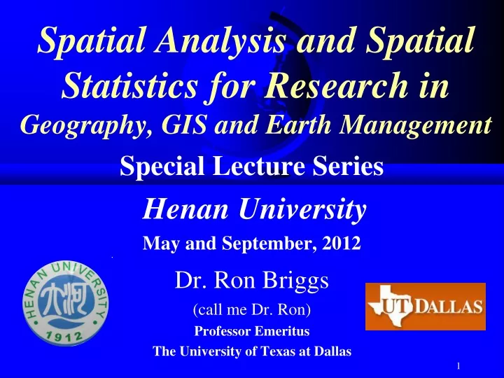
Spatial Analysis and Spatial Statistics for Research in Geography, GIS and Earth Management. Special Lecture Series Henan University May and September, 2012 Dr. Ron Briggs (call me Dr. Ron) Professor Emeritus The University of Texas at Dallas. Introducing the Lecture Series.

E N D
Spatial Analysis and Spatial Statistics for Research in Geography, GIS and Earth Management Special Lecture Series Henan University May and September, 2012 Dr. Ron Briggs (call me Dr. Ron) Professor Emeritus The University of Texas at Dallas
Introducing the Lecture Series Today, I will introduce the lecture series: • Introduce myself • Explain the goals of the lecture series • Discuss fundamental research principles: • the major steps of any research project • the importance of the research objective • the need to review the existing literature • Introduce a project that you can work on
Geography, GIS and Earth Management Where Why ? • Geography • The science of location • Where things are located, and why • Geographic Information Science (GIS) • Technologies for analysis of where and why • Earth Management • Geography and GIS applied to the real world This class is for you all!
Geography, GIS and Earth Management(G-GIS-EM) Description Explanation Application Geography GIS Earth Management This class is for you all!
Who am I? • Dr. Ronald Briggs (call me Dr. Ron) • Professor Emeritus (retired!?) • University of Texas at Dallas • Email: briggs@utdallas.edu or rbriggs@utdallas.edu • Web: www.utdallas.edu/~briggs • Office: Room 319 • Come and talk with me there • My cell phone number is 18739962744
Personal (continued) • Born in Liverpool, England • At the same time as The Beatles
Moved to the US in 1966 • Ph.D. The Ohio State University, Columbus • First job at University of Texas at Austin • Moved to UT-Dallas in 1976 • Director of computing (1982-1995) • Director of programs in GIS (1995-2008) Columbus, Ohio Dallas Austin Texas
Nanjing Rd, Shanghai • My specialization is Urban Geography and GIS Sydney, Australia Rio de Janeiro, Brazil
But I am also interested in the natural environment But bust North Island, New Zealand Amazon Rain Forest, Brazil British Virgin Islands, Caribbean
Goal #1 • help you conduct high quality research in Geography and Geographic Information Systems • describe standard research practices and procedures in western countries
Goal #2: Improve your English. • By talking in English about some GIS concepts you already know • and some that you don’t know • hopefully, I can provide some new insight and understanding!
Goal #3: Learn about Spatial Statistics Centrographic Statistics Spatial Autocorrelation • We will focus on Spatial Analysis in general, and Spatial Statisticsin particular. • Hopefully, you already know at least something about spatial statistics • Talking about it again here will help your English, and help you better understand spatial analysis and spatial statistics
Goal #4: Learn about doing research on the U.S. • Learn about datasets for the United States • Learn about geographical concepts used with US data, for example • Coordinate systems such as the State Plane Coordinate System • Geographic units used for reporting data such as Metropolitan Statistical Areas (MSA), census tracks, census blocks, etc.
Research in geography, GIS and Earth Management • Types of Research • Spatial analysis—the focus of my lectures • The steps of a research project • The importance of the research objective • Using and citing the Existing Literature
Types of research in G-GIS-EM ? Data set generation Often what you do for your first job! Technology or tool development Usually at universities or computer companies Spatial Analysis identifying spatial patterns understanding why they occur but all are interrelated
Research Interrelationships used for Data generation Technology or tool development uses requires used for used for requires Spatial Analysis Description Application Explanation
Example:Urban tree inventoryFang Qiu, Jie Chang , Caiyun Zhang at UT-Dallas • Urban forests (trees in cities) very important resource today • Need inventory of trees by tree species • Data generation • Interpolation and cluster analysis techniques used to identify trees and their species • Tool development and spatial analysis
Interpolation and cluster analysis techniques applied to remote sensing data used to identify tree species • Ground Points Accuracy doubled from existing methods: --60%-70% versus 30%-40%
Urban tree inventory:relevant to all your areas of study • Physical geography • Trees are an important part of the natural environment • Biogeography and forestry • Economic geography • Trees are an important economic resource • significantly increase the value of houses and land • GIS • GIS tools and techniques required to do the inventory • Earth Management • Trees are a critical resource to be managed $
Example: cancer data(source: Rogerson and Yamada p. 17, from Cuzick and Edwards, 1990)(data is for childhood cancer in northern England) Location of children with cancer --they appear to cluster (concentrated in one area) Why? --because people cluster in cities? --because there is a source of pollution? Need to apply spatial analysis to examine if cancer cases still cluster after we remove the obvious factor that people cluster in cities. Briggs Henan University 2010
This lecture series will focus on tools and techniques for spatial analysis • The goal of spatial analysis is to • Describe and identify spatial patterns, and • understand why they occur • Spatial analysis usually • states a hypothesis: a guess at a possible explanation • e.g. Environmental pollution results in higher rates of disease • designs a study to test that hypothesis using • Appropriate data • Appropriate tools and techniques • Spatial statistics are often the best tools to use • We will focus on spatial statistics • See Outline of Lecture Topics • Stating an hypotheses • A hypotheses is “a guess at an explanation,” for example • (More people get sick in areas which have more pollution) • Designing a study to test that hypotheses
Outline of Lecture Topics: Spring (May) Week 1 (May 7) 1. Research Methodology: The Central Role of Goals and Objectives. (1Intro.ppt) 2. Spatial Analysis: Concepts and Issues (2spatanal.pp) 3. Spatial Data: What is special about spatial data? (3spatdata.pp) Week 2 (May 14) 4. Standard Statistics & Spatial Statistics: Differences & Similarities (5CentroStat.ppt) 5. Descriptive Spatial Statistics for Points and Polygons 6. Inferential Spatial Statistics: Standard and spatial (6InfStat.pp) Week 3 (May 21) 7. Point Pattern Analysis: Concepts and Tests for Clustering and Dispersion (7.1PointPat.pp) 8. Point Pattern Analysis: Applied Point Pattern Analysis (7.2PointPat.ppt) 9. Conclusion and preview of September classes: Analyzing polygons and surfaces
Outline of Lecture Topics (Fall) Week 4 (Fall- 1st week) 10. Review of May sessions (Point Patterns) and Intro to fall (Polygons & Surfaces) 11. Spatial Autocorrelation: concept and implementation (9SAconcepts.pp) 12. Global Measures of Spatial Autocorrelation: Moran’s I and Geary’s C (10SAglobal.ppt) Week 5(Fall-2nd week) 13. Local measures of Spatial Association: Anselin’s LISA & others (11SALocal.ppt) 14. Using GeoDA for measuring spatial autocorrelation (12SADemo.pp) 15. Regression and Correlation: standard approach (13SpatReg.pp) Week 6 (Fall-3rd week) 16. Spatial Regression 17. Using GeoDA for standard and spatial regression (15Regdemo.pp) 18. Analyzing surfaces: Concepts and Trend Surface Analysis (18Surfaces.pp) Week 7 (Fall-4th week) 19. Analyzing surfaces: IDW and Kriging 18. Research at UT-Dallas: spatial statistics in practice. (16UTDRes.ppt) 19. A taste of other topics: cluster creation, network analysis, interaction data
Software(training will be included) • ArcGIS from ESRI, Inc. (licensed) • GeoDA by Luc Anselin, Arizona State University (freely available) http://geodacenter.asu.edu/software/downloads • Crime Stat III by Ned Levine, National Institute for Criminal Justice (freely available) http://www.icpsr.umich.edu/CrimeStat/download.html Copies also on my web site at: www.utdallas.edu/~briggs
Research projects:what must be included. US students seldom get this right. You must do better!!!
The seven parts of every Research Project • Objective, explains the purpose of the research and why it is important • Usually includes Hypotheses: possible explanations which you will test • Literature Review, identifies the key pieces of existing research relevant to the project and the hypotheses • Data Sources, identifies and explains the data used. • Analysis and Methodology, explains the methodology applied to the data. • Results, describes the main research findings, whether or not the hypotheses were upheld, and any potential problems or shortcomings • Conclusion, discusses the implications of your results relative to your initial project objective. • References, provide standard format citations for all resources used in the project. For more detail, go to: http://www.utdallas.edu/~briggs/poec6389/gisc6389_contents.doc
These 7 parts are necessary for every research project • Every research paper or report should include a section covering each part
Which component do you spend the most time on in your courses? • Data and methods!! • Which component is the most important for successful research? • The objective and the hypotheses Objective: the foundation for any research project
Objective Everything depends on the objective • Hypotheses are based upon the objective • data is selected which enables you to test the hypotheses and meet your objective • methods of analysis are applied to the data in order to meet your objective • Your results and conclusions are always made relative to your objective Everything links back to the objective!
Objective: one sentence Example (project you can do): • This research is in the area of environmental justice. • Environmental justice is concerned with whether or not some groups of people are more exposed to environmental hazards than other groups • “The objective of this research is to examine if low income or ethnic minorities in Dallas, Texas are more exposed to pollution than higher income groups or non-minorities”
Objective—your guide for everything! Your guide for every research decision • What hypothesis will meet my objective? • What data is needed to meet my objective? • Which analytical method(s) is best to meet my objective? • How are my results relevant to my objective? If it doesn’t relate to the objective, don’t do it!
The Literature Review • All research and analysis should build upon the existing base of knowledge • Must use the existing base of knowledge to: • Identify appropriate objectives • State logical hypotheses • Select and use correct methodologies and appropriate data • All of this is accomplished by reviewing the existing literature • of scientific knowledge published in refereed journals • not a Baidu or Google search Base of Knowledge
Help with Literature Reviews A standard Baidu or Google search is not sufficient! Instead, use Google Scholar • http://scholar.google.com/ The single most commonly used academic bibliographic database in US is probably “Web of Science” at • http://isi10.isiknowledge.com/portal.cgi?DestApp=WOS&Func=Frame • Your library may provide access A very useful bibliography fro GIS from ESRI is • http://training.esri.com/campus/library/index.cfm Lists of GIS journals are available • On website of Dr Fang Qiu • http://www.utdallas.edu/~ffqiu/ • On my web site (with other information about GIS) • http://www.utdallas.edu/~briggs/other_gis.html
How to Format Citations • It is very important to use the correct format when citing literature • copying/pasting a URL is not sufficient! • It may be gone tomorrow • The Chicago Manual of Style is the accepted norm. The Chicago Manual of Style. Chicago: University of Chicago Press, 15th ed., 2003 • Or, copy the format used by any major journal in your field • Good summaries of correct formatting are available at: • http://www.libs.uga.edu/ref/chicago.html • Or , http://library.osu.edu/help/research-strategies/cite-references/chicago-author-date/ • References are usually listed in a section at the end of the paper • For powerpoint presentations, it is good also to include the full citation on the slides where it is discussed • A person reading a paper can "flip to the end" to check a reference, but a listener cannot do that with a presentation!
Texts O’Sullivan, David and David Unwin, 2010. Geographic Information Analysis. Hoboken, NJ: John Wiley, 2nd ed. Other Useful Books: Mitchell, Andy 2005. ESRI Guide to GIS Analysis Volume 2: Spatial Measurement & Statistics. Redlands, CA: ESRI Press. Allen, David W 2009. GIS Tutorial II: Spatial Analysis Workbook. Redlands, CA: ESRI Press. Wong, David W.S. and Jay Lee 2005. Statistical Analysis of Geographic Information. Hoboken, NJ: John Wiley, 2nd ed.
Example ProjectYou do it! Hypothesis Testing using ArcMap
ArcMap Project Zip file (proj1_data.zip) Word document (proj1.doc) • Purpose: • Example of spatial analysis with objective, hypotheses, etc. • Experience with US data ArcMap project