Download
1 / 25
510 likes | 1.25k Views
Dr Nigel Trodd Coventry University. Spatial Queries & Analysis in GIS. Aim. Your aim is to better understand the reasons for and methods of spatial queries and spatial analysis. a fundamental question . whywhywhywhywhy perform sp a ti a l a n a lysis ?. Why?.

E N D
Dr Nigel Trodd Coventry University Spatial Queries & Analysis in GIS
Aim Your aim is to better understand the reasons for and methods of spatial queries and spatial analysis
a fundamental question ... whywhywhywhywhy perform spatial analysis ?
Why? The cost of data input to a GIS is high, and can only be justified by the benefits of analysis / modelling / decision-making performed with the data. 60 polygons per hour = $1 per polygon estimates as high as $40 per polygon 500,000 polygon database costs $500,000 to create using the low estimate $20m using the high estimate
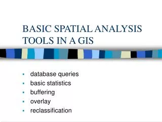
What can justify these costs? Query if it is faster than manual lookup Analyses which are simple in nature but difficult to execute manually map measurement, particularly area Analyses that exploit GIS capabilities for data integration Exploratory spatial data analysis Analyses that develop spatially distributed models Predictions that support decision-makers Simulations, hypothesis testing
Objectives In this lecture we will • Identify spatial queries • identify a range of spatial operations available to you in a GIS. • explain the principles of the algorithms on which these operators are based.
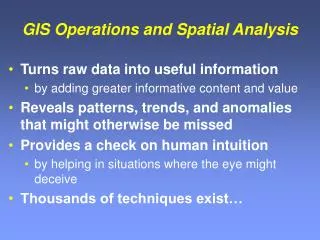
what is data analysis? ...the data information transformation
So, what is a spatial query? Select Extract Interactive query examples
What Qs are spatial Qs? • What is where? • What is found at a location? • Where is what? • Where can you find a feature? But, spatial queries are NOT spatial analysis
What is spatial analysis? Data analysis transforms data into useful information A method of analysis is spatial if the results depend on the locations of the entities being analyzed move the feature(s) and the results change Or the analysis modifies the geometry or creates new geometry
Spatial operations Berry, J.K., 1987, Fundamental operations in computer-assisted map analysis, International Journal of GIS1 119-36. Reclassifying maps Topological overlay Measuring distance and connectivity Characterizing neighbourhoods
Reclassify Reclassify and then merge adjacent areas with the same attribute i.e. change geometry
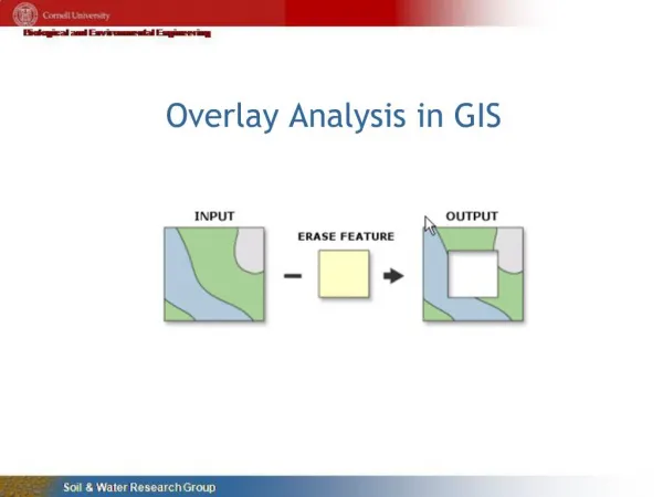
Overlay analysis Point-in-polygon Line-in-polygon Point-on-line Line-on-line Polygon-on-polygon But, visually superimposing 2 or more layers is NOT an overlay operation
Point in Polygon overlay Determine whether a point lies inside or outside a polygon used to assign crimes to police beats, voters to enumeration districts, children to school catchments, patients to PCTs
Point in Polygon Algorithm Draw a line from the point to infinity in any direction, and count the number of intersections between this line and each polygon’s boundary. The polygon with an odd number of intersections is the containing polygon: all other polygons have an even number of intersections.
Polygon on Polygon overlay for vector data B A Two polygons (A, B) are intersected to form 9 new polygons. One is formed from both input polygons; four are formed by Polygon A and NOT Polygon B; and four are formed by Polygon B and NOT Polygon A.
Polygon on Polygon algorithms • Algebraic • Statistical • Boolean
Proximity analysis: buffering Create a new area within a user-defined distance of an existing entity e.g., to determine areas impacted by a proposed highway
Point Area Line
Contiguity analysis Which states share a border with Missouri? …a question of connectivity
Neighbourhood analysis calculate an output value at a location from the values at nearby locations… as determined by a moving-window
Spatial Queries & Spatial Analysis Queries manipulate the database Analysis transforms data into information Spatial analysis transforms spatial data 4 basic types of spatial operation Several operators of each type Algorithms for raster and vector data models