Download
1 / 21
220 likes | 279 Views
Seismology and Earthquake Hazards. Chapter 19.2-19.4. Seismometers and Seismograms. Most of the vibrations caused by seismic waves cannot be felt at great distances from an earthquake’s epicenter

E N D
Seismology and Earthquake Hazards Chapter 19.2-19.4
Seismometers and Seismograms • Most of the vibrations caused by seismic waves cannot be felt at great distances from an earthquake’s epicenter • However, they can be detected by sensitive instruments called seismometers, which measure horizontal or vertical motion during an earthquake.
Seismometers and Seismograms • The record produced by a seismometer that can provide individual tracking of each type of seismic wave is a seismogram.
Seismometers and Seismograms • Travel-time curves provide the average time it takes for P- and S-waves to reach seismic stations.
The Richter Scale • A numerical rating system that measures magnitude of an earthquake. • Magnitudeis the measure of the energy released during an earthquake. • The numbers in the Richter scale are determined by the height, called the amplitude, of the largest seismic wave.
Measuring and Locating Earthquakes Moment Magnitude Scale • The moment magnitude scale is a rating scale of the energy released by an earthquake, taking into account the size of the fault rupture, the amount of movement along the fault, and the rocks’ stiffness.
Depth of Focus • Earthquakes are classified as shallow, intermediate, or deep, depending on the location of the focus. • Shallow-focus earthquakes are the most damaging.
Locating an Earthquake The epicenter’s location, as well as the time of occurrence, can be determined using seismograms and travel-time curves.
Distance to an Earthquake Seismologists determine the distance to an earthquake’s epicenter by measuring the separation on any seismogram and identifying that same separation time on the travel-time graph.
Distance to an Earthquake To locate the epicenter of an earthquake, scientists identify the seismic stations on a map, and draw a circle with the radius of distance to the epicenter from each station. The point where all the circles intersect is the epicenter.
Seismic Belts The majority of the world’s earthquakes occur along narrow seismic belts that separate large regions with little or no seismic activity. The locations of most earthquakes correspond closely with tectonic plate boundaries.
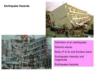
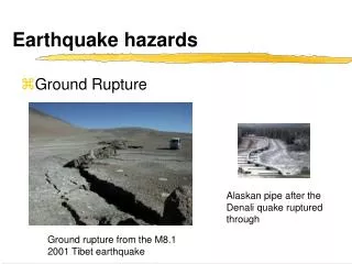
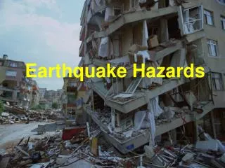
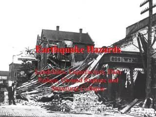
Earthquake Hazards • Earthquake hazards are factors that determine the severity of damage produced by an earthquake. • Identifying earthquake hazards in an area can sometimes help to prevent some of the damage and loss of life.
Structural Failure • Pancaking • shaking causes a building’s supporting walls to collapse and the upper floors to fall one on top of the other like a stack of pancakes
Land and Soil Hazards • In sloping areas, earthquakes can trigger massive landslides. • In areas with sand that is nearly saturated with water, seismic vibrations can cause the ground to behave like a liquid in a phenomenon called soil liquefaction.
Earthquakes and Society Tsunami • A tsunami is a large ocean wave generated by vertical motions of the seafloor during an earthquake.
Earthquake Forecasting The probability of an earthquake’s occurrence is based on two factors: • the history of earthquakes in an area • the rate at which strain builds up in the rocks
Earthquake Forecasting Seismic risk • The probability of earthquakes in seismic belts is much greater than elsewhere on Earth. • The history of an area’s seismic activity can be used to generate seismic-risk maps.
Earthquake Forecasting Recurrence rates Earthquake-recurrence rates along a fault can indicate whether the fault ruptures at regular intervals to generate similar earthquakes.
Earthquake Forecasting Seismic gaps Seismic gaps are sections located along faults that are known to be active, but which have not experienced significant earthquakes for a long period of time.