Download
1 / 26
260 likes | 527 Views
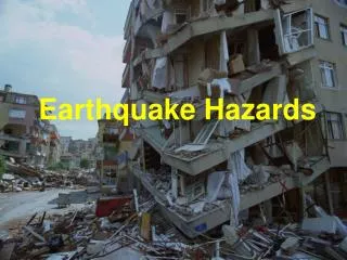
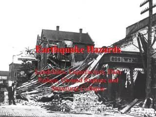
Earthquake Hazards And Earthquake Risks in the Central US. Or, What Keeps Geologists Awake at Night…. Earthquake Magnitude. How much energy released Logarithmic scale M6 = ~30 x M5 M7 = ~1,000 x M5. Earthquake Intensity. How much energy delivered to any one site

E N D
Earthquake HazardsAnd Earthquake Risks in the Central US Or, What Keeps Geologists Awake at Night….
Earthquake Magnitude • How much energy released • Logarithmic scale • M6 = ~30 x M5 • M7 = ~1,000 x M5
Earthquake Intensity • How much energy delivered to any one site • Subjective: depends on felt-reportsfrom each location • Many different intensities for same earthquake
Earthquake Depth • Range from shallow to deep (surface to ~800 km) • Central US range 0 to 40 km • Shallow = more energy and intensity at the surface • Deep = less energy and intensity at the surface
Earth’s Crust • Thinner than an apple peel • Floats on viscous mantle • Pieces ‘bump and grind’ along plate edges plate tectonics • Anomaly: Central US & others
Earthquake Duration • Felt for a few seconds • small earthquake, near epicenter • Felt for several minutes • large earthquake, farther from epicenter • Extreme earthquakes ‘ring the earth’ for hours
Aftershocks & Series • Occur after most larger earthquakes • Become smaller and less frequent over time • Can cause significant damage • Central US: major earthquakes tend to occur in series
Did You Feel It? • April 18, 2008 • 4:36 am (CDT) • Magnitude 5.4 • Depth ~11 km • Epicenter near Bellmont, Ill.
Earthquake Locations • Need three earthquake recordings (seismograms) • Measure distance from each recorder • Common point is approximate epicenter
Earthquake Locations • Regional velocity of earthquake waves is known • Distance from epicenter is estimated • More recordings = better accuracy
Mississippi Embayment • Very clear on maps! • ‘Bedrock trough’ dips & widens to the SW • New Madrid fault zone • ‘Bottom’ of trough • North end of trough • Filled with sediments • Mississippi River follows ‘easiest’ route
New Madrid fault zone • Southeast Missouri & northeast Arkansas • Mississippi Embayment • Old weakness in earth’s crust • Active for hundreds of millions of years • Activity continues now • 8-year ‘monitoring’ is inconsequential
Central US Earthquakes • New Madrid FZ • Three ‘dog-legs’ segments • Wabash Valley FZ • East Tennessee FZ • Ste. Genevieve FZ • ‘Background’ faults everywhere
New Madrid 1811-12 • Founded 1789; heavy forests • Largest town between St. Louis & New Orleans • Frequent floods and swamplands around it • Heavy forests
New Madrid Earthquakes • Winter of 1811-12 • Three earthquakes ~M7+ • 1000s of aftershocks • Wracked land, choked river • Most people left the area
New Madrid Earthquakes • December 16, 1811 • ~mag 7.5 • January 23, 1812 • ~mag 7.3 • February 7, 1812 • ~mag 7.6
Eliza Bryan • Born Pennsylvania 1780 • Arrived New Madrid 1791 • Earthquakes 1811-12 • Chronicled earthquakes 1816
New Madrid Earthquakes • Eliza Bryan account • ‘Violent shocks …’ • ‘Continuous agitation …’ • ‘Sand ... from fissures’ • ‘Twenty foot waves …’ • Evidence still visible today
New Madrid Earthquakes • River recedes from bank • 15- to 20-foot waves • ‘Waters gathered like a mountain …’ • Boats torn from moorings • ‘Water took groves of cottonwood trees’ • Flooded tributary ¼-mile
New Madrid Earthquakes • ‘Retrograde current’ • Fault uplifted land surface downstream • Natural dam • Backflow created Reelfoot Lake • Channel soon reclaimed • Evidence still visible today
New Madrid Earthquakes • Probably hundreds died, mostly on the river • African and Native Americans not counted • Insurance records (!) show losses of lives and insured cargoes
Evidence Still Visible Today • Sandblows
Evidence Still Visible Today • Reelfoot Lake • Northwest Tennessee • Sunklands
New Madrid Earthquakes • Felt area larger than same-size California earthquakes • Rock here is different! • Aftershocks for years • What is odd about this map?
USGS Products • Detailed hazard maps • Memphis, Tenn. • Evansville, Ind. • St. Louis, Mo. • Groundshaking • Liquefaction • Not site-specific!
Phyllis Steckel, RG Earthquake Insight LLC Washington, Mo. In cooperation with the US GEOLOGICAL SURVEYCENTRAL US EARTHQUAKE PROGRAM