Download
1 / 41
420 likes | 519 Views
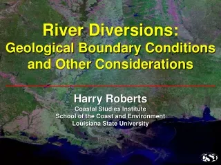
River Diversions: Geological Boundary Conditions and Other Considerations. Harry Roberts Coastal Studies Institute School of the Coast and Environment Louisiana State University. Louisiana’s Coastal Land Loss: A Regional Geology Problem.

E N D
River Diversions: Geological Boundary Conditions and Other Considerations Harry Roberts Coastal Studies InstituteSchool of the Coast and EnvironmentLouisiana State University
Louisiana’s Coastal Land Loss: A Regional Geology Problem Mississippi Delta Land Loss and Gain USGS
Key Geologic Factors in Land Loss • Crustal Downwarping • Compaction-Dewatering of Young Deposits • Faulting • Decreasing Sediment Supply-Increasing Accommodation
River Diversions: Best Hope for Off-Setting Coastal Land Loss
When the Scale of Coastal Land Loss is Considered — Sediment Availability is a Problem USGS
Sediment Storage in the System Before Human Intervention
The Lower Mississippi River and Delta • Glacial-period braided streams within incised valley • Holocene valley filling and delta construction • Valley fill reflects interactions between climate and sea-level change New Madrid Memphis Post-Glacial Alluvium and Deltaic Sediments = ~60.500 km2 Post-Glacial Alluvium and Deltaic Sediments = ~60.500 km2 Vicksburg Baton Rouge New Orleans Mississippi incised valley
Longitudinal Profile of the Lower Mississippi Valley and Delta Tracing Late Pleistocene Braided Streams into the Subsurface Using Base of Backswamp Deposits braided stream deposits Based on 325 USACE boreholes from Blum et al. (2008)
Lower Mississippi Valley and Delta Magnitude of Post-Glacial Deposition Balize Delta > 100 m Thick Total storage = 1860-2300 km3 or 2790-3450 BT of sediment Storage rate = ~230-290 MT/yr over 12,000 yr post-glacial period sediment isopachs adapted from Kulp (2000)
Mississippi River Discharges and Sediment Storage Pre-Dam Sediment Load*: ~400 – 500 MT/yr Mean Sediment Storage**: 230 – 290 MT/yr 1976-2006 Mississippi & Atchafalaya Sediment Load: ~205 MT/yr *Suspended Sediment Load Meade et al. (1990); Kesel et al. (1992) **Avg. over 12 kyrs
Lower Mississippi River Sediment Load Pre- and Post-Dam Loads 230-290 MT/yr Data courtesy of USGS Baton Rouge Data courtesy of USGS Baton Rouge Modern post-dam sediment loads are ~65% of the long-term mean storage component alone
Projections of Sea-Level Rise and Subsidence Increasing Accommodation
Global Sea-Level Rise Sea-Level Change Data and Projections Satellite observations Tide-gauge observations ~3.0 mm/yr ~1.7 – 2.0 mm/yr ~1mm/yr from IPCC 2007
The Louisiana Coast in 2100? Baton Rouge Lafayette New Orleans Projected future land loss of 10,500-13,500 km2 New accommodation ~12-16 km3 (Requires ~18-24 BT to fill accommodation)
Mass balance considerations present tough choices for diversion scenarios The Louisiana Coast in 2100? New Orleans Baton Rouge Lafayette 1400-1800 km2 with 50% of sediment load Projected future land loss of 10,500-13,500 km2
A Goal of River Diversions: Maximize Retention of Sediment Within the Coastal Plain
Fundamental Questions: River Diversions • How are the sediments partitioned within the coastal-shelf system? • What is the sediment retention capability in the delta and adjacent marshland? • What are the important processes linked to sediment transport to the delta-marsh-offshore?
Primary Physical Process Data Collection Sites Delta ADCP Delta ADCP
Important Positive Impacts of Hurricanes, Tropical Storms and Cold Fronts
Delta Side-Looking ADCP
Tropical Storm Lee September 4, 2011
Primary Physical Process Data Collection Sites Delta ADCP Delta ADCP
Marsh Accretion Study Site M3 M2 M1
Sediment Accretion Inland Marsh Site M1 Wax Lake Delta Site 9 4 cm / 6 months 1.5 cm / 5 months
Impact of Cold Fronts: Less Energetic but More Frequent than Tropical Storms
Rising Flood and Cold Fronts Form Synergistic Sediment Delivery Processes
Cold Front Modulation of Sediment Transport • Prefrontal: • Onshore Winds • Water Level Set-Up • Onshore Sediment Transport • Postfrontal: • Offshore Winds • Water Level Set-Down • Offshore Sediment Transport
Water Level Demeaned and Offset with Wind Speed
Prefrontal Conditions RESULT: Marshward Transport of Sediment (20-30 times/year)
Postfrontal Conditions RESULT: Sediment Deposition, Marsh Substrate Accretion, Nutrient Loading
Project Results Suggest: Placement of River Diversions in Landward Parts of Interdistributary Basins Will Maximize Sediment Retention Through Landward Suspended Sediment Transport by Cold-Front-Related Processes.