Download
1 / 36
360 likes | 499 Views
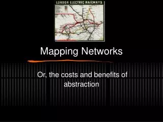
Mapping Networks. Or, the costs and benefits of abstraction. Mapping Networks. What are Networks Elements of Network Mapping Schematic Maps. Networks, Defined. What is a network?. Networks, Defined. What is a network? An interconnected group or system

E N D
Mapping Networks Or, the costs and benefits of abstraction
Mapping Networks • What are Networks • Elements of Network Mapping • Schematic Maps
Networks, Defined • What is a network?
Networks, Defined • What is a network? • An interconnected group or system • a system of intersecting lines or channels; "a railroad network"; "a network of canals” • Networks are important in geography and mapping
Elements of Networks • Networks are a collection of: • Nodes • AKA: Vertices • Edges • AKA: Links
Early Quantitative Geography • The Seven Bridges of Königsberg • Famous network problem based on an actual place (An urban riddle) • Let’s try and solve the riddle…
The city of Königsberg is set on the Pregel River. • The city included 2 large islands and was connected to the mainland by exactly 7 large bridges • Is it possible to walk a route that crosses each bridge exactly once?
Is it possible to walk a route that crosses each bridge exactly once?
Is it possible to walk a route that crosses each bridge exactly once?
Is it possible to walk a route that crosses each bridge exactly once?
So, what’s the solution? • There is no solution! It is impossible. • In 1736, Leonhard Euler proved it impossible • Formulated solution in terms of “graph theory” • Eliminated all features except land masses and the bridges (nodes, edges)
A Eulerian Path • A solution did not exist • Problem concerned degrees of nodes • Degree of a node is the number of edges touching it • Konisberg: 1 5-degree node, 3 3-degree nodes • Euler proved that a “circuit” is only possible if there are exactly 0 or 2 nodes of an odd degree • This type of walk is called a Eulerian Path
Harry Beck • Electrical Draftsman, English, 1903-1974 • Created the most famous network map of all-time • What is it?
The “Tube Map” • Network Map of the London Underground • A Schematic Diagram • More Topological than Geographic
Tube Map • Emphasizes connectivity over geographic congruence • How?
Octilinearity • Every line on the map is drawn in one of 8 directions • Multiples of 45 degrees • Octilinearity • Reduces geographic congruence, increases clarity
The Beck Map • First drafts made between 1931-1933 • Designed in the form of the electrical circuitry diagrams of that time • Style adopted worldwide • Subway maps are among the most used network maps…
Dangers of the schematic style • What are the dangers of the beck map?
Dangers of the schematic style • What are the dangers of the beck map? • Result in warped mental maps of actual geography • Since distance and direction are inaccurate
1643 Matthew Simons in A Direction for the English Traviller pub. Thomas Jenner (distance tables by John Norden)
Santa Fe Trail Zebulon PikeMap of the "Santa Fe Trail"St. Louis: ca. 1806Manuscript mapNational Archives, Washington, D.C.
Conclusion • “Graphs” are useful to simplify geographic spaces • Sacrifices are made to achieve increased clarity