Download
1 / 30
300 likes | 307 Views
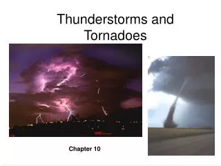
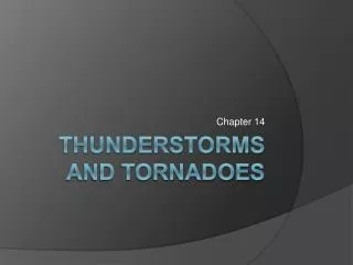
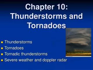
Understanding the Weather EAS-107. Chapter 14 Thunderstorms and Tornadoes. Understanding the Weather EAS-107. Chapter 14 Overview Ordinary Cell Thunderstorms Severe Thunderstorms Mesoscale Convective Complexes Lightning Tornadoes.

E N D
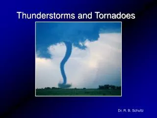
Understanding the WeatherEAS-107 Chapter 14 Thunderstorms and Tornadoes
Understanding the WeatherEAS-107 • Chapter 14 Overview • Ordinary Cell Thunderstorms • Severe Thunderstorms • Mesoscale Convective Complexes • Lightning • Tornadoes
Understanding the WeatherEAS-107 • Thunderstorms • A thunderstorm contains thunder and lightning. • Come in many different shapes and sizes. • Warm, moist air rises in a conditionally unstable environment. • As long as parcel is warmer than environment then it will continue to rise, it is buoyant. • Greater the temp difference, the faster the air will rise. • Rising air must be “triggered”/forcing mechanism. • Unequal heating, terrain, lifting of air along shallow boundaries of converging winds. • Frontal lifting. • Large scale divergence aloft.
Understanding the WeatherEAS-107 • Ordinary Cell Thunderstorms • Afternoon storms develop away from fronts. • Form in a region with limited wind shear – wind speed and direction do not change with height. • Form along shallow convergence zones. • Topography, sea-breezes, cold outflow from a prior thunderstorm (differences in temp) can be locations for development.
Understanding the WeatherEAS-107 • Ordinary Cell Thunderstorms (Cumulus/Growth Stage) • Warm and humid parcel of air rises, cools, and condenses into one cloud or a cluster of clouds. • Gradually moistens the dry air aloft. • Latent heat release keeps the parcels warm. • Must have continuous source of rising air, the cloud needs to be constantly fed rising air from below. • Updrafts suspend the liquid until it grows large enough to fall. • This usually does not happen until ice is present.
Understanding the WeatherEAS-107 • Ordinary Cell Thunderstorms (Mature Stage) • The entrainment of drier air at the edges of the storm evaporates some of the liquid which cools the surrounding air. Evaporative cooling. • The air, now heavier and cooler than the air around it, begins to descend a downdraft. This can be enhanced by falling precip. • When this occurs the storm is mature. • The updraft and downdraft now constitute the cell.
Understanding the WeatherEAS-107 • Ordinary Cell Thunderstorms (Mature Stage) • The most intense stage. Lightning, thunder, rain, and occasionally small hail. • Top of cloud reaches a stable region (tropopause) and spreads out into anvil, up to 40,000 ft (12 km). • Some updrafts are so strong they penetrate the stable air, a condition know as overshooting. • The cold downdraft forms a gust front. • The gust front can act to force more warm, humid air into the storm.
Understanding the WeatherEAS-107 • Ordinary Cell Thunderstorms (Dissipating Stage) • Once the storm enters the mature stage, it begins to dissipate after 15 – 30 mins. • Downdrafts dominate through much of the cloud and cut off the supply of warm, moist air. • Deprived of the rich supply of warm, humid air, cloud droplets no longer form. • As the storm dies, the lower-level cloud particles evaporate rapidly.
Understanding the WeatherEAS-107 • Severe Thunderstorms • Criteria: A thunderstorm that produces hail at least ¾” diameter (penny/dime), and/or surface wind gusts of 50 kts, and/or produces a tornado. • The longer a storm survives, the more likely it will become severe. • Forms in same way as an ordinary storm, only the environment features vertical wind shear. • The lack of wind shear in an ordinary thunderstorm causes the precip to fall into the updraft. • Increased winds aloft push the precip away from updraft. • The downdraft can still undercut the updraft without the precip falling into it. This produces a long-lasting multicell storm.
Understanding the WeatherEAS-107 • Severe Thunderstorms (Multicell Storm) • Most ordinary thunderstorms are multicell storms (storms with a cluster of cells at various stages of their life cycles), however many multicell storms are severe. • The gust front initiates new storms (cells). • This process may repeat over and over, producing a long lasting storm. • Each cell in a different state of development.
Understanding the WeatherEAS-107 • Severe Thunderstorms (Supercell) • When the upper level winds are even stronger and also change direction with height : • The storm can move in such a way that the downdraft never undercuts the updraft. • Can create horizontal spin which may be tilted into a rotating updraft. • The result is a supercell. • A supercell modifies its own environment. • The vertical wind shear creates a storm structure that allows the storm to continually move towards the area of warm moist air. • Supercells move to the right of the mean flow.
Understanding the WeatherEAS-107 • Severe Thunderstorms (Supercell) • The supercell thunderstorm is typically a large thunderstorm that consists primarily of a single rotating updraft. • The internal structure is organized in a way so that the storm may maintain itself as a single entity for hours on end. • Storms of this magnitude can produce updrafts that exceed 90 kts, hail the size of grapefruit, damaging surface winds, and large, long lasting tornadoes.
Understanding the WeatherEAS-107 • Mesoscale Convective Complex • A large, convectively driven system that is made up of many individual thunderstorms. Many times, as much as 1000 times larger than an individual thunderstorm cell. • Within the MCCs, the individual thunderstorms work together to generate a long-lasting weather system that moves slowly and quite often for periods exceeding 12 hrs. • Typically about the size of Ohio. • Often forms during summer nights. • Major source of rainfall for Plains states in the summer.
Understanding the WeatherEAS-107 • Lightning • Lightning is simply a discharge of electricity (giant spark) which usually occurs in mature thunderstorms. • Cloud to cloud, cloud to ground, cloud to air, within cloud. • Can heat the air to 54,000°F!! (5 times hotter than sun) • The extreme heating causes the air to rapidly expand, initiating a shock wave that becomes a sound wave, called thunder. • Sound travels 330 m/sec vs. 300 million m/sec for light. • Sound travels faster in warm air than in cold air. • It takes sound about 5 seconds to travel 1 mile. • If you see lightning and hear thunder 15 seconds later, the lightning stroke occurred 3 miles away.
Understanding the WeatherEAS-107 • Lightning (Electric Charge) • In normal fair weather, the electric field of the atmosphere is characterized by a negatively charged surface and a positively charged upper atmosphere. • For lightning to occur, separate regions containing opposite electrical charges must exists within the cloud. • Separation of charge is brought about by precipitation processes. • There is a net transfer of positive ions (charge) from a warmer object to a colder object. • Ice crystals are colder than hailstones (graupel). • Hailstones become negatively charged, ice crystals positively. • Charge is then distributed by weight. • Ice and a strong updraft are necessary for lightning to occur.
Understanding the WeatherEAS-107 • Lightning (Exchange of Charge) • When the negative charge near the bottom of the cloud is large enough to overcome the air’s resistance, a flow of electrons (stepped leader) rushes towards the earth. • As the electrons approach the ground, a region of positive charge moves up into the air through any conducting objects (trees, buildings, even humans). • When the downward flow of electrons meets the upward surge of positive charge, a strong electric current (bright return stroke) carries the positive charge up into the cloud. • Takes 3 or 4 return strokes to fully exchange the charge.
Understanding the WeatherEAS-107 • Tornadoes • A tornado is a rapidly rotating column of air that blows around a small intense area of low pressure. • Circulation must reach the ground as either a cloud or area of swirling debris. • Funnel cloud is a tornado that does not reach the ground. • The majority of tornadoes rotate counterclockwise. • Diameter 300 – 2000 ft, some > 1 mi. • Usually move NE at 20 – 40 kts, up to 70 kts. • Most tornadoes usually last only a few minutes and have an average path length of 4 miles. • But some can last many hours and travel hundreds of miles. • Most are found in the Plains (tornado alley).
Understanding the WeatherEAS-107 • Tornadoes (Occurrence) • Top number: Number of tornadoes in 25 years. • Bottom number: Number of tornadoes per 10,000 square miles. • Tornado alley is from north Texas through Nebraska. • Can occur in any state.
Understanding the WeatherEAS-107 • Tornadoes (Watch vs Warning) • Tornado watch. Tornadoes are likely to form within the next 4 to 6 hours somewhere in the region (issued by Storm Prediction Center). • Tornado warning. A tornado has been spotted or indicated on Doppler radar (issued by the local weather service office). • Take shelter in the basement in an interior room. In a structure without a basement, the safest place is in an interior room on the lowest floor. • In a dorm or apartment building, move to an interior hallway and lie flat with your head covered.
Understanding the WeatherEAS-107 • Tornadoes (Life Cycle) 1. Dust Whirl Stage 2. Organizing Stage 3. Mature Stage 4. Shrinking Stage 5. Decay Stage 2. 1. 3. 4. 5.
Understanding the WeatherEAS-107 • Tornadic Thunderstorms • Not everything is known about the formation of a tornado. • It is known that tornadoes tend to form with intense thunderstorms and that a conditionally unstable atmosphere is essential for their development. • Tornadoes form with both supercell thunderstorms and non-supercell thunderstorms. • The most intense tornadoes form with supercell thunderstorms. Thunderstorms with a strong, single rotating updraft that develop in a region of strong vertical wind shear.
Understanding the WeatherEAS-107 • Tornadic Thunderstorms (Mesocyclones) • The rotating updraft of a supercell thunderstorm is called a mesocyclone. • Change of wind speed and direction with height is responsible for the rotating updraft. • Creates horizontally rotating vortex tubes. • The strong updraft will tilt the tube and draw it into the storm. • This creates a mesocyclone 5-10 km wide.
Understanding the WeatherEAS-107 • Tornadic Thunderstorms (Bounded Weak Echo Region) • The updraft is so strong in a supercell that precipitation cannot fall through it. Southwesterly winds aloft usually help to blow the precipitation northeastward. • Large hailstones that have remained in the cloud for some time, usually fall just north of the updraft. • If a mesocyclone is strong and persistent, the precip can be wrapped around the updraft. • This swirling area of precip shows up on the radar, where the area inside the mesocyclone does not. • This is called the bounded weak echo region, an area that is bounded by precip. On radar, it can appear as a hook on the southern side of the storm.
Understanding the WeatherEAS-107 • Tornadic Thunderstorms (Tornado Formation) • The mesocyclone can be compared to a small low pressure system, like those that we have studied. • At this point, the updraft, counterclockwise swirling precip, and the surrounding air interact to form the rear flank downdraft (southwestern side of supercell). • When the downdraft strikes the ground, it may interact with the region of inflow to help initiate the tornado.
Understanding the WeatherEAS-107 • Tornadic Thunderstorms (Tornado Formation) • As air rushes into the low-level core of the mesocyclone, the air expands, cools, and if moist, condenses into a cloud (funnel cloud). • As the air beneath the funnel cloud is drawn into its core, the air cools rapidly and condenses, and the funnel descends to the surface. • As the funnel reaches the ground, it usually picks up dirt and debris, making it appear dark. • While the air along the outside of the funnel is spiraling upward, in the most violent tornadoes, the air is descending towards the extreme low pressure at the ground (sometimes 100 mb lower than surrounding air).
Understanding the WeatherEAS-107 • Tornadic Thunderstorms (Final Thoughts) • Not all supercells produce tornadoes; in fact, only around 15% do. • However, studies reveal that supercells are more likely to produce tornadoes when they interact with a pre-existing boundary. • Outflow boundary from previous convection. • Warm front • When supercells interact with these boundaries, low-level wind shear is enhanced. This can lead to a stronger and deeper mesocyclone.
Understanding the WeatherEAS-107 • Fujita Scale • Classifies wind speed based on damage. Tornado winds are estimated based on the damage caused by the storm. • Studies indicate that the majority of tornadoes are F0 and F1, and only a few % are above F3. • On average, only 1 or 2 F5’s occur a year.
Understanding the WeatherEAS-107 • Fujita Scale (F0 and F1) F0 F1
Understanding the WeatherEAS-107 • Fujita Scale (F2 and F3) F2 F3
Understanding the WeatherEAS-107 • Fujita Scale (F4 and F5) F4 F5