Download
1 / 38
390 likes | 735 Views
Chapter 11 Thunderstorms and Tornadoes. Air mass thunderstorms are the most common and least Destructive , usually lasting for less than an hour. The cumulus stage begins when unstable air begins to rise and cool adiabatically to form fair weather cumulus clouds.

E N D
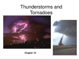
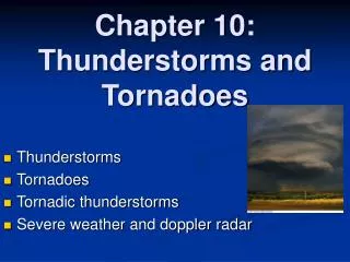
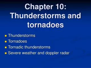
Chapter 11 Thunderstorms and Tornadoes
Air mass thunderstorms are the most common and least Destructive, usually lasting for less than an hour. The cumulus stage begins when unstable air begins to rise and cool adiabatically to form fair weather cumulus clouds. The mature stage begins when precipitation starts to falldragging air toward the surface as downdrafts form in areas of intense precipitation. As the cloud yields heavy precipitation, downdraftsoccupy an increasing portion of the cloud base,the supply of additional water vapor is cut off, and the storm enters its dissipative stage.
Cumulonimbus formation Santa Barbara, Feb 26, 2011 Upper level Divergence of air Possible Strong Downdrafts
What stage was this Cb cloud (Isla Vista, CA, Feb 26/2011)? (Author of the Picture: Ms Sizhu Wang)
A Low pressure system on the continent caused westerly winds that forced air parcels to raise (topographic effect) in a unstable atmosphere L
Severe thunderstorms have wind speedsexceeding 93 km/hr,have hailstones larger than1.9 cm in diameter, or spawn tornadoes. They typically appear in groups with individual storms clustered together in mesoscale convective systems. Mesoscale convective systems that occur as linear bands are called squall lines.
Mesoscale convective complexes(MCCs) appear as oval or roughly circular organized systems containingseveral thunderstorms and are self-propagating in thattheir individual cells often create downdrafts, leading to the formation of new, powerful cells nearby.
Mesoscale Convective Systems: Squall lines Anvil Leading Edge Strong updrafts
The precipitation from each thunderstorm cell creates its own downdraft,which is enhanced by the cooling of the air asthe rain evaporatesand consumes latent heat. Upon hitting the ground,the downdrafts spread outward and converge withwarmer surrounding air forming an outflow boundary.
New Convective cells formed as cold air descends from decaying storms Santa Barbara, Feb 26, 2011
Squall line thunderstorms consist of individual storm cells arranged in a linear band about 500 km in length that form parallel to and about 300 to 500 km ahead of cold fronts. Strong winds aloft push the updrafts ahead of the downdrafts and allow the rising air tofeed additional moisture into the storm. As the downdrafts reach the ground,they surge forward as a wedge of cold, dense air (gust front).
Satellite images of squall lines Stratiform rainfall Water vapor image of a SL Convective rainfall
SUPERCELL STORMS A supercell storm consists of a single, extremely powerful cell. Despite their single-cell structure, supercell storms are complex, with the updraft and downdraft bending and wrapping aroundeach other due to strong wind shear. The downdraftsserve to amplify the adjacent updrafts.
Doppler radar can reveal a feature of a supercell called a hook, which looks like a small appendage attached to the main body of the storm whose appearance usually means tornado formation is imminent. When displayed on a radar screen a large portion of the stormseems tobe missing.This zone, known as a vault,marks the location where the inflowof warm surface air enters the supercell.
Strong downdrafts may also create downbursts, potentially deadly gusts of wind that can reach speeds in excess of 270 km/hr. When strong downdraftsreach the surface, they can spread outward in alldirections to form intense horizontal winds capable of causing severe damage at the surface. See this video and what you should not do in the middle of a storm http://video.google.com/videoplay?docid=-5882717619572526776
Strong downdrafts associated with mesoscale convective systems can produce very powerful, larger-scale horizontal winds called derechos (Spanish for “straight ahead”). Such winds may last for hours at a time and achieve speeds higher than 200 km/hr (120 mph).
Downbursts with diameters of less than 4 km are called microbursts, and can produce a particularly dangerous problem when they occur near airports. See this video as an example http://video.google.com/videoplay?docid=-5882717619572526776#docid=-1647492853543566084
Example of supercell in CA VIS VIS
Infrared images IR IR IR IR
Rotation can be generated by shear (horizontally or vertically) Positive vorticity wind Negative vorticity
TORNADOES Tornadoes are zones of extremely rapid, rotating winds beneath the base of cumulonimbus clouds. Though the majority of tornadoes rotate cyclonically, a few spin in the opposite direction. Strong tornadic winds result from extraordinarily large differences in atmospheric pressure over short distances.
Vertical wind shear is important The first observable step in tornado formation is the slow, horizontal rotation of a large segment of the cloud which begins deep within the cloud interior (a). The resulting large vortices are mesocyclones. Under the right conditions, strong updrafts in the storm tilt the horizontally rotating air so that the axis of rotation is approximately vertical (b).
The narrowing column of rotating air stretches downward, and the cloud base protrudes downward to forma wall cloud. Wall clouds form where cool, humid air fromzones of precipitation is drawn into the updraft feeding themain cloud. The cool, humid air condenses at a lower height than does the air feeding into the rest of the cloud. Wall clouds tend to occur in the southern or southwestern portions ofsupercells near areas of large hail and heavy rain.
An idealized supercell storm. Funnel clouds form when a narrow, rapidly rotating vortexemerges from the base of the wall cloud. A funnel cloud hasall the characteristics and intensityof a true tornado;the only difference is thata funnel cloud has yet to touch the ground.
http://www.mesoscale.ws/pictures/structure/ Supercell Storms
No other countryhas nearly as many tornadoes as the U.S. The continent covers a wide range of latitudes;its southeastern portion borders the warm Gulf of Mexico, while the northernmost portion extends into the Arctic. Much of the eastern portion of the continent is flat and no major mountain range extends in an east–west direction. These features allow for a collision of maritime tropical air with continental polar air along the polar front.
Tornadoes around the globe (likely underestimated in the Southern Hemisphere).
Tornado with multiple suction vortices. Although most tornadoes rotate around a single,central core, some of the most violent ones haverelatively small zones of intense rotations(10 m in diameter) called suction vortices. These small vortices probably cause thephenomenon of one home being destroyedwhile another remains unscathed.
The Fujita scale provides a widely used system for rankingtornado intensity. Documented tornadoes fall into seven levelsof intensity, with each assigned a particular F-value. In the U.S., 69 percent fall into the weak category,which includes F0 and F1 tornadoes.
A severe thunderstorm watch means that the situation is conducive to the formation of such activity. If a severe thunderstorm has already developed, a severe thunderstorm warning is issued. Likewise, tornado warnings alert the public to the observation of an actual tornado or the detection of tornado precursors on Doppler radar.
Do tornadoes occur in California? Riverside, May 23, 2008
Waterspouts occur over warm water and aretypically smaller than tornadoes with diametersbetween 5 and 100 m. Though they are generally weaker than tornadoes, they can havewind speeds of up to 150 km/hr. While some waterspoutsoriginate when land-based tornadoes move offshore, the majority form over water.
Video on the formation of waterspout http://www.youtube.com/watch?v=P72ih5ebId4 Video on multiple waterspout http://www.youtube.com/watch?NR=1&feature=endscreen&v=X08_bvDSwmo
National Geographic movies: General explanation: http://video.nationalgeographic.com/video/environment/environment-natural-disasters/tornadoes/tornadoes-101/ Chasing Tornados http://video.nationalgeographic.com/video/player/environment/environment-natural-disasters/tornadoes/tornado-samaras.html Rare look inside a tornado: http://www.huffingtonpost.com/2009/06/08/rare-look-inside-a-tornad_n_212538.html Entire movie: http://www.youtube.com/watch?v=C_uj7bYbs-k Top 10 biggest tornadoes: http://www.youtube.com/watch?v=EqI1wC0ED4U&feature=related Tornados Videos