Download
1 / 189
1.89k likes | 1.9k Views
Earthquakes Mt St. Helens Vertical trees Coal Land Bridges Peleg part7. EVANGELISM O DE CIENCIA CREACIONISTA. Seminario Parte 6b: La Teoria de Hovind Acerca: de la Inundación, la Formación de Glaciares, el Deriva Continental, y la Formación de Cañon y Montaña. Lecci ó n 1 3 de 1 5 .

E N D
Earthquakes Mt St. Helens Vertical trees Coal Land Bridges Peleg part7
EVANGELISMODE CIENCIA CREACIONISTA Seminario Parte 6b: La Teoria de Hovind Acerca: de la Inundación, la Formación de Glaciares, el Deriva Continental, y la Formación de Cañon y Montaña. Lección 13de 15. Un Seminario de Creación Por Dr. Kent Hovind 29 Cummings Road Pensacola, FL 32503 850-479-3466 www.drdino.com Correo Electronico: dino@drdino.com
En el principio crió Dios los cielos y la tierra. In the beginning, God created the heaven and the earth. Gen. 1:1 Génesis 1:1
Flood El Diluvio Last page of seminar notebook, available from CSE $8.50., 850-479-3466, Also available laminated $5.
The Hovind Theory 6. During the last few months of the flood the unstable plates of the fractured earth shifted. The thin spots sank down to become ocean basins. Other places lifted up to make mountains. The runoff caused huge erosion canyons.
The Earth is almost perfectly smooth for it’s size. The 5 mile Mt. Everest on an 8000 mile earth is an insignificant .0625% bump. Cue balls have bigger bumps than that. At this distance you can’t even find Mt. Everest or the Rocky Mountains. Scott Foresman Earth Science 1990 p. 272
If the oceans were just 10% deeper, the beach would be here!
Minneapolis is only 670 feet higher than New Orleans. Prentice Hall Earth Science, 1991 p. 247
Minneapolis is about 1150 miles from New Orleans. A 670 foot drop in 1150 miles is 7 inches of drop every mile.
If a dam were built across Grand Canyon a large lake would form!
Looping, meandering rivers are typical of “old age” and low slope. Holt Earth Science 1994 p. 86
Steep sides are characteristic of young rivers or high slope. BSCS Biology 1978 ed., p. 320
One catastrophe like the 1964 earthquake in Alaska shown here, can change the real estate in a hurry! Namowitz/ Spaulding 1989 p. 250
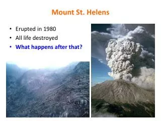
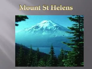
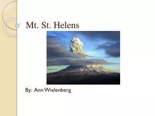
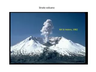
Mt. St. Helens in Washington, USA May 18, 1980
While the north slope slid down the mountain. The volcano was “un-corked” releasing the ash and steam.
Ash from Mount St. Helens traveled hundreds of miles. See: Creation Information Center 4749 Spirit Lake Highway, Silverlake, WA 98645, 360-274-5737. nwcreationism.net
Mt. St. Helens blew out enough material for everyone on earth to have a ton. It would fill a 10 cubic yard dump truck every second (24 hrs/day) for 600 years. 7 Wonders of Mount St. Helens by Lloyd Anderson, Mt. St. Helens Creation Info Center, 360-274-5737, www.creationism.org/sthelens
The hot mud flow covered blocks of ice that had been blown off the mountain.
“River system formed in nine hours. • The landslide of May 18 buried the river and highway to Spirit Lake to an average depth of 100’. It also buried most other drainages in the 23 square miles of the Upper Toutle Valley and plugged the valley’s mouth. For twenty-two months water had no established path to the lower waterway.