Download
1 / 44
470 likes | 691 Views
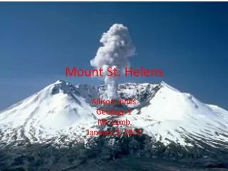
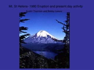
Mt. St. Helens. 1980 Eruption Before, During and After. Where is Mt. St. Helens. The Cascade Range is a volcanic chain stretching from Northern California to British Columbia Mt. St. Helens is part of this range.

E N D
Mt.St. Helens 1980 Eruption Before, During and After
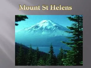
Where is Mt. St. Helens • The Cascade Range is a volcanic chain stretching from Northern California to British Columbia • Mt. St. Helens is part of this range
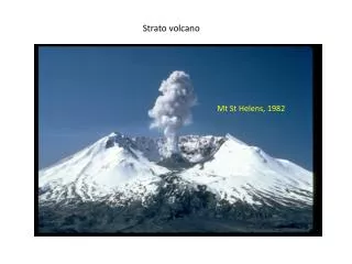
Mt. St. Helens, the smallest of five major volcanic peaks in Washington state had an elevation of 9677 feet before the eruption of May 1980. Mt. Adams (12,286) in the distance
First Evidence of Activity • Initial ice fractures on March 27, 1980 • 3/28- First phreatic (steam) eruption • The vent: 250 ft in diameter
March 29, 1980 Second Crater • Crater appeared on the NE side of the first crater • The new vent was 75ft. Wide and 30-60ft deep • 3/31 the two craters joined together
March 30, 1980 Ash Darkens Slopes • Ash came from rock pulverized by the explosively-expanding, high-temperature steam and other gases- No new rock produced • Mt. Rainier in the background
Bulge Forms on N-NE Flank • Bulge first detected on 4-23 • End of April the bulging area was one mile long and 0.6 mile wide • Maximum uplift 320 feet • Some areas of uplift - 5 feet a day!
Steam Eruption Prior to 5-18-80 • Typical phreatic (steam) eruption in early May • Eruptions reached 13,000 feet in elevation • This activity was followed a two week quiet period
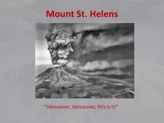
On may 18th 1980 at 8:32… Geologist David Johnston was taking measurements on a ridge just 5 miles NW of the summit when he radioed “Vancouver! Vancouver! This is it! Moments later he was vaporized by the cloud of hot gas, ash, rock, ice and trees that hit him
For more than nine hours, the eruption continued. People that escaped had to drive 80+mph on old logging roads to escape
May 18th 1980 • 8:32 AM PDT a magnitude 5.1 shook Mt. St. Helens • The bulge and surrounding material slid away in a gigantic landslide and debris avalanche
Computer Version of Landslide • The initial earthquake and eruption triggered one of the largest landslides in recorded history. • The slide traveled 110-155mph • Hit a 1150ft high ridge about 6 miles north. Some of the slide spilled over the ridge • Most of the slide moved 13 miles down the North Fork of the Toutle River filling its valley up to 600 ft deep
The initial May 18th Eruption View From Less Than Three Miles • The cloud rose to more than 12 miles in 10 minutes • The cloud generated its own lightning • Ash rained down initially in an area that extended 25-30 miles to the north and east • Later, ash covered parts of eleven states From an airplane that barely made it back!
For over nine hours, a vigorous plume of ash erupted reaching 12-15 miles above sea level • The plume moved eastward at an average speed of 60 mph with ash reaching Idaho by noon • Many cities had to use snowplows to remove the several inches of ash accumulation
This area was completely forested prior to the May 18, 1980 eruption View from the NE on June 19, 1980
Helicopters were deployed to try and save survivors. Few were found • Some people were found with their arms calmly folded or a camera held to their eye. The hot gasses killed them as they stood. It is believed that some people and vehicles were instantly incinerated The total volume of ash as approximately .26 cubic mile or enough ash to cover a football field to a depth of 150 miles
The initial blast flattened over four billion board feet - Enough to build over 150,000 homes.
Nearly 135 miles of river channels surrounding the volcano were affected by the lahars. Note the “mud line” on the trees and the person in the picture
The remains of Spirit Lake, once surrounded by lush forest Mt. Rainier, 14,410ft in the distance
After the May 18,1980 eruption, Mt.St. Helens’ elevation was only 8364 feet and the volcano had a one-mile wide horseshoe-shaped crater Craters were formed when water and hot ash came together making large steam explosions
Reid Blackburn, a National Geographic Photographer’s car Ried Blackburn along with Volcanologist David A. Johnston were never found
The “U” shaped basin formed by the landslide and 5/18/80 eruption June 4th 1980 - Mudflows are visible in the picture
Mt. St. Helens erupted often between 1980 and 1986 • An explosive eruption on 3/19/82 sent pumice and ash 9 miles into the air and resulted in a lahar
Pyroclastic flow from August 7,1980 eruption During the 5/18/80 eruption, at least 17 separate pyroclastic flows descended the flanks of the mountain Pyroclastic flows typically move at speeds of over 60 mph and reach temperatures of over 800 degrees
October 24, 1980 a new dome started growing. This October dome was 112ft high and 985 feet wide making it taller than a nine-story building and wider than the length of three football fields
Mt. St. Helens soon after the 5/18/80 eruption from Johnston’s Ridge Taken September 10, 1980
USGS Scientist Explore Pumice Blocks from a Pyroclastc flow October 17, 1980
Geologists install a seismic station near the dome. An increase in seismicity is often the first precursor to an approaching eruption
5/19/82- Plume from Harry's Ridge Plumes of steam, gas, and ash often occurred at Mt. St. Helens in the early 1980’s. On clear days, they could be seen from Portland Oregon, 50 miles to the south
Measuring magnetic field in crater 6/18/84 Geologist measured the strength of the magnetic field surrounding the dome. The strength of the field increased as the dome cooled and magnetic minerals formed. During the eruptions, the strength usually changed rapidly as magma heated and deformed the dome
Mt.St. Helens Lake Reflection- After the Eruption Picture taken May 19, 1982
2005 Saw An Increase In Activity Picture Taken May 7, 2005