Download
1 / 32
330 likes | 504 Views
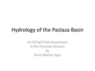
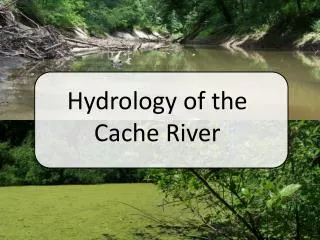
The Hydrology of Freshwater in the Artic. Yazmin Navedo. The Artic. The Arctic has 4 hydrologic periods: snowmelt; outflow breakup (w/ total annual flow of 75%); a summer period w / high evaporation; and a winter period(ice cover thicker than 2 m). .

E N D
The Hydrology of Freshwater in the Artic YazminNavedo
The Artic • The Arctic has 4 hydrologic periods: snowmelt; outflow breakup (w/ total annual flow of 75%); a summer period w/ high evaporation; and a winter period(ice cover thicker than 2 m). • Now there are 4 types of arctic rivers which show different sensitivity to climatic variations: • 1. Artic-Nival • 2. Subartic-Nival • 3. Proglacial • 4. Muskeg
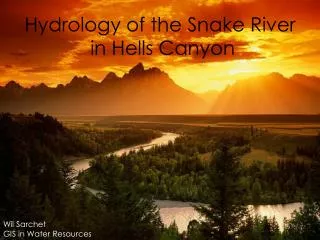
The Artic Rivers Proglacial: snowmelt produces a spring peak, yet flows continue throughout the summer as areas at progressively higher elevations melt. Muskeg: large areas of low relief characterized by poor drainage. • Arctic–nival: continuous permafrost where deep infiltration is impeded by perennially frozen strata. • Subarctic–nival: dominated by spring snowmelt events, with peak water levels often the product of backwater from ice jams.
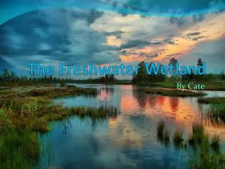
Perennial Snow Banks Perennial snow banks is snow that falls in winter and lies throughout the summer without melting until the following winter's snowfalls. This new snow can lie on top of the unmelted old snow, and this is a condition for the formation of glaciers and ice caps, and are the major source of runoff. During winter, when biological processes are dormant, the active layer freezes & thaws. Spring snowmelt guarantees water availability about the same time each year, at a time when rainfall is minimal but solar radiation is near its max. Summer hydrology varies from year to year and depends upon summer precipitation patterns and magnitudes. During dry periods, runoff is either minimal or ceases.
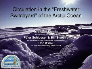
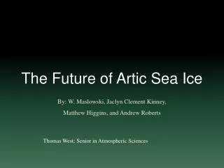
Climate affect Climate change is causing the Arctic to warm more quickly than the rest of the world, causing a dramatic loss of Arctic sea ice. For at least 800,000 years, the Arctic Ocean has had at least some sea ice throughout the year. Today, sea ice loss is occurring even more rapidly. As warming seas cause its ecosystem to restructure, the Arctic is becoming a different place.
Global Climate Affect Globally, Arctic sea ice helps regulate climate by reflecting sunlight back into space. As sea ice is lost, more sunlight is absorbed into the newly open ocean. The water warms, causing more ice to melt. A surprising amount of carbon is locked into Arctic tundra, wetlands and in pockets of gas frozen under the ocean floors. Massive amounts of methane gas are currently locked in and beneath permafrost(A thick subsurface layer of soil that remains frozen throughout the year, occurring chiefly in polar regions)in the Arctic and on continental shelves. If climate change allows these gases to reach the atmosphere, they will cause even greater warming
Conclusion The Hydrology and the climate of the Artic are relatively linked together. Changes in temp. and precipitation affect all forms of water on and in the landscape. If the storage water changes then the variety of feedback mechanisms will be affected.
WWK Groundwater Hydrology, How Groundwater Comes To Be, Aquifers, Recharge and Discharge, Groundwater Movement, and Water Supply Wells By Lex Pritchett
How Groundwater Comes To Be • Hydrology is the movement of water above, on, and below the earth's surface. It is a cycle that replenishes ground water supplies. It begins as water vaporizes into the atmosphere from plants, soil, lakes, rivers, snowfields and oceans, a process called evapotranspiration. As the water vapor rises it condenses to form clouds that return water to the land through precipitation as rain, snow, sleet, hail, and any other form of precipitation, that soaks into the ground. The water moves down into the ground because of gravity, passing between particles of soil, sand, gravel, or rock, until it reaches a depth where the ground is filled, or saturated, with water. The area that is filled with water is called the saturation zone and the top of this zone is called the water table. The water table may be very near the ground’s surface or it may be hundreds of meters below below.
Aquifers • Groundwater exists everywhere underground, but some parts of the saturated zone contain more water than others. An aquifer is an underground formation of permeable rock or loose material which can produce useful quantities of water when tapped by a well. These aquifers may be small, only a few acres in area, or very large, underlying thousands of square kilometers of the earth’s surface.
Recharge • Recharge is the process by which ground water is replenished. A recharge area is where water from precipitation is transmitted downward to an aquifer. How much water infiltrates depends on vegetation cover, slope, soil composition, depth of the water table, the presence or absence of confining beds and other factors. Recharge is promoted by natural vegetation cover, flat topography, permeable soils, a deep water table and the absence of confining beds.
Discharge • Ground water discharge occurs where the water table intersects the land surface. Where this happens, springs or seeps are found. Springs and seeps may flow into fresh water bodies, such as lakes or streams, or they may flow into saltwater bodies.
Water Supply Wells • When water is withdrawn from a well, its water level drops. When the water level falls below the water level of the surrounding aquifer, ground water flows into the well. The rate of inflow increases until it equals the rate of withdrawal. The movement of water from an aquifer into a well alters the surface of the aquifer around the well. It forms what is called a cone of depression. A cone of depression is a funnel-shaped drop in the aquifer's surface. The well itself penetrates the bottom of the cone. Within a cone of depression, all ground water flows to the well. The outer limits of the cone define the well's area of influence.
The students will know how different geological processes affect the Earth’s surface. By Logan Mulligan
What is weathering? There are two basic types of weathering, or, two basic types of the process of breaking down rocks into smaller pieces by chemical or physical means. The two different types are physical (also known as mechanical) weathering and chemical weathering. Physical weathering: Breaking down rocks so they become smaller, but are still composed of the same minerals and have the same chemical properties. Chemical weathering: The breakdown of rocks by chemical means, like with acid rain.
Erosion Erosion, which is the removal of rock and soil by wind, water or ice, is the next step in this geological assembly line after weathering. Once weathering makes the rocks and other substances into smaller particles, erosion comes in and moves those particles. Erosion is easily confused with weathering. The two are similar, but not the same process.
The Different Types of Erosion Water: Most erosion is performed by running water. A running water source, like a river or stream can drastically change a landscape (i.e. the Grand Canyon). Ice: Glaciers erode the land on mountaintops and hills. The majority of ice erosion is in the form of a glacier. Wind: Wind blows around dust and sand. Most sand dunes are created because of wind erosion.
Abrasion Abrasion is the process of eroding by friction. Abrasion occurs mostly in rivers, but can occur pretty much anywhere where two rocks can rub against each other. Abrasion also can occur at the same time as erosion. This process of abrasion can cause rocks to become smooth, and can form blocks out of boulders.
Deposition The process of laying down sediments is called deposition(deposition is also called sedimentation). Deltas form from deposition. Sediments are carried by a source of running water to form wedge-shaped accumulations. Deposition is a reoccurring process. Sediments are deposited in one area, stay for a while, and then picked up and deposited in another area.
How does it all tie together? In conclusion: The Earth’s surface is constantly being changed by weathering, erosion, abrasion and deposition. Some of the most famous land marks were created by a series of geological processes and cycles, including the four mentioned. We may only notice the long term effects, but the Earth is being changed right in front of our very eyes. These processes couldn’t work together as one big process without each other. Each one relies on the other.
WWK:Students will know how the use of different energy resources effect Earth’s subsystems over periods of time. Unit 11 Table 1 Danny Monsante Fabel Per. 5
Subsystems The Earth is made up of four major subsystems. The hydrosphere; contains all the planets water. The lithosphere; contains all the planets land. The biosphere; contains all the planets living organisms. The atmosphere; contains all the planets air.
Renewable Resources There are several different types of renewable resources. Solar, wind, hydro, and geothermal power are natural resources that can easily be replenished over time. Renewable resources emit little or no dangerous gases in the atmosphere and are better for the environment.
Non-renewable Resources The burning of fossil fuels releases harmful gases like carbon dioxide into the atmosphere. These natural fuels are made up from the geological remains of past living organisms. Fossil fuels are also known as non-renewable resources because they take millions of years to form and they burned up much quicker than new ones are made. Over long periods of time these limited resources produce huge amounts of pollution and causes higher temperatures.
Greenhouse Gases Carbon dioxide, water vapour, methane and nitrous oxides are all greenhouse gases created when fossil fuels are burned. Theses gases trap heat in the atmosphere causing rises in temperature.
Fossils Fuel Damages Fossil fuel pollution can cause damage the ozone layer and even some peoples respiratory health. Acid rain, land pollution, and oil spills are all caused by the use of fossil fuels and have been damaging the Earth for years. Renewable resources are much more clean, sustainable, and efficient which allows for cleaner production
K.S.’s • What are the four Artic rivers and define one of them. • What occurs where the water table of an aquifer intersects land surface ? • What are the two basic types of weathering? • What are two examples of renewable resources?
Videos • http://www.youtube.com/watch?v=uQRvN6MUajE • http://www.youtube.com/watch?v=lyysL02ZvQ8 • http://www.youtube.com/watch?v=n2a4i2pDUCg