Download
1 / 15
150 likes | 277 Views
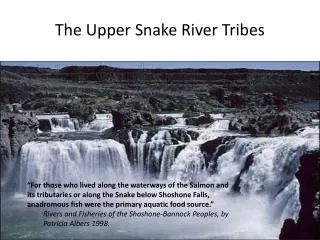
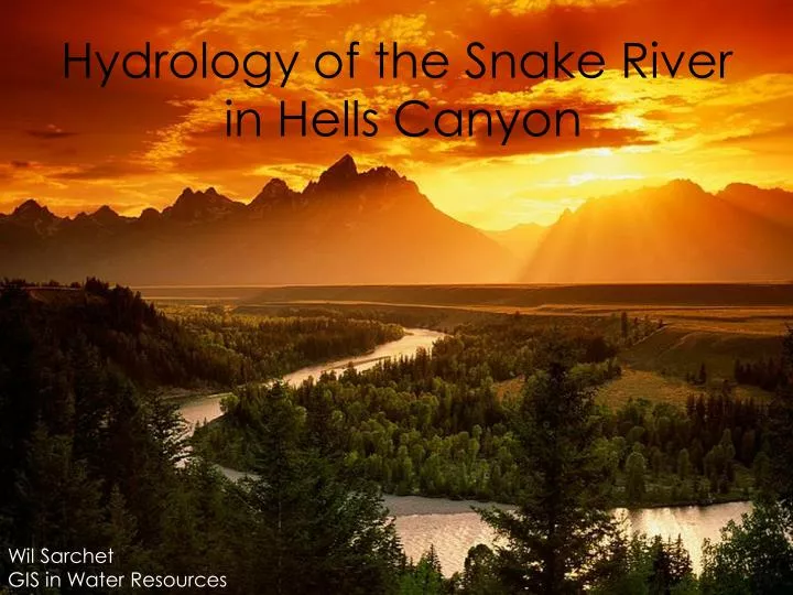
Hydrology of the Snake River in Hells Canyon. Wil Sarchet GIS in Water Resources. introduction. objective. methodology. results. conclusions. | introduction |. flow. Welcome to Hells Canyon. Snake River Originates in Yellowstone Park in northwest Wyoming

E N D
Hydrology of the Snake River in Hells Canyon Wil Sarchet GIS in Water Resources
introduction objective methodology results conclusions
|introduction| flow Welcome to Hells Canyon Snake River • Originates in Yellowstone Park in northwest Wyoming • Outlets into the Columbia River in southeast Washington • River’s length is 1040 miles • Watershed drains 108,000 sq. miles Hells Canyon • Carved by Snake River • North America’s deepest river gorge at 7993 feet deep • 10 miles wide
|objective| Examine the relationship between snow, precipitation, slope, and flow in Hells Canyon
|methodology| Map building
|methodology| Data points NCDC • Precipitation • Total for month USGS • Flow • Monthly average Snotel • Snow Water Equivalents • Monthly average • Amount of water in snowpack • Depth of water if snowpack melted
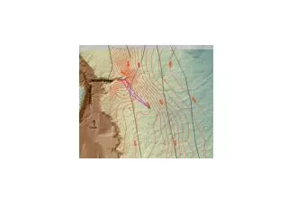
|results| Channel Elevation
|results| Total Monthly Precipitation (in.) 2000 2001 2006 2005 0.0 – 0.5 0.5 – 1.0 1.0 – 1.5 1.5 – 2.0 2.0 – 2.5 2.5 – 3.0 3.0 – 3.5 3.5 – 4.0 4.0 – 4.5 4.5 – 5.0 5.0 – 5.5 5.5 – 6.0 6.0 – 6.5 6.5 – 7.0 7.0 – 7.5 7.5 – 8.0 8.0 – 8.5 8.5 – 9.0 9.0 – 9.5 9.5 – 10.0 November July August September October December April June January February March May June May
|results| Snow Water Equivalents (in.) 2001 2000 2005 2006 0.0 – 5.0 5.0 – 10.0 10.0 – 15.0 15.0 – 20.0 20.0 – 25.0 25.0 – 30.0 30.0 – 35.0 July August September June May October March November January December April February
|results| Undisturbed flow
|results| Dam impacted flow
|results| Dam impacted flow
|conclusions| • Snowfall has a direct effect on river flow • Precipitation does not have as strong a correlation to river flow • Dams significantly alter the hydrology of the river
|references| Images • http://www.fs.fed.us/hellscanyon/overview/maps.shtml • http://en.wikipedia.org/wiki/Image:Map_of_USA_with_state_names.svg • http://www.fs.fed.us/hellscanyon/overview/index.shtml • http://www.luminous-landscape.com/tutorials/exposing_snow.shtml • http://lennthompson.typepad.com/photos/uncategorized/rain_1.jpg • .http://www.desktopscenes.com/Scenes%20from%20Big%20Sky%20Country%20(200 3)/Lone%20Mountain%20Summit.jpg • http://www.icwhen.com/ncc14/topics/waikato/images/image-0001.jpg • http://geoimages.berkeley.edu/Waterfalls/Idaho/ShoshoneFallsL.html • http://www.visitusa.com/oregon/images/hellscanyonorpic.jpg • http://www.windingwatersrafting.com/gallery_app.php • http://209.20.186.111/images/Idaho/HellsCanyon2.jpg • http://en.wikipedia.org/wiki/Snake_river • Http://en.wikipedia.org/wiki/Image:Hells-canyon-dam-id-us.jpg • http://en.wikipedia.org/wiki/Image:Oxbow_Hydroelectric_dam.jpg • http://www.ifskiclub.com/Portals/0/Photos/Yellowstone.JPG