Download
1 / 26
260 likes | 401 Views
Arctic GIS Workshop, Seattle Washington, 2001. Dynamic Internet Mapping and Distributed GIServices. Ming-Hsiang Tsou mtsou@mail.sdsu.edu Web site: http://map.sdsu.edu Department of Geography, San Diego State University. Why Internet-based GIServices?.

E N D
Arctic GIS Workshop, Seattle Washington, 2001 Dynamic Internet Mapping and Distributed GIServices Ming-Hsiang Tsou mtsou@mail.sdsu.edu Web site: http://map.sdsu.edu Department of Geography, San Diego State University
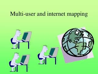
Why Internet-based GIServices? Globalize Information Access/Exchange Decentralize Database Management/Update Distribute Software Processes The Network is the Computer
Development History • Internet (ARPANET 1970s, TCP/IP 1983) • World Wide Web (HTTP 1990, Mosaic 1993) • On-line GIS • The Xerox PARC Map Viewer (Putz,1994) • GRASSLinks (Huse, 1995) • The Alexandria Digital Library (1994) • Organization • The Open GIS Consortium (OGC, 1994) • ISO/TC 211 (the 211 Technical Committee of the International Standards Organization, 1994)
Problems for Internet-based GIS • Heterogeneous Geospatial Data Format • Vector: Coverage, Shapefiles, CAD, DLG, TIGER... • Raster: GRID, IMG, LAN..TIFF, GIF, JPEG. • GIS Database Connectivity: • large and complicated compared to other databases. • can not support spatial features directly, • Map engine on the server side to convert spatial features to images or vector streams. • Map browser on the client side • GIS Operations: • unable to provide on-line GIS operations. • Difficult to distribute GIS procedures from one machine to another.
Internet Mapping Technology • Software Development Platform: • CORBA (Common Object Request Broker Architecture) OMG • DCOM (Distributed Component Object Model) or .NETMicrosoft • Java PlatformSun Microsystems Inc. • GIS Internet Mapping Solutions: • ESRI ArcViewIMS, ArcIMS, • Autodesk MapGuide • INTERGRAPH GeoMedia Web Map • Small World, Internet Application Server
Current On-line GIS Development • What can we do now? • On-line display (spatial features) • On-line query (attributes) • Very limited GIS functions. (Identifying, selections, buffering? ). • On-line editing new graphs and send back to servers. • What can we not do now? • Full GIS operations (overlay, network analysis, 3D…) • Add new layers from client-side • Editing existing maps from client-side. • Upload a GIS Model or procedures to server side.
ESRI ArcIMS 3
ArcIMS Specifications • Platforms: • UNIX or Windows NT (2000). • Web Server with Servlet Engine (not included) • Application Server (Middle-ware) • Spatial Server + Database (ArcSDE) • Technology: • Remote administration (Servlet Engine) • Extensible Markup Language (XML) --> ArcXML • JavaScripts, Java applets and Servlets • Display: vector (feature server) and raster (image server) • Client browser: HTML version or Java applets version.
Map Guide Specifications • Platforms: • Windows NT or 2000. • Web Serve: IIS, or Netscape Enterprise. • Database Connection: OLE-DB or ODBC. (Microsoft) • Oracle 8i and MS SQL server. • Technology: • Spatial Data Files (SDFs) • Microsoft COM-based development. • Display: vector and raster. • Client browser: HTML version (new release 5?) or • Java plug-in version.
GeoMedia Web Map Specifications • Platforms: • Windows NT (2000) only. • Web Server (IIS) with Active Server Pages (ASP) • COM + ODBC • GeoMedia Data Servers --> multiple types of data • Technology: • Microsoft COM based technology. • ActiveX scripting, ActiveX controls, and VB Script • Client: Arctive CGM plug-in (Computer Graphics Metafile) • Display: vector -- ActiveCGM + MDF (Map definition Files) raster -- GeoTIFF, JPEG, GIF, INTERGRAPH.
Smallworld Internet Application Server • Platforms: • Intel chip platforms: Windows NT (2000) or RedHat Linux 6.1. • Web Server: IIS (win), Netscape Enterprise, or Apache(Linux) • Smallworld 3 core products and extended services • Middle-ware: CGI or Servlet Engine (not included). • Technology: • Conform to OpenGIS WMS (Web Mapping Testbed) specification. • Smallworld Magik for developing new services • Standard Transforms. (data conversion) • Smallworld: Objec-Oriented GIS • Client browser: HTML version or Java version • (Java applets or Java applications)
Future Development • Smart Mapping Software • Intelligent Agents • Mobile devices • GPS / Cellular Phone/ PDA Integration • On-line GIS functions and Modeling • Arctic research, Hydrology modeling.. • On-line Classes • Distance learning tools.
The Roaming of Agent (Carry a [Procedure-A]) The Planning Department The Tax Assessor Department Land value and parcels Flood zone Land use Agent Agent Procedure-A: Procedure-A: CODOT The Policy Department Roads Crime Risk Index Agent Agent Procedure-A: Procedure-A: Dick’s GIS node • Procedure-A: (from Dick’s requests] • Buffer 200m from [Road] to create [Buffer zone] • Overlay [Land use] [Flood zone], [Buffer zone], and [Land parcels], [Crime Risk Index]. Agent Procedure-A: