Download
1 / 93
960 likes | 1.25k Views
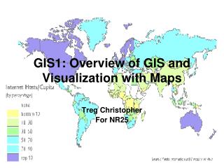
Maps and GIS. Created by Lisa Bingham University of Stavanger, Norway. Course Objectives. Read, understand, and interpret maps Basic understanding of GIS Basic understanding of GPS. http://img.moonbuggy.org/the-road-to-success/. Reading a map. Reading maps. Maps relate information

E N D
Maps and GIS Created by Lisa Bingham University of Stavanger, Norway
Course Objectives • Read, understand, and interpret maps • Basic understanding of GIS • Basic understanding of GPS
Reading maps • Maps relate information • It is up to the viewer to interpret the information • How? • Investigate the map • Identify the parts of the map • Familiarize yourself with the map • Are there graphs? Inset maps? Additional figures? • What is the purpose of the map? What does the map tell you? What information does it relate?
What makes a “good” map? • Defined purpose and audience. • These influence what makes a “good” map for the intended audience. • tourist vs. geologist • Avoid cluttering or over-complications • Legible labeling • Coloring and patterns should follow cartographic conventions.
Features of a map • A concise map title • An easy to read scale bar • An easy to read legend, if necessary • North arrow if the coordinate system is not clear or if the map is turned to an angle • Legible coordinates at the border of the map • Projection information
Identify the parts of a map • Locate: • Title • Scale • Scale bar • Legend • Coordinate system • or grid markings • Location or inset map • Publication information
Where is the title? Title Where is the legend? Where is the inset map? Where is the scale bar? Scale Scale bar Where is the scale? Where are the grid coordinates? Where is the north arrow? Where is the publication information? Compiler and publication information Where are the graphs? Some maps have north arrows or compass roses, or may include projection information. This map does not. Legend Inset map Grid coordinates Graphs
Mineral-rich in the north Mineral-poor in the center Minerals in the south What does the map tell you? Diamonds with gold in the northeast Gold in north-central • If you represented a mining company, • where would you look for: • gold? • diamonds? • bauxite? • radioactive minerals? Mica-rich in the south Diamond production decreasing
Understanding Map Scales • Representations: • verbal (1 map centimeter represents 30,000 ground centimeters) • fraction (1:25,000) • graphic (scale bar) • Map scale indicates how much a given distance was reduced to be represented on the map.
Understanding Map Scales • Small-scale map depicts large areas, so low resolution. • 1:10,000,000
Understanding Map Scales • Large-scale map depicts small areas, so high resolution. • 1:50,000 • 1,267 inches to 1 mile
Small-scale vs. Large-scale Maps • When the scale is written as a fraction, is the fraction very small or very large? • 1/1,000 • 1/100,000 • 1/1,000,000 • 1/5,000,000 • 1/10,000,000 • Identifying a map as small- or large-scale is an exercise of relativity
Reading Map Contours • First familiarize yourself with the map • Locate the contour interval • Investigate the contours • Are they close together? Far apart? • Are the very straight? • Are there many concentric circles? • Do the contours shape like V’s or U’s?
What can be said about the elevation in this area (northeast corner of the previous map)?
What can be said about the elevation in this area (northeast corner of the previous map)? V shape Steep slopes Coastline V shape Less steep area
What can be said about the elevation in this area (central area of the large map)?
What can be said about the elevation in this area (central area of the large map)? Flat area Coastline Flat area Steeper area with very curvy contours High point or depression?
High point or depression? High point
What is a coordinate system? • A mathematical system used to explain the location of a point on the earth (or other planet). • A geographic coordinate system is used to assign geographic locations to objects. • A global coordinate system of latitude-longitude is one such framework. • Another is a planar or Cartesian coordinate system derived from the global framework.
Latitude facts: • Lines of latitude (parallels) are evenly spaced from 0o at equator to 90o at poles. • 60 nautical miles (~ 110 km)/1o, ~1.8 km/minute and ~ 30 m/second of latitude. • N. latitudes are positive, S. latitudes are negative. Equator From M. Helper, University of Texas, 2008
P.M. 180o Longitude facts: • Lines of longitude (meridians) converge at the poles; the distance of a degree of longitude varies with latitude. • Zero longitude is the Prime (Greenwich) Meridian (PM); longitude is measured from 0-180o east and west of the PM. • East longitudes are positive, West longitudes are negative. From M. Helper, University of Texas, 2008
Units of Measure • Decimal degrees (DD), e.g. - 90.50o, 35.40o • order by longitude, then latitude • Format used by ArcGIS software • Degrees, Minutes, Seconds (DMS), e.g. – 90o 30’ 00”, 35o 24’ 00” From M. Helper, University of Texas, 2008
What is a map projection? • A map projection is used to portray all or part of the round Earth on a flat surface. This cannot be done without some distortion. • Every projection has its own set of advantages and disadvantages. There is no "best" projection. • The mapmaker must select the one best suited to the needs, reducing distortion of the most important features.
Laying the earth flat • Why? • Need convenient means of measuring and comparing distances, directions, areas, shapes. • Traditional surveying instruments measure in meters or feet, not degrees of longitude and latitude. • Globes are bulky and can’t show detail. • 1:24,000 globe would have diameter of ~ 13 m • Typical globe has scale of ~ 1:42,000,000 • Distance & area computations more complex on a sphere. From M. Helper, University of Texas, 2008
Laying the earth flat • How? • Using projections – transformation of curved earth to a flat map; systematic rendering of the longitude and latitude graticule to rectangular coordinate system. Scale1: 42,000,000 Scale Factor0.9996 (for specific points) Map Earth Globe Globe distanceEarth distance Map distanceGlobe distance Mercator Projection From M. Helper, University of Texas, 2008
Inflatable globe demonstration Blown up and Cut up
Laying the earth flat • Systematic rendering of Latitude (f) & Longitude (l) to rectangular (x, y) coordinates: y 0, 0 x Geographic Coordinates(f, l) Projected Coordinates(x, y) Map Projection From M. Helper, University of Texas, 2008
y f x l Laying the earth flat • “Geographic” display – no projection • x = l, y = f • Grid lines have same scale and spacing From M. Helper, University of Texas, 2008
y x f l “Geographic” Display • Distance and areas distorted by varying amounts (scale not true); e.g. high latitudes From M. Helper, University of Texas, 2008
90 f 0 0 5+ Projected Display • E.g. Mercator projection: • x = l • y = ln [tan f + sec f] y From M. Helper, University of Texas, 2008
Laying the earth flat • How? Projection types: Orthographic Gnomonic Stereographic A’ a A’ A’ a a T’ T’ T’ T T T b B’ B’ b b B’ From M. Helper, University of Texas, 2008
Inflatable globe demonstration Light shines through
Projection produces distortion of: • Distance • Area • Angle • Shape Distortions vary with scale; minute for large-scale maps (e.g. 1:24,000), gross for small-scale maps (e.g. 1: 5,000,000) Goal: find a projection that minimizes distortion of property of interest From M. Helper, University of Texas, 2008
How do I select a projection? • Scale is critical – projection type makes very little difference at large scales • For large regions or continents consider: • Latitude of area • Low latitudes – normal cylindrical • Middle latitudes – conical projection • High latitudes – normal azimuthal • Extent • Broad E-W area (e.g. US) – conical • Broad N-S area (e.g. S. America) – transverse cylindrical • Theme • e.g. Equal area vs. conformal (scale same in all directions) From M. Helper, University of Texas, 2008
How to know which map projection to use? • General guide:http://erg.usgs.gov/isb/pubs/MapProjections/projections.html • Conventions for different areas or fields of study
Key Questions and Issues • What is GIS? • What are the applications of GIS? • How is the real world represented in GIS? • What analyses can GIS perform?
What does GIS stand for? • GIS is an acronym for “Geographic Information System”
What is GIS? • Computerized management and analysis of geographic information • Group of tools (and people) for collection, management, storage, analysis, display and distribution of spatial data and information • Computer-based tool for mapping and analyzing things that exist and events that happen • Refer to readings for other definitions From M. Helper, University of Texas, 2008
GIS Software • There are several GIS software programs available for use. • Open source (not necessarily free) • MapServer • TerraView • Quantum GIS • UDig • Proprietary software • IDRISI • GMT • Manifold • MapPoint • ESRI (used in class)
GIS Example From M. Helper, University of Texas, 2008
A GIS is Composed of Layers Geology DEM Digital elevation model Hydrography Roads From M. Helper, University of Texas, 2008
Features have locations Stavanger X = 638539 m Y = 8135093 m X axis Origin (0, 0) Y axis From M. Helper, University of Texas, 2008
Spatial relationships can be queried • What crosses what? • Proximity – What is within a certain distance of what? • Containment - What’s inside of what? • Which features share common attributes? • Many others From M. Helper, University of Texas, 2008


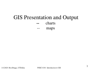
![Making maps, many maps! [What is GIS?]](https://cdn1.slideserve.com/3592384/making-maps-many-maps-what-is-gis-dt.jpg)