Download
1 / 44
450 likes | 740 Views
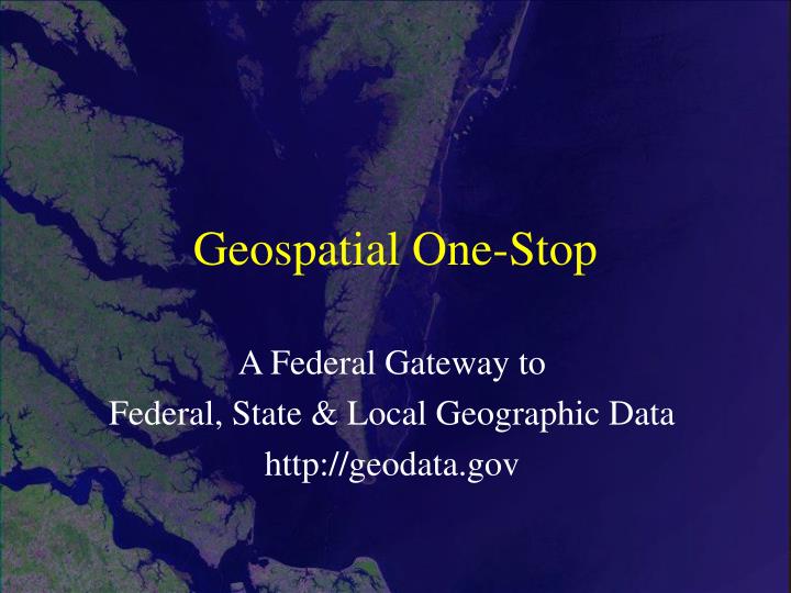
Geospatial One-Stop. A Federal Gateway to Federal, State & Local Geographic Data http://geodata.gov. Geospatial One-Stop (GOS). GOS Overview GOS Architecture & Building Blocks Publishing Metadata on GOS Summary Exercises. A Brief Look at the Geospatial One-Stop Portal.

E N D
Geospatial One-Stop A Federal Gateway to Federal, State & Local Geographic Data http://geodata.gov
Geospatial One-Stop (GOS) • GOS Overview • GOS Architecture & Building Blocks • Publishing Metadata on GOS • Summary • Exercises
A Brief Look at the Geospatial One-Stop Portal Geospatial One-Stop operates the portal at geodata.gov “to provide “one-stop” access to all registered geographic information and related online access services.” http://gos2.geodata.gov
A Brief Look at the Geospatial One-Stop Portal The portal can be accessed through the FGDC Web site, or by going directly to http://gos2.geodata.gov Direct access Access through FGDC Web site
A Brief Look at the Geospatial One-Stop Portal Simple searches can be performed from the main page, or more advanced searches can be performed by clicking on the “Show Advanced Search Options” link.
A Brief Look at the Geospatial One-Stop Portal Results from searches return a list of matching metadata records, along with links to the full record, a summary version of the record, or a link to the website related to that record.
A Brief Look at the Geospatial One-Stop Portal Choose to view a summary version of the record, or select to view the full record in FGDC format A portion of a full metadata record in FGDC format Summary metadata for selected data set
Clearinghouse Servers Geospatial One-Stop (GOS) Portal Federal agencies You! State agencies Web user interface http Z39.50 Universities Resources are catalogued for discovery Industry & NGO’s Multiple organizations providing metadata that is harvested and catalogued by GOS GOS Architecture The FGDC metadata clearinghouse is a decentralized system of Internet servers you can use to search for available geospatial data.
GOS Building Blocks The descriptive information that fuels this system is metadata, which is collected in a standard format to facilitate query and consistent presentation across the multiple participating sites.
GOS Metadata Can Describe: • Existing Geospatial Data • Planned Geospatial Data Acquisitions • Online Mapping Systems
Publishing Metadata on GOS Methods • Direct Data Entry via a Web-Form • Manual Upload • “Harvesting”
Publishing Metadata on GOS • GOS Home Page: http://gos2.geodata.gov • “Sign Up” to register as a user • Username, password, first & last name, email • Login & go to “My Tools” tab
What is metadata harvesting? • Metadata harvesting is an automated scheduled process for collecting new and updated metadata from a wide variety of GIS metadata sources. • The process of harvesting allows geodata.gov to synchronize its metadata with publishers metadata. • If you participate in metadata harvesting, any update to your metadata should be made on your metadata repository. geodata.gov will obtain the update through harvesting.
How Does Harvesting Work? Metadata harvesting in geodata.gov is performed in three steps: 1) Harvesting – based on information provided during the registration, geodata.gov will connect to your metadata repository, retrieve all metadata records if it is the first time harvesting, or only the updated records since the last harvesting date. You need to verify that the date of creation or last update is stored in your metadata (Metadata Date).
How Does Harvesting Work? 2) Validation – during validation, each metadata record will be examined to meet the minimum requirements (see the list at the end of this description). The validation function will recognize only the FGDC tags. You can access your validation report via the harvesting history function.
How Does Harvesting Work? 3) Publishing – during publishing, all successfully validated metadata will be published in the geodata.gov. If the same document (as indicated by document unique ID) already exists, then the existing document will be updated. Otherwise the document will be inserted in geodata.gov as a new document. Once the metadata is published, it will be searchable from geodata.gov.
What Protocols Are Supported? Currently geodata.gov can harvest FGDC-compliant metadata from five different harvesting protocols: • Z39.50 metadata clearinghouse node • ArcIMS metadata service • Web Accessible Folder (WAF) • Open Archive Initiative (OAI) metadata service. • CS-W
Harvesting Requirements Document unique ID - each metadata file requires a unique ID to determine if a document is new to geodata.gov. • If your metadata clearinghouse is a Z39.50 type, you need to verify if document unique ID has been implemented in each metadata document. For Isite, please check the Isite distribution to obtain the new release of Isite (Isite Vers. 2.10) which implements document unique ID and update date. • Document unique ID is not an issue if your repository is a WAF, OAI metadata service, or an ArcIMS metadata service because these services already handle and expose a unique identifier for each document in the collection
Harvesting Requirements Update date • Once your repository been has harvested, the next harvesting will only look for metadata documents that are updated since the last harvesting date. In all cases the update date should be reflected in the “Metadata Date” field of CSDGM metadata.
ISO Topic Categories In ArcCatalog, you can use ISO Wizard as your editor, or manually enter information
Metadata Considerations Going Beyond the Minimum • Minimal metadata is minimally useful. • If you limit your metadata to the mandatory elements of the Content Standard for Digital Geospatial Metadata (CSDGM), then you have limited your metadata to those elements common to all data types and have not realized the value of metadata to capture that which is unique to the data set. • Metadata producers must determine all metadata elements necessary to adequately characterize the data set and provide complete, current information for each element.
Metadata Considerations Going Beyond the Minimum • When you create metadata that goes beyond the minimum, you create a data management resource that serves both your community and your own data management efforts.
Metadata Considerations Multiple Online_Linkage Values • As a ‘repeatable’ element, Online_Linkage (Citation Information) is used to provide access to a variety of data download, data clearinghouse, and web-mapping services. Use this field to fully represent your geospatial data access and distribution capabilities by providing complete URLs and necessary information to indicate the nature of the weblink using the following style guidance:
Metadata Considerations Multiple Online_Linkage Values • OGC Web Map Service (WMS) links include a ‘getmap’ request with a layer name, version, preferred image format, and preferred SRS, at a minimum: • http://server/service?REQUEST=getmap&VERSION=1.1.0&LAYERS=roads&FORMAT=image/gif&SRS=EPSG:4326
Metadata Considerations Multiple Online_Linkage Values • ArcIMS “Image” services using a URL-like request. If you pasted this request in a browser you will not connect to an ArcIMS server since it does not permit this style of request, however it contains enough information to allow geodata.gov to connect to an ArcIMS service: • http://<server>/image/<service_name> will be assigned as Live Map, ArcXML Image service, where server URL is <server> and service name is ArcIMS <service_name>. The sub-path “/image/” must be present in the URL
Metadata Considerations Multiple Online_Linkage Values • direct download sites include URLs, that start with either ftp:// or http:// and point to filenames with .zip, .tar, .tgz, .gz, .dxf, or .e00 extensions.
Summary • Metadata is easily searchable, since it is collected and stored in a consistent format • Since metadata is collected and stored in a consistent format, it can be viewed in a number of different ways (FGDC standard, FAQ, or a custom-made form) • The FGDC “clearinghouse” is a decentralized system • The Geospatial One-Stop is a: • Portal for searching multiple nodes • Repository for storing your metadata • Virginia is in the process of developing it’s own metadata clearinghouse.
The Hunt for Good Metadata Exercise
Exercise Developing a Crosswalk for Virginia Lite and ArcCatalog • In this exercise, you will familiarize yourself with ArcCatalog’s metadata entry tool, by developing a crosswalk between the VA Metadata Lite and ArcCatalog. • Refer to the hand outs for further instructions!