Download
1 / 14
140 likes | 146 Views
Geospatial One Stop. Building Blocks for Implementing the National Spatial Data Infrastructure. Hank Garie Executive Director hgarie@fgdc.gov (703) 648-5569. Geospatial One Stop. Purpose of the project:. Making it: Easier Faster Cheaper.

E N D
Geospatial One Stop Building Blocks for Implementing the National Spatial Data Infrastructure Hank Garie Executive Director hgarie@fgdc.gov (703) 648-5569
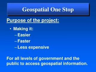
Geospatial One Stop Purpose of the project: • Making it: • Easier • Faster • Cheaper For all levels of government and the public to access geospatial information.
Geospatial One Stop • Raises the visibility of the strategic value of geographic information. • Increases federal agency accountability for the stewardship and sharing of geospatial resources. • Establishes a collaborative model for directing an intergovernmental initiative.
Geospatial One Stop • Framework data standards • Portal development • Existing Data Inventory • Data Acquisition Marketplace Project Modules
Framework Standards Draft Standards available at www.geo-one-stop.gov Rail Air Roads Elevation Transportation Transit Geospatial One-Stop Base Standard Waterways Cadastral Geodetic Control Governmental Units Orthoimagery Hydrography Source – INCITS/L1
Contact Theme E-mail Phone Julie Binder Maitra Base Standard jmaitra@fgdc.gov 703 648 4627 Robin Fegeas Orthoimagery rfegeas@usgs.gov 703 648 4511 John Crowe Elevation jcrowe@usgs.gov 703 648 5596 Bob Pierce Hydrography rrpierce@usgs.gov 770 903 9113 Rick Yorczyk Geodetic Control Rick.yorczyk@noaa.gov 301 713 3191 Carol Brandt Transportation carol.brandt@bts.gov 202 366 6662 Fred Broome Governmental Units fbroome@geo.census.gov 301 763 1056 Don Buhler/Nancy Von Meyer Cadastral dbuhler@sc.blm.gov 202 452 7781 Framework StandardsTheme Leads
GOS Portal & Web Services Goals • Establish web-based Portal for access to maps, data, and map services • Enable intuitive discovery of geospatial data • Rely on standardized web services & metadata • Assist federal agencies to establish web services for Framework data • Use Geo-Partnerships to bring state/local/tribal providers on-line
Geospatial One Stop • Support the business of government • Support decision making Will improve our collective ability to:
Homeland Security Recreation One Stop Disaster Management Smart Growth Citizen Services Other E-gov Initiatives Watershed Management States Cities Feds Tribes Counties • User Community • Data Searches • Map Services • Visualization GOS Portal Support Government Business Support Decision Making Map Services
Geo-Partnerships Expectations • Standards • Metadata • Stewardship Incentives • Tools • Training • Software • Grants Outcome: improved public services through stewardship and data sharing.
Cities Feds States Tribes PrivateSector Counties Implementing Geo-Partnerships Will Lead To: . . . A National, Distributed GIS
Layers of GOS Information Architecture Decision makers- leaders acting upon geospatial information Users - professionals viewing and analyzing data; citizens accessing map services GOS Portal - gateway to distributed data holdings, map services, and metadata GOSfocus On-line services - standardized access methods Metadata - consistent and accurate descriptions of data Framework standards - harmonization of data content models Data - gathered & maintained by jurisdiction
Geospatial One Stop Governance Intergovernmental Board of Directors • National Association of State CIOs • National States Geographic Information Council • National Association of Counties • National League of Cities • International City/County Managers Association • Intertribal GIS Council • Western Governors Association • Department of the Interior: USGS, BLM • Department of Commerce: Census Bureau, NOAA • Department of Transportation • NASA
Geospatial One Stop • Board of Directors and Management Team in place • Consensus process developed draft standards for 10 themes (Framework +) • Portal requirements complete • Federal agency data inventory underway • Survey instrument for local data inventory complete Highlights of Progress to Date