Download
1 / 36
360 likes | 367 Views
Space based precipitation estimation. Anthony DeAngelis. Abstract.

E N D
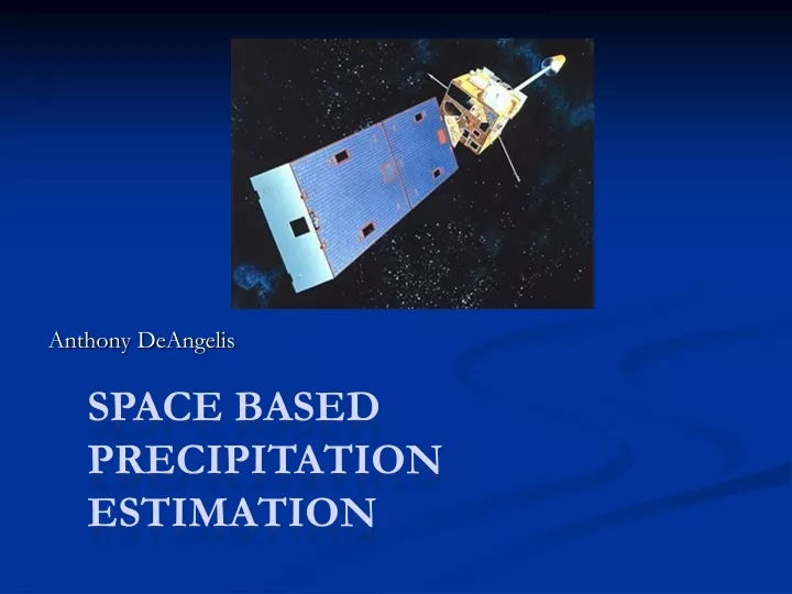
Space based precipitation estimation Anthony DeAngelis
Abstract Estimation of precipitation provides useful climatological data for researchers; as well as invaluable guidance for forecasters of flash floods, widespread heavy rain, and heavy snow. Satellites present one of the many tools used to provide spatial representations of precipitation rates and totals from past events. Satellite based precipitation measurements are needed because ground based radar and rain gauges have spatial and technical limitations. Satellite precipitation estimates are derived from common satellite parameters, such as GOES 11 and 12 cloud-top temperatures, and brightness temperature at various wavelengths from several microwave satellites- to name a few. The infrared theory relies on the relationship between cloud-top temperature and precipitation rate, while the microwave theory depends on the relationship between ice and water content in clouds and precipitation. By combining both theories into one algorithm, the future of space based precipitation estimation appears promising.
Outline • Why use satellites to estimate precipitation? • Satellites used in precipitation estimation • GOES Auto-Estimator Algorithm • Applications
Outline • Why use satellites to estimate precipitation? • Satellites used in precipitation estimation • GOES Auto-Estimator Algorithm • Applications
Ways to Estimate Precipitation Ground based radar (ie. NEXRAD) Network of Rain Gauges Satellites
Why Use Satellites? Significantly expands spatial coverage- within US, outside US, and over oceans
US NEXRAD “Gaps” (West) http://www.wunderground.com/radar/map.asp
Why Use Satellites? Significantly expands spatial coverage- within US, outside US, and over oceans No beam block (mountains, buildings, insects)
NEXRAD Beam Block (West) http://www.wunderground.com/radar/map.asp
Why Use Satellites? Significantly expands spatial coverage- within US, outside US, and over oceans No beam block (mountains, buildings, insects) No signal attenuation effects
Ground Based Radar Signal Attenuation http://www.weathertap.com/protected/static/nexrad.html
Why Use Satellites? Significantly expands spatial coverage- within US, outside US, and over oceans No beam block (mountains, buildings, insects) No signal attenuation effects Less need for calibration- often using only one instrument (such as GOES)
Why Use Satellites? Significantly expands spatial coverage- within US, outside US, and over oceans No beam block (mountains, buildings, insects) No signal attenuation effects Less need for calibration- often using only one instrument (such as GOES) Supplements ground based radar and rain gauge estimates
Outline • Why use satellites to estimate precipitation? • Satellites used in precipitation estimation • GOES Auto-Estimator Algorithm • Applications
Main Satellites Used • Infrared • GOES 11 and 12 • Microwave • DMSP SSM/I • NOAA AMSU-A • NOAA AMSU-B • NASA AMSR-E • Satellite Radar • NASA TRMM
Infrared Theory • Relationship between cloud-top temperature, cloud-top thickness, and precipitation: • Colder cloud-top temperatures imply higher and thicker clouds, which imply heavier precipitation • Relationship between changes in cloud-top surface and precipitation • Vertically growing clouds are associated with precipitation while decaying clouds are not
Microwave Theory • Direct relationship between ice in cold clouds and precipitation • Ice scatters terrestrial radiation back down to the surface, making microwave imagery appear “cold” where ice clouds are present (passive) • Direct relationship between water content in clouds and precipitation • Water in clouds emits microwave radiation, making microwave imagery relatively “warm” where high water content clouds are present (passive)
Outline • Why use satellites to estimate precipitation? • Satellites used in precipitation estimation • GOES Auto-Estimator Algorithm • Applications
GOES Review Geostationary- stays over the same place 24/7, semi-major altitude of ~ 42,000km GOES 11- W. Hem., GOES 12- E. Hem. http://celebrating200years.noaa.gov/historymakers/johnson/goes_spacecraft650.html
History of GOES Algorithms • Interactive Flash Flood Analyzer (IFFA)- 1978 • Manual and time consuming • Auto-Estimator (AE)- 1998 (GOES 11/12) • Similar to IFFA but automated and more advanced • Hydro-Estimator (HE)- 2002 (GOES 11/12) • Similar AE but more advanced and operational • GOES Multi-Spectral Rainfall Algorithm (GMSRA)- 2001 (GOES 11/12) • Uses all 5 GOES imaging channels
History of GOES Algorithms • Interactive Flash Flood Analyzer (IFFA)- 1978 • Manual and time consuming • Auto-Estimator (AE)- 1998 (GOES 11/12) • Similar to IFFA but automated and more advanced • Hydro-Estimator (HE)- 2002 (GOES 11/12) • Similar AE but more advanced and operational • GOES Multi-Spectral Rainfall Algorithm (GMSRA)- 2001 (GOES 11/12) • Uses all 5 GOES imaging channels
GOES Auto-Estimator Procedure • Step 1: Measure cloud-top brightness temperature. Initiate rainfall rate based on a non-linear (power-law) relationship between cloud-top temperature and rainfall rate produced by ground based radar • Uses 10.7μm channel http://www.weatheroffice.gc.ca/data/satellite/goes_nam_1070_100.jpg
Nonlinear Power-Law Relationship R = 1.1183*1011 * exp (-3.6382 10-2* T1.2) R in mm/hour , T in °K, Developed in 1970s http://www.star.nesdis.noaa.gov/smcd/emb/ff/technique.html
GOES Auto-Estimator Procedure • Step 2: Account for the availability of atmospheric moisture- where rainfall rate obtained from the first step is multiplied by a correction factor • Uses NCEP Eta model relative humidity (RH) and precipitable water (PW)
Accounting for Atmospheric Moisture • Determine a moisture correction factor PWRH: • PWRH = PW (sfc. to 500mb) * RH (sfc. to 500mb) • Scale PWRH empirically between 0.00 and 2.00 • Multiply precipitation rate by PWRH • If TB < 210K, do not multiply by PWRH (implies enough moisture) • If TB < 200K, rainfall rate limited to 72mm/hr (maximum average rainfall rate in US)
GOES Auto-Estimator Procedure • Step 3: Determine where rain is actually falling -assume rain to be falling only where there are growing clouds exhibiting over-shooting tops • This uses consecutive half-hourly IR images
Screening Out Non-Raining Pixels • Use consecutive images to see where cloud-tops are becoming colder (growing) or becoming warmer (decaying) • Establish cloud growth correction factor (CG) • CG= 1, where cloud-tops are growing • CG=0, where cloud-tops are decaying • Multiply precipitation rate by CG, acts like “rain mask”
GOES Auto-Estimator Summary • Rainfall rate= power-law rainfall rate (R) * moisture correction factor (PWRH) * cloud growth correction factor (CG) • Products: • 15 minute rainfall rates • 1 hr, 3hr, 6hr, 24hr totals • Mainly US • Mainly used for heavy convective precipitation • Hydro-estimator- few extra steps
Example 24-hr Total http://www.star.nesdis.noaa.gov/smcd/emb/ff/auto.html
GOES Precipitation Overview • Advantages: • High temporal resolution (geostationary)- precipitation estimates every 15 minutes • Fairly high spatial resolution of about 4km • Disadvantages: • Crude scientific theory which doesn’t always hold • Can mistake cumulonimbus for cold cirrus • Weaker performance for non-convective precipitation
Outline • Why use satellites to estimate precipitation? • Satellites used in precipitation estimation • GOES Auto-Estimator Algorithm • Applications
Applications • Forecasting of heavy precipitation • Use NOAA AMSU-B (microwave) hourly rainfall rates as input • Uses TB at 89 and 150GHz regressed against radar data over both land and ocean (scattering theory- passive) • Temporal resolution: 4 times a day • Spatial resolution: ~ 16km • Use Tropical Rainfall Potential (TRaP) algorithm to produce a 24 hour precipitation forecast
Satellite Precipitation Forecasting Overview Advantages: Does a fairly good job forecasting the maximum amount of rainfall expected Disadvantages: Does a poor job forecasting the spatial extent of heavy rainfall
TRaP Calculations ETA Model Forecast 12UTC Jun 5 to 12UTC Jun 6 2001 12.5” max 3” 24 h ending 12 UTC Jun 6 2001 Tropical Storm Allison Stage III multi-sensor observations 12” max 24 h ending 12 UTC Jun 6 2001
Conclusions • Satellites are superior to alternative methods with respect to coverage and calibration. • Satellites supplement ground radar and rain gauges- they are all interconnected. • GOES products are superior to microwave due to higher temporal and spatial resolution. • Microwave products have more robust scientific theory than GOES. • A combination of microwave and infrared theory is promising for the future.
Main References Vicente G.A., R.A. Scofield, and W.P. Menzel, 1998: The Operational GOES Infrared Rainfall Estimation technique. Bulletin of the American Meteorological Society, 79, 1883-1898. www.comet.ucar.edu/class/rfc_hydromet/03_Nov27_2001/docs/Kuligowski/hydromet02.ppt www.ssd.noaa.gov/PS/TROP/NWAOct2001a.ppt http://www.star.nesdis.noaa.gov/smcd/emb/ff/auto.html http://www.oso.noaa.gov/goes/