Download
1 / 17
170 likes | 311 Views
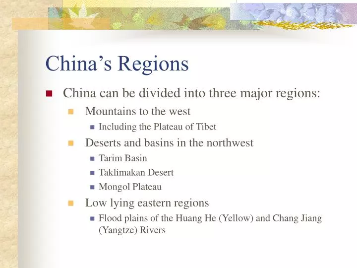
China’s Regions. China can be divided into three major regions: Mountains to the west Including the Plateau of Tibet Deserts and basins in the northwest Tarim Basin Taklimakan Desert Mongol Plateau Low lying eastern regions

E N D
China’s Regions • China can be divided into three major regions: • Mountains to the west • Including the Plateau of Tibet • Deserts and basins in the northwest • Tarim Basin • Taklimakan Desert • Mongol Plateau • Low lying eastern regions • Flood plains of the Huang He (Yellow) and Chang Jiang (Yangtze) Rivers
Plateaus of China • The Tibetan Plateau is the highest region in the world. It is bordered by Nepal and Bhutan to the south. • 2 million people live in the harsh environment of the plateau.
Basins of China • Tarim Basin and Dzungarian Basin are too cold for growing crops so they are utilized by herders.
Eastern Region of China • 2/3 of the people of China live in the eastern region. This area is the cradle of Chinese civilization. • The alluvial plains are the most distinctive feature of the region where China’s economic and social life developed.
Major River Systems in China • Huang He (Yellow) and the Chang Jiang (Yangtze) Rivers empty in to the East China Sea.
The Yangtze River • The Chang Jiang or Yangtze River is China’s most important river. Much of it is navigable. • It provides a water route deep into the interior of China.
The Huang He (Yellow) River • This river is known as “China’s Sorrow” because of its frequent flooding, it has taken many lives.
Mongolia • Mongolia is divided into two regions: • The Mongolian Altai Mountains in the northwest. • The steppe areas and Gobi Desert
Mountains in Mongolia • The Mongolian Altai Mountains form the border between Mongolia and Siberia
The Gobi is one of the world's great deserts. • It covers 1.3 million square kilometers, extending 1,600 km from east to west across Central Asia, in southeast Mongolia and northern China. • It is from 1,000 m to 1,500 m in elevation, with cold winters, short hot summers, and fierce sand and wind storms. • Grassy fringe areas support a small population of nomadic Mongol herders.