Download
1 / 38
380 likes | 845 Views
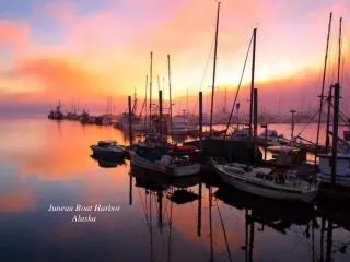
WRF Simulations at very high resolution in the complex terrain around Juneau Alaska. Don Morton 1 , Delia Arnold 2,3 , Irene Schicker 2 , Carl Dierking 4 , Kayla Harrison 1 1 Arctic Region Supercomputing Center, University of Alaska Fairbanks, Fairbanks, Alaska USA

E N D
WRF Simulations at very high resolution in the complex terrain around Juneau Alaska Don Morton1, Delia Arnold2,3, Irene Schicker2, Carl Dierking4, Kayla Harrison11Arctic Region Supercomputing Center, University of Alaska Fairbanks, Fairbanks, Alaska USA 2Institute of Meteorology, University of Natural Resources and Life Sciences, Vienna, Austria 3Institute of Energy Technologies, Technical University of Catalonia, Barcelona, Spain 4Juneau Weather Forecast Office, National Oceanic and Atmospheric Administration / National Weather Service, Juneau, Alaska, USA
Outline • Initial motivations – success in previous High Resolution Modeling in Complex Terrain (HiRCoT) scenarios • Aviation operations at Juneau • Attempt to simulate past wind event • Problems • Future
Previous Motivations for High Resolution Wind Modeling • Isabelle Pass • Savoonga (Saint Lawrence Island)
Morton & Mölders Key finding – only at 1 km resolution can we match the observed winds
Using WRF to Simulate the Saint Lawrence Island Wind Storm of February 27, 2009
The Event • Peak wind at Savoonga: 99 mph (or 139mph?) • Peak wind at Gambell: 61 mph • Same synoptic scenario at both locations • Why different wind speeds? • Why so strong at Savoonga?
IFR Ops in Juneau, Alaska Runway 08
IFR Ops in Juneau, Alaska Turn right as soon as practical Runway 08
IFR Ops in Juneau, Alaska Under strong wind conditions characterized by post-frontal topographically enhanced wind shear, aircraft following these procedures may encounter turbulence or wind shear classified as severe. In January 1993, a Boeing 737 aircraft at a 30-degree bank encountered extreme crosswinds resulting in departure from controlled flight, with successful recovery occurring within 50 meters of the ground. Turn right as soon as practical Runway 08
Juneau Airport Wind System (JAWS) • Intended to warn of imminent wind shear conditions • Anemometers – Single point wind velocity and temperature, average over 1-minute intervals • Profilers – Vertical wind profile, average over 10-minute intervals Courtesy Research Applications Laboratory, NCAR
A First Modeling Effort • Wind shear event, 18 Dec 2009 • Compared • AK-NAM and ECMWF initialisations • Different parameterisations • 9 / 3 / 1 / 0.333 km nests • NED2s terrain for high resolution
Preliminary Results 1km • Signs of promise, with timing of wind shift improving with higher resolution 333m
Preliminary Results 1km • Though not consistent, signs of promise, with Mount Roberts wind speed improving with higher resolution • Inspired by 333m success, tried to do this at 111m, but couldn’t replicate the previous case!! What happened?!?! 333m
Moving Ahead • Runing the simulation again at 9 / 3 / 1 / 0.333 and 0.111 km resolution (75 vertical levels) • Had hoped to try a 55.5 m resolution, Large Eddy Simulation • Topography • GTOPO (default WRF, terrain only goes down to 30s) • NED 2s • SRTM 3s • Namelist – Lin microphysics, rrtm/Dudhia radiation, MYNN sfclay_physics, Noah LSM, MYNN pbl. Also, used epssm time off-centering for vertical sound waves
Topography in Nest 5 (111m) GTOPO 30s NED 2s SRTM 3s NED minus SRTM
Topography in Nest 4 (333m) NED 2s NED minus SRTM
2D 10-meter wind (4h10m) Gtopo 30s NED 2s SRTM 3s
2D 10-meter wind (16h40m) Gtopo 30s NED 2s SRTM 3s
Verification • For each station, use the lat/lon to extract WRF forecast winds at the nearest grid point • We focus on Mount Roberts and Runway Center. • Getting the lat/lon matching to the correct grid point proves to be problematic Courtesy Research Applications Laboratory, NCAR
Mount Roberts 10m Wd Time Series Nest 5 Gtopo 30s NED 2s SRTM 3s
Mount Roberts 10m Wv Time Series Nest 5 Gtopo 30s NED 2s SRTM 3s
Runway Center 10m Wd Time Series Nest 5 Gtopo 30s NED 2s SRTM 3s
Runway Center 10m Wv Time Series Nest 5 Gtopo 30s NED 2s SRTM 3s
Shifted Topographies? At 111m resolution, NED2s is shifted by about 300m when ingested to WPS Verified in several different ways Have not completely ruled out operator error! Graphic produced with WTOOLS
Station Elevations Mount Roberts actual elevation: 537m Runway Center actual elevation: 10m
Effects of Shifted Grid • If our primary problems arise from the shifted grids, then maybe we can find the “correct” solution at a nearby gridpoint? • Next slides • 5x5 stencils around lat/longridpoint of interest • See if there is a systematic shift in a good solution Courtesy Research Applications Laboratory, NCAR
111m grid model elevation minus actual elevation at lat/lon of center grid point
24-hour time-series WvObs versus Forecast correlation wrt center grid point observed
24-hour time-series WdObs versus Forecast correlation wrt center grid point observed
In addition to potential topographic shifting, there may be fundamental model issues to deal with
75 versus 40 model levels – 111m horizontal resolution 75 model levels 40 model levels
Profiler Comparisons • Three vertical wind profilers • Working on direct wrfout / profiler comparisons – still in progress Profiler obs WRF Profiler
Summary • Trying to push into “unexplored terrain” • Need to understand our early “success” and why it’s now evasive (strongly suspecting errors in early results) • Verification in this kind of terrain, with high-res topos can be very difficult • This seems to be a problem with many degrees of freedom • Different, but related problems have been found in other areas, such as the Alps • Need to consider smoothing and interpolations effects • Need to compare against profiler data • Are we being too idealistic in our hopes to replicate the observations? • Would LES offer potential improvements?