Download
1 / 46
460 likes | 534 Views
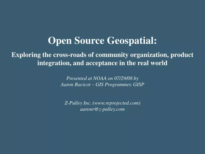
Open Source Geospatial: Exploring the cross-roads of community organization, product integration, and acceptance in the real world Presented at NOAA on 07/29/08 by Aaron Racicot – GIS Programmer, GISP Z-Pulley Inc. (www.reprojected.com) aaronr@z-pulley.com. Who am I?.

E N D
Open Source Geospatial: Exploring the cross-roads of community organization, product integration, and acceptance in the real world Presented at NOAA on 07/29/08 by Aaron Racicot – GIS Programmer, GISP Z-Pulley Inc. (www.reprojected.com) aaronr@z-pulley.com
Who am I? B.S. Computer Science M.S. Environmental Science Open Source User/Developer GIS Programmer
Open Source Geospatial – What Is It? OS GIS Web Apps (Mapserver, MapGuide, OpenLayers, etc.) OS GIS Desktop Apps (QGIS, GRASS, UDig Jump, OSSIM, etc.) OS GIS Base Tools (GDAL, FDO, PostGIS, etc.) OS Base Tools (Apache, Compilers, etc.) OS Core (Linux)
OSGeo – Open Source Geospatial Foundation Website System Administration Fundraising Education and Curriculum Incubation Public Geospatial Data Promotion and Visibility Projects General Members Charter Members Board of Directors
OSGeo – Mission • To provide resourcesfor foundation projects - eg. infrastructure, funding, legal. • To promote freely available geodata- free software is useless without data. • To promote the useof open source software in the geospatial industry (not just foundation software) - eg. PR, training, outreach. • To encourage the implementation of open standardsand standards-based interoperability in foundation projects. • To ensure a high degree of quality in foundation projects in order to build and preserve the foundation "brand". • To make foundation and related software more accessibleto end users - eg. binary "stack" builds, cross package documentation. • To provide support for the use of OSGeo software in educationvia curriculum development, outreach, and support. • To encourage communication and cooperation between OSGeo communities on different language (eg. Java/C/Python) and operating system (eg. Win32, Unix, MacOS) platforms. • To support use and contribution to foundation projects from the worldwide community through internationalization of software and community outreach. • To operate an annual OSGeo Conference, possibly in cooperation with related efforts (eg. EOGEO).
OSGeo – Projects Projects Mapbender MapGuide MapServer OpenLayers GRASS OSSIM QGIS FDO GDAL/OGR GeoTools GeoNetwork
A picture speaks louder than words…
Examples - Desktop Grass - Raster Processing
Examples - Desktop QGis
Examples - Web-Based Chameleon Mapserver framework Spatially constrained queries and scenarios GMT generated graphics AJAX-User Based Data Filter PostGIS Spatial Data
Examples - Web-Based Tile based image server “Google Maps” Like Tools Super Slippy! Openlayers
Personal Use…. Navigating Wilderness Areas with GRASS Classification Cost Surface Thanks to Dylan Beaudette: http://casoilresource.lawr.ucdavis.edu/drupal/node/244
Creating Data…. Digitizing, Modifying, Extracting… Context Layer Viewing Create New Shapes Create New Attributes
Transforming Data…. How to get coordinates in UTM to Geo-NAD83?
Spatially enable your database…. How to select data within a polygon area? Intersects Geometry Definition Distance(geometry, geometry) Equals(geometry, geometry) Disjoint(geometry, geometry) Intersects(geometry, geometry) Touches(geometry, geometry) Crosses(geometry, geometry) Within(geometry A, geometry B) Overlaps(geometry, geometry) Contains(geometry A, geometry B) Intersects(geometry, geometry) Relate(geometry, geometry, intersectionPatternMatrix) Relate(geometry, geometry) Centroid(geometry) Area(geometry) Length(geometry) PointOnSurface(geometry) Boundary(geometry) Buffer(geometry, double, [integer]) ConvexHull(geometry) Intersection(geometry, geometry) SymDifference(geometry A, geometry B) Difference(geometry A, geometry B) GeomUnion(geometry, geometry) GeomUnion(geometry set) MemGeomUnion(geometry set)
Decision Support Pattern - Fisheries Field Work Back at the Office Field Data Collection Data Analysis QA/QC/Feedback Inform Decision Makers
Tools Used PyQGIS PyQT
Requirements to build QGIS 0.9+ QT 4.3+ SIP 4.7+ PyQT 4.3+ OpenOceanMap 0.1+ Py2Exe/Py2App Inno Installer
QT and QGIS API exposed # PyQt4 includes from PyQt4.QtCore import * from PyQt4.QtGui import * # QGIS bindings from qgis.core import * from qgis.gui import *
Windows inherit from QT # Main window used for housing the canvas, # toolbars, and dialogs class MainWindow(QMainWindow, Ui_MainWindow): def __init__(self,splash): QMainWindow.__init__(self) # required by Qt4 to initialize the UI self.setupUi(self)
Create a map canvas from QGIS # create map canvas self.canvas = QgsMapCanvas(self) self.canvas.setCanvasColor(QColor(255,255,255)) self.canvas.enableAntiAliasing(True) self.canvas.useQImageToRender(False) self.canvas.show()
Hook up simple tools…Zoom In # create a little toolbar for map tool self.toolbar = parent.addToolBar(“MapTool") self.toolbar.addAction(parent.mpActionZoomIn) self.toolZoomIn = QgsMapToolZoom(self.canvas,False) self.toolZoomIn.setAction(parent.mpActionZoomIn) # Connect the button signal to a slot QObject.connect(parent.mpActionZoomIn, SIGNAL("triggered()"), self.zoomIn) # Signal handler for zoom in button def zoomIn(self): self.canvas.setMapTool(self.toolZoomIn)
Bundle it all up… py2exe C:\openoceanmap>more setup.py from py2exe.build_exe import py2exe from distutils.core import setup opts = { "py2exe": { "includes": ["sip"], "packages": ["qgis","PyQt4"], "dist_dir": "bin", } } setup(options = opts, console=[{"script": "openoceanmap.py"}] ) C:\openoceanmap>python setup.py py2exe
Other parts of the process…QA/QC Field Work Back at the Office Field Data Collection Data Analysis QA/QC/Feedback Inform Decision Makers
Other parts of the process…DST’s Field Work Back at the Office Field Data Collection Data Analysis QA/QC/Feedback Inform Decision Makers
Next? Integrated DSS for Tidal In Stream Energy Conversion Projects
Where to go for more info Tools • PostGIS - http://postgis.refractions.net/ • Remote Sensing - http://remotesensing.org/ • GDAL/OGR - http://gdal.maptools.org/ • PROJ.4 - http://proj.maptools.org/ • R-Statistics - http://www.r-project.org/ • GMT - http://gmt.soest.hawaii.edu/ Blogs - Aggregators • http://planetosgeo.crschmidt.net/ • http://www.planetgs.com/ • http://slashgeo.org/ Blogs - Individual • http://www.osgeo.org/blog • http://zcologia.com/news/ • http://openlayers.org/blog • http://blog.qgis.org/ • http://mappinghacks.com/ • http://hobu.biz/ • http://www.reprojected.com/geoblog IRC • #osgeo, #grass, #mapserver, #openlayers, etc… Local User Group • http://groups.google.com/group/cugos Z-Pulley Inc. - Reprojected • http://www.reprojected.com Ecotrust • http://www.ecotrust.org OSGeo • http://www.osgeo.org OSGIS • Maptools - http://www.maptools.org • FreeGIS - http://freegis.org/ • Open Source GIS - http://opensourcegis.org/ Standards • OGC - http://www.opengeospatial.org/ Desktop • GRASS - http://grass.itc.it/ • QGIS - http://qgis.org/ • OSSIM - http://www.ossim.org/ • UDIG - http://udig.refractions.net/ • JUMP – http://jump-project.org/ • OpenEV - http://openev.sourceforge.net/ Server/Web • Mapserver - http://mapserver.gis.umn.edu/ • MapBender - http://www.mapbender.org • MapGuide OS – http://mapguide.osgeo.org/ • OpenLayers - http://www.openlayers.org/ • EXTJS – http://extjs.com/ • TileCache - http://www.tilecache.org/ • FeatureServer - http://featureserver.org/