Download

1 / 11
120 likes | 150 Views
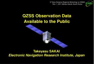
3 rd Asia-Oceania Regional Workshop on GNSS Nov. 1, 2011 @Jeju Island, South Korea. QZSS Observation Data Available to the Public. Takeyasu SAKAI Electronic Navigation Research Institute, Japan. Introduction. QZSS (Quasi-Zenith Satellite System) program :

E N D
3rd Asia-Oceania Regional Workshop on GNSS Nov. 1, 2011 @Jeju Island, South Korea QZSS Observation Data Available to the Public Takeyasu SAKAI Electronic Navigation Research Institute, Japan
Introduction • QZSS (Quasi-Zenith Satellite System) program: • Regional navigation service broadcast from high-elevation angle by three or more satellites on the inclined geosynchronous (quasi-zenith) orbit; • Broadcast GPS-like supplement signals on three frequencies and two augmentation signals, L1-SAIF and LEX; ENRI is working for L1-SAIF; • The first QZS satellite successfully launched on Sept. 11, 2010; • Technical verification is ongoing by some research organizations. • Broadcasting ranging signals constantly: • Ranging signals are broadcast constantly and stable; Now no alert flag; • QZS-1 is in the operational phase while technical verification is ongoing; • Now need to promote rapid spread of QZSS capability to consumer equipment. • ENRI just began continuous observation of QZSS: • Measures all signals on triple frequencies except LEX; • We have decided to make observations open to the public for promotion of R&D on QZSS applications; • Daily RINEX files are publicly available for free of charge on the web.
Signal Center Freq. Bandwidth Min. Rcv Power QZS-L1C L1CD 1575.42 MHz 24 MHz –163.0 dBW L1CP 24 MHz – 158.25 dBW QZS-L1-C/A 24 MHz – 158.5 dBW QZS-L1-SAIF 24 MHz – 161.0 dBW QZS-L2C 1227.6 MHz 24 MHz – 160.0 dBW QZS-L5 L5I 1176.45 MHz 25 MHz – 157.9 dBW L5Q 25 MHz – 157.9 dBW QZS-LEX 1278.75 MHz 42 MHz – 155.7 dBW QZSS Signals Supplement Signals (JAXA) Augmentation (ENRI) • Supplement Signals: L1C/A, L2C, and L5 are GPS-like (PRN193); • Augmentation Signals: L1-SAIF is SBAS-like (PRN183); LEX is original signal; • For detail, see IS-QZSS. URL: http://qz-vision.jaxa.jp/USE/is-qzss/index_e.html Augmentation (JAXA/GSI)
Continuous Observation • Observation conditions: • ENRI just began continuous observation of L1-SAIF signal for technical verification in October 2011; Also observes other supplement signals; • Observation is available on the web: URL http://www.enri.go.jp/sat/qzss_e.htm • Range measurements are converted into RINEX format and navigation message is formatted in EMS file; Both are slightly extended for QZSS; • Data files are stored on daily basis. Note - Sometimes there is missing data due to some reason such as power outage.
Equipment Setup JAVAD Rx Ethernet Converter LAN ANT Linux Server Serial Trimble Zephyr Geodetic 2 Realtime Data Collection
Observation: RINEX Format • Extension of existing RINEX format: • The current RINEX format does not support QZSS; SV identifier is not defined for QZSS signals; • Observation is provided in RINEX 2.11 format with an extension; • For supplement signals we use “Jnn” regarding other core systems; • For L1-SAIF augmentation signal, we use “Snn” like SBAS. For QZS-1 Supplement: J01 L1-SAIF: S83
Example of RINEX Observation 2.11 OBSERVATION DATA G (GPS) RINEX VERSION / TYPE dat2rnx 1.00 20111019 01:16:43UTCPGM / RUN BY / DATE dat2rnx 1.00 (Oct 18 2011) COMMENT MTKB MARKER NAME ENRI, JAPAN ELECTRONIC NAVIGATION RES INST, JAPAN OBSERVER / AGENCY 1 TR_G3TH_4 3.4.0a3_qzss8 Jun,10REC # / TYPE / VERS 1 TRM55971.00 ANT # / TYPE -3947737.9910 3364428.7640 3699428.9764 APPROX POSITION XYZ 0.0000 0.0000 0.0000 ANTENNA: DELTA H/E/N 1 1 WAVELENGTH FACT L1/2 14 L1 C1 P1 D1 S1 L2 C2 P2 D2# / TYPES OF OBSERV S2 L5 C5 D5 S5 # / TYPES OF OBSERV 2011 10 18 0 0 0.0000000 GPS TIME OF FIRST OBS 2011 10 18 23 59 59.0000000 GPS TIME OF LAST OBS END OF HEADER 11 10 18 0 0 0.0000000 0 21R23R21G07S37G19G13S29G03R12R22G16G30 G31R10R20G06R11G21G23J01S83 131781550.7370 24635168.7740 24635170.4044 2895.0620 38.0000 102496754.6854 24635189.4140 24635186.6924 2251.6814 35.7504 : : 133569864.0430 25417497.0210 25417498.3644 2635.4920 38.2500 104080417.5974 25417501.4880 25417504.3784 2053.3764 19.0004 195451243.8520 37193140.8190 -995.3470 42.7500 : : 194779121.9180 37065243.8380 -722.2830 44.7500 151775927.3420 37065245.7170 -562.8480 42.5000 145451928.7700 37065250.8380 -539.3800 48.0000 194779167.9350 37065241.0500 -722.2760 43.7500 Large # of measurements 21 SVs Epoch Time QZSS GLO Slot 23 Carrier C/A code P/Y code Doppler C/N0 GPS PRN 07 SBAS PRN 137 L2C code L5 code QZS-1 L1 C/A QZS-1 L1-SAIF
Navigation Message: EMS File • Extension of EMS File Format: • Navigation messages broadcast on L1C/A-equivalent ranging signals are decoded and archived in the extended EMS Format; • EMS format is used in EGNOS Data Archive Service (EDAS); Originally contains only EGNOS broadcast messages; • Our extension: Including GPS/GLONASS/QZSS navigation messages additionally.
137 11 10 18 00 00 02 25 9A6610581702DFA7FBFF808000...2B00 (64 chars) 129 11 10 18 00 00 02 63 9AFC0000000000000000000000...7700 (64 chars) 183 11 10 18 00 00 02 50 9ACA06292A06079C2421E79968...4D00 (64 chars) 60 11 10 18 00 00 02 9 480BC1BA68F4C024B5D6992CE0 58 11 10 18 00 00 02 9 480BC1BA68F4C024B5D6992CF0 : 48 11 10 18 00 00 02 9 480BC1BA68F4C024B5D6992C00 137 11 10 18 00 00 03 2 C608DFFC009FFDFFC003FFDFFD...3500 (64 chars) 129 11 10 18 00 00 03 2 C609DFFC011FFDFFC013FD5FFD...D000 (64 chars) 183 11 10 18 00 00 03 51 C6CE03B79FB824827D84B7D020...1AC0 (64 chars) 137 11 10 18 00 00 04 3 530CDFFC005FFDFFC00DFFFFF7...7D00 (64 chars) 129 11 10 18 00 00 04 3 530EDFFC011FFDFFC011FFC000...7300 (64 chars) 183 11 10 18 00 00 04 51 53CE8477D878477BFF85D007F8...8180 (64 chars) 60 11 10 18 00 00 04 10 55B8AC6957F0A00C0F7D592CE0 58 11 10 18 00 00 04 10 55B8AC6957F0A00C0F7D592CF0 : 48 11 10 18 00 00 04 10 55B8AC6957F0A00C0F7D592C00 7 11 10 18 00 00 00 1 8B09E8E8E1029C09E90002DEA1...8D00(76 chars) 19 11 10 18 00 00 00 1 8B09E8E8E1029C09E90002DEA1...F800 (76 chars) : 21 11 10 18 00 00 00 1 8B09E8E8E1029C09E90002DEA1...3CC0(76 chars) 23 11 10 18 00 00 00 1 8B09E8E8E1029C09E90002DEA1...4A00(76 chars) 137 11 10 18 00 00 05 4 9A11DFFDFFFFF7FF1FFFFEBFDD...9C00(64 chars) 129 11 10 18 00 00 05 4 9A12DFFDFFC007FFDFFFFE3FD1...3B00 (64 chars) 193 11 10 18 00 00 00 1 8B000048E10217C9EA00426000...8800 (76 chars) 183 11 10 18 00 00 05 2 9A081FFDFFC001FFDFFFFF9FFD...B500 (64 chars) 137 11 10 18 00 00 06 28 C67308C963CF4080702A827907...FE00 (64 chars) 129 11 10 18 00 00 06 28 C67308CB63EF7080702D027917...BD00 (64 chars) 183 11 10 18 00 00 06 3 C60C1FFDFFC001FFDFFC005FFC...1180 (64 chars) SBAS/L1-SAIF GLONASS SBAS/L1-SAIF Order of completion of message decoding GLONASS GPS SBAS/L1-SAIF QZSS L1C/A SBAS/L1-SAIF PRN Epoch Time Msg ID Data Example of EMS File
Discussion • Is RINEX appropriate for data publication? • So far, RINEX seems most commonly used data exchange format; • Option: BINEX and RTCM 3.0 could be used (also for realtime?). • Some applications are not capable of large # of measurements: • Need degraded version of observation, for example, 2-frequency version? • Is RINEX navigation message file necessary? (Is EMS file enough?) • RINEX navigation file (*.YYn) is easily applicable to QZSS L1-C/A; • L1-SAIF message: Ephemeris message may be stored in RINEX file (*.YYh); But other messages have little option other than EMS (or similar) format; • An idea: Store L1-SAIF messages in RINEX observation file using comment record. • Does anyone need realtime distribution? • ENRI is ready for realtime distribution; • Data collection is performed in a realtime manner; • Communication line available for realtime distribution may be less capacity. • ENRI is also collecting data at some locations inside Japan.
Conclusion • QZSS needs promotion: • QZS-1 is in the operational phase while technical verification is ongoing; • Need promotion for rapid spread of QZSS capability to consumer equipment. • ENRI’s contribution: • Began continuous observation of QZSS and data publication; • Measures all signals on triple frequencies except LEX; • Daily RINEX files are publicly available for free of charge on the web. • URL http://www.enri.go.jp/sat/qzss_e.htm • Proposal: • SV identifier for RINEX observation: • For supplement signals, use “Jnn” (J01 for QZS-1) regarding other core systems; • For L1-SAIF augmentation signal, use “Snn” (S83 for QZS-1) like SBAS. • Feedback your comments to: sakai@enri.go.jp