Download
1 / 27
280 likes | 403 Views
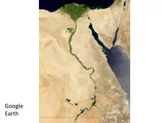
Google Earth: Putting the World in your Students’ Hands. Pamela Newman Bucks County Intermediate Unit October 2008. Google Earth. Satellite imagery of the Earth that includes layers of information Free download http://earth.google.com

E N D
Google Earth: Putting the World in your Students’ Hands Pamela Newman Bucks County Intermediate Unit October 2008
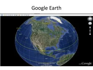
Google Earth • Satellite imagery of the Earth that includes layers of information • Free download http://earth.google.com • Content partners include Discovery Education, National Geographic, Wikipedia • Still pictures • Share files
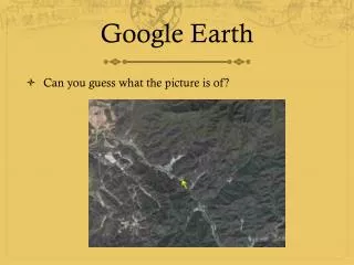
Ways to Use • Searchable virtual globe of satellite images • GIS-like map layers= Transferable skill • Touring • Combine with video, audio, image content • Alternate assessment medium
Search panel - Use this to find places and directions and manage search results. Google Earth EC may display additional tabs here. • Overview map - Use this for an additional perspective of the Earth. • Hide/Show sidebar - Click this to conceal or the display the side bar (Search, Places and Layers panels). • Placemark - Click this to add a placemark for a location. • Polygon - Click this to add a polygon. • Path - Click this to add a path (line or lines). • Image Overlay - Click this to add an image overlay on the Earth. • Measure - Click this to measure a distance or area size. • Email - Click this to email a view or image. • Print - Click this to print the current view of the Earth. • Show in Google Maps - Click this to show the current view in Google Maps in your web browser. • Sky - Click this to view stars, constellations, galaxies, planets and the Earth's moon. • Navigation controls - Use these to tilt, zoom and move around your viewpoint (see below). • Layers panel - Use this to display points of interest. • Places panel - Use this to locate, save, organize and revisit placemarks. • Add Content - Click this to import exciting content from the KML Gallery • 3D Viewer - View the globe and its terrain in this window. • Status bar - View coordinate, elevation and imagery streaming status
Navigation Tools Tilt Reorient to North Move Rotate Zoom In Zoom Out
Sidebar • Search • Enter a location name • Eiffel Tower • Niagara Falls • Paste coordinates from Wikipedia or another source • Blarney Castle, Loch Ness • Enter City, Country • Petronus Towers in Kuala Lumpur, Malaysia • Places • Save your work here • Each student can create and save folders • Layers • Great pre-made resources
Layers • Discovery Networks Layer • Tours • Road Trips • Interactive media
Take 5 minutes to explore Google Earth Think of ways you can use it in your classroom
Personalizing Media • To create a folder: • Right click on My Places • Name the folder
Placemarks • Make placemarks be your starting point to link to Discovery articles, videos, pictures and other Internet resources. • Add a placemark • Customize icon
Add a Description • Add an article, Limit your Discoverystreaming search to “Articles” • Copy and paste text • <br> creates a line break
Add Images • Add an Overlay • Limit DiscoveryStreaming search to images • Download image • Load file
Add Video • Find Discovery Streaming video • Right click the green play button next to the segment • Copy shortcut • Paste into description in Google Earth
Make a Path or Polygon Create path using Path or Polygon Tool • Click each location in order • Navigate • Close path or polygon box
Measurement • Show Spatial relationships: • Ruler tool • Pointer elevation display • View menu> Scale Legend
Differentiation: HTML Code • Code for line break <br> • Code to make link attractive <a href=“Paste copied Shortcut here">Click here for video</a> • Code to insert image into a description box • Right click the picture in Streaming> Properties • Select entire URL and copy <img src=“Paste the URL here”>
Organize, Save and Share • Drag content into a logical sequence in your folder • Right click on the folder • Save as a KMZ file on a shared server, flash drive, or burn to a CD • Google Earth file extensions: .kmz and .kml
Touring • Click on folder • Use play button • Control tours under tools Play repeatedly for Parent Night
Alternate Assessment Are you starting to see the ways our students can produce work?
Differentiation • Gathering information about locations to be marked • Using GIS (Geographic Information System)-like layers to find information on map • Customizing a map with placemarks • Composing and editing text in a word processor before copying it to the map • Sequencing a tour’s placemarks and image overlays to play in a logical order
Differentiation by Content • Finding specified facts, e.g. when was this landmark erected vs. finding student’s own facts, e.g. why is this place important and interesting • Open-endedness: find 2 landmarks vs. find as many landmarks as you can in this class period • Difficulty of subject matter: Western European, North American, and East Asian countries have larger high resolution areas and more entries in the layers, compared to Central African and Central American nations. It is easier to locate landmarks in London, England than in Abuja, Nigeria.
Differentiation by Process • Research using library resources organized by the library media specialist. • Use Discovery Streaming videos and Google Earth layers as well as written text. • For a country of origin project, interview relatives. • Http://simple.wikipedia.org is written in simple English and is useful for researching very common topics. It features only 25,000 articles vs. 2.209 million articles in English at www.wikipedia.org. • Nettrekker DI www.nettrekker.com offers articles organized by reading level. • Put students in groups and try different roles: Internet researcher, Google Earth navigator, video evaluator, image locator.
Differentiation by Product • Tour can feature or omit links, photos, video, text, HTML. • Vary length of tour and/or specificity of placemark location (on landmark vs. on city where landmark is located). • Present tour as an oral report, accompanied by a written summary, or simply as the Google Earth file.
Additional Resources http://www.gelessons.com A treasure trove of tips, KMZ files and lesson plans! http://bbs.keyhole.com/ Google Earth Community message board. Includes a board for educators and one for students. http://edweb.tusd.k12.az.us/dherring/ge/googleearth.htm An educator’s site with more KMZ files and ideas. http://creativephysics.wikispaces.com/Google+Earth Using Google Earth in Science esp Earth Science http://googleearthgoods.pbwiki.com/ Cindy Lane’s wiki with many online GE resources. http://streaming.discoveryeducation.com Videos, images, encyclopedia articles by subscription.
Contact Information Pamela Newman Bucks County Intermediate Unit (215)348-2940 x1607 pnewman@bucksiu.org PowerPoint will be posted at www3.bucksiu.org/instructionaltechnology.