Download
1 / 8
80 likes | 172 Views
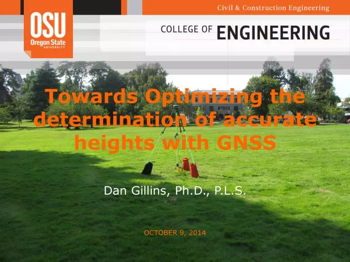
Towards Optimizing the determination of accurate heights with GNSS. Dan Gillins, Ph.D., P.L.S. October 9, 2014. Current Research Efforts. Optimizing the determination of accurate heights with GNSS (NGS) NGS 58/59 guidelines OPUS-RS, OPUS-S, OPUS Projects GPS+GLONASS vs. GPS-only

E N D
Towards Optimizing the determination of accurate heights with GNSS • Dan Gillins, Ph.D., P.L.S. October 9, 2014
Current Research Efforts • Optimizing the determination of accurate heights with GNSS (NGS) • NGS 58/59 guidelines • OPUS-RS, OPUS-S, OPUS Projects • GPS+GLONASS vs. GPS-only • Real-time networks • UAV remote sensing • Evaluating accuracy of current practice • Improving data collection and processing steps • Earthquake hazard mapping • Megaquake-induced liquefaction (USGS) • Liquefaction & lateral spreading hazard maps (USGS) • O-HELP: a web-based GIS tool for assessing earthquake hazards in Oregon (CLiP) • GNSS surveying in forested environments
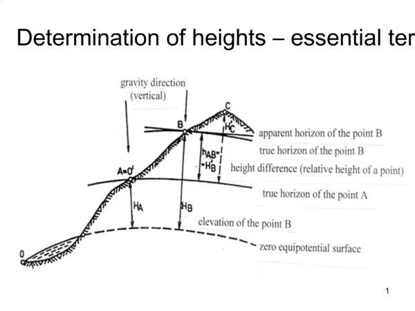
Importance of Research • Accurate heights are crucial for a multitude of scientific studies and engineering projects • monitoring deformations, engineering layout, flood mapping, sea level rise, development of nautical charts, topographic mapping, crustal movement, subsidence studies • Geodetic leveling remains the most accurate form of obtaining heights • Requires line-of-sight, slow (expensive), prone to errors • GPS has revolutionized the surveying of geodetic networks • Does not require line-of-sight, easy to use, quite accurate • It is desirable to take advantage of the economics of GPS to determine ellipsoidal and orthometric heights
Testing and Improving NGS 58/59 Height Modernization Guidelines Objectives: • Evaluate NOS NGS 58 and 59 guidelines • Follow guidelines to establish a control network from Salem to Corvallis • 20 varying benchmarks • B versus C stability under varying canopies • Recommend new guidance based on current technology • Use of GLONASS? • Improved hybrid geiod models (GEOID12A, GEOID14) • Use of modern GNSS antennas+receivers • Improved accuracy and availability of GNSS orbits • Real-time networks • Various processing tools • OPUS, OPUS Projects • Star*Net
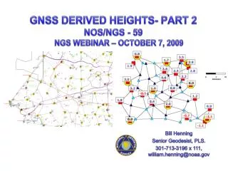
Summer 2014 Height Mod. Survey • Collect static GPS+GLONASS data • 10 total days of surveying • 3 days of 5 hour sessions (primary network), 7 days of 1 hour sessions (secondary network) • 5 receivers (6 for 3 days) • 20 marks covering 350 square miles • 28 total unique sessions • 264 total baselines observed • 103 independent baselines obtained after removing outliers (avg. length 10.79 km)
Phase 3: Find ellipsoidal heights following NGS 58 • Use only GPS data • Partially constrained the HARN stations according to their reported NGS network accuracies • Average 95% confidence on ellipsoidal height =1.23 cm • Only 1 mark exceeded 2 cm from the published NGS ellipsoidal height (N99RESET) • J54 appears to have been disturbed
Next Steps • Determine which benchmarks have "valid" orthometric heights • Identify any needs to conduct geodetic leveling as a redundancy check • Repeat study using other techniques • GPS+GLONASS (compare with GPS-only results) • Rapid ephemerides instead of precise ephemerides • Use of OPUS-S, OPUS-RS, and OPUS Projects • Use of Oregon Real Time Network (ORGN) • Single base versus real-time networks • GPS only versus GLONASS • Use of Star*NET versus ADJUST versus OPUS-Projects • Give recommendations for optimizing the determination of accurate heights