Download
1 / 33
330 likes | 392 Views
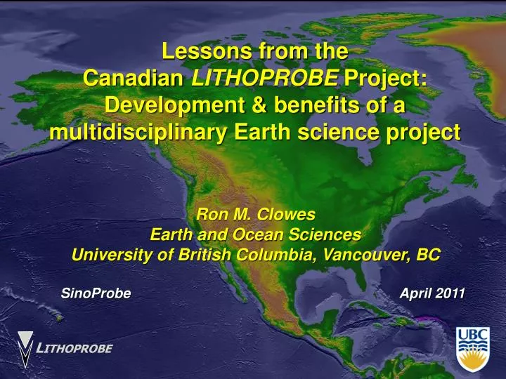
Lessons from the Canadian LITHOPROBE Project: Development & benefits of a multidisciplinary Earth science project Ron M. Clowes Earth and Ocean Sciences University of British Columbia, Vancouver, BC SinoProbe April 2011. L ITHOPROBE. What is LITHOPROBE ?.

E N D
Lessons from the Canadian LITHOPROBE Project: Development & benefits of a multidisciplinary Earth science project Ron M. Clowes Earth and Ocean Sciences University of British Columbia, Vancouver, BC SinoProbe April 2011 LITHOPROBE
What is LITHOPROBE ? • A national Earth science research project • To investigate the three-dimensional structure and evolution of Canada’s landmass and continental margins • By probing the lithosphere, Earth’s relatively cold, strong, rigid outer shell which is typically 100 km or more thick
Why LITHOPROBE ? • To gain a basic understanding of the continent on which we live, from which we derive resources and which generates natural hazards • To obtain regional background information useful to base-metal mining, diamond and petroleum industries
Multidisciplinary Collaboration Partnerships Decentralized research What made LITHOPROBE work?
DECENTRALIZED RESEARCH Archean Proterozoic Phanerozoic 4Ga 3Ga 2Ga 1Ga 0Ga
GEOLOGY GEOPHYSICS GEOCHEMISTRY REGIONAL INFORMATION FOR INDUSTRY LITHOSPHERIC STRUCTURE DETAILED STUDIES WITH & TECTONIC PROCESSES INDUSTRY MULTIDISCIPLINARY
MULTIDISCIPLINARY • Geological mapping and structural geology • [Example: Paleoproterozoic Trans-Hudson Orogen, central Canada]
MULTIDISCIPLINARY • Geological mapping and structural geology • [Example: Paleoproterozoic Trans-Hudson Orogen, central Canada] Delta-winged porphyroclast- Shows reverse sense of shear Sheath fold defined by attenuated mafic dykes
MULTIDISCIPLINARY • Geochemical analyses • [Example: Archean Abitibi & Pontiac metasediments, eastern Canada] • εNd vs Th/Sc plot • shows clastic sequences from 2 subprovinces derive from different sources.
MULTIDISCIPLINARY • Geochronological dating [Concordia diagrams] • [Example: Archean Slave Province, northwest Canada] ID-TIMS dates for zircons from a granite-greenstone terrane
MULTIDISCIPLINARY: P-T-t paths • [Example: Two domains in the Mesoproterozoic Grenville Province, central Canada] U-Pb & 40Ar/39Ar dates for high-grade metamorphism, extensional deformation and cooling; different in two domains
MULTIDISCIPLINARY • Magnetotelluric (MT) studies • [Example: Archean Slave Province, northwestern Canada] • Map of Slave with locations of MT sites: red - sites above Central Slave Mantle Conductor; black diamonds – kimberlite locations. • Yellow line – location of cross-section in next slide
MULTIDISCIPLINARY • Magnetotelluric (MT) & petrologic studies [Example: Archean Slave Province, NW Canada] • (b) 2-d resistivity model; (c) Petrologic stratigraphy from xenoliths from kimberlites (left); photomicrographs of mantle eclogites (right)
MULTIDISCIPLINARY: Geodynamic modeling to compare with interpreted cross-sections • [Mesoproterozoic Grenville Province, central Canada] • Interpretation on same scale as model results. • c) Model shows lower crustal nappes above strong lower crustal indentor. • d) Model, grid removed; cross-section superimposed
Economic Benefits Understanding of global processes involved with continental evolution has relevance for industry Regional tectonics and geologic discoveries help guide exploration programs Petroleum exploration Base and precious metal mining exploration Diamonds and kimberlites
New technology in instrumentation and software with technology transferred to industry Portable refraction seismographs (PRSs) [seismologists and GSC]: to Scintrex Ltd., Toronto million $$ sales New magnetotelluric (MT) instrumentation: GSC with Phoenix Geophysics, Toronto now largest international distributor of MT sales & services Economic Benefits History History How it was done How it was done Trans-continental Trans-continental Continental Rift Slave N Cordillera Superior Benefits Benefits Future Future
Applicability of the high resolution seismic reflection technique for Base and precious metal exploration problems Uranium exploration in Athabasca Basin Delineation of diamondiferous kimberlite dikes Contribution to renewed petroleum exploration on the west coast of Newfoundland – and a new discovery! Economic Benefits
27 % of world’s nickel • Asteroid impact • 1850 +/- 3 Ma • 250 km crater (deformed) The big nickel Sudbury nickel – result of meteorite impact
Sudbury structure: major nickel minesStructure tectonically deformed after impact
SIC Sub-layer Footwall complex Vertical data slice from processed 3-D data volume
Seismic image of the ore deposit: horizontal slice at ~1600 m from 3-D data volume Footwall complex Ore deposit Seismic signal
3-d display of structural framework of uranium mine camp (NW Sask.) derived from 2-d & 3-d seismic data and tied to boreholes
Kimberlite Core 1.63m Imaging a diamondiferous low-angle dyke with hi-res reflection seismic – Snap Lake diamond mine, NW Canada km Dyke imaged from depths of 60 m to more than 1350 m
Training the next generation of earth scientists ~500 grad and undergrad students, PDFs and research associates in an environment of collaborative and multidisciplinary studies Public education and outreach programs Improved understanding of earthquake hazards on Canada’s west coast Social Benefits
Feb. 28, 2001: Nisqually quake (Mw = 6.8, depth = 52 km) – the big “wake-up” for those living in ‘Cascadia’ [Pacific NW of U.S. and SW B.C.] WHEN WILL THE NEXT “BIG ONE” [ Mw = 9+ ] OCCUR?
Explorer Plate North American Plate Transition Locked Juan de Fuca Plate Pacific Plate Gorda Plate Cascadia subduction zone Vancouver Victoria Seattle Portland Project NEPTUNE
Cascadia Subduction Zone Last “mega-thrust” earthquake: Jan. 26, 1700, 9pm PST Periodicity: 300-900 y Project NEPTUNE
Social Benefits Education and public awareness of science and technology • Brochures, posters, slide sets and web-based material for schools and universities • Media articles: Web, TV, radio, magazines, newspapers • www.lithoprobe.ca
Public Education and Outreach • Posters: • Trans-Canada cross-section • Regional posters: • NE Canada; NW Canada; • Southern B.C. • Children’s book (2003) • with teacher’s guide • Adult book (April 2009) • buy a copy!
Collaboration:among geologists, geochemists, geochronologists and geophysicists Partnerships: among all sectors: universities, governments and industry (when appropriate) Multidisciplinary: – all applicable subdisciplines of geology, geochemistry & geophysics Decentralized research: – local control for target areas; central coordination for overall project In Review…What made LITHOPROBE work?
Demonstrated a new modus operandi for Earth science research in Canada Cooperation & collaboration among all sectors Geologists, geochemists and geophysicists working together; whole is more than sum of its parts Training of HQP: ~500 grads, PDFs and Res Assoc Regional information for industry plus technical innovation and technology transfer to private sector Education and public awareness of Earth sciences and its contributions Enhancing the international renown of Canadian Earth science In Review…Benefits to Canada