Download
1 / 10
100 likes | 168 Views
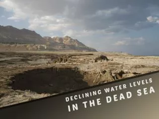
Changes in Relative Sea Levels. And their associated landforms. Introduction.

E N D
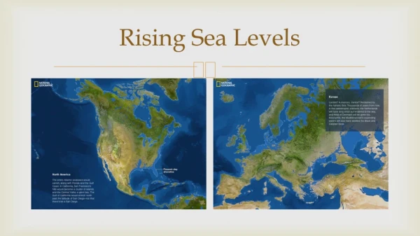
Changes in Relative Sea Levels And their associated landforms.
Introduction • During times of maximum glaciation large volumes of water were stored on the land as ice this meant that there was a eustatic fall in sea level. Ice accumulated and its weight pressed down on that part of crust beneath it causing isostatic changes in sea level. • Eustatic Change = Water. • Isostatic Change = land. • Positive Change = Flood and therefore a rise in the base level. • Negative Change = Water draining off the land and therefore a fall in the base level.
How it happened • Formation of glaciers and ice sheets this gave a eustatic fall in the sea level giving a negative change in the base level. • Further growth of ice sheets left an isostatic depression of the land under the ice producing a positive change in the base level. • The ice sheets melted giving a eustatic rise in the sea level and a positive change in the base level. • There was a decline of ice sheets and glaciers producing an isostatic uplift of the land leaving a negative change in the base level. There was a continuing eustatic rise in the sea level.
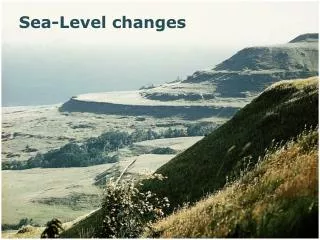
Squally Point near the head of the Bay of Fundy is the highest raised beach in Nova Scotia, nearly 40 m above mean sea level. The beach can be seen as a flat terrace without trees on top of the sheer volcanic cliff. Sea level was actually never this high. In fact the land was pushed down several hundred metres during the last ice age by the great weight of a 1 km thick glacier. • When the glaciers melted 13,000 years ago the land rebounded, leaving this beach high and dry.
70 million years ago, Greenland is covered with green vegetation; the climate is warm • During the ice-age, Greenland is covered with ice, and is pressed down because of the thick ice cover • 10.000 years ago, the ice draws back, watch the ice-tongue! This ice-tongue will cause the deep icefjord of Ilulissat • Present: The icefjord is created. You can clearly see the "threshold", over which the icebergs are pressed, when the fjord is overfilled with icebergs.
Submergence Landforms • Rias - these are drowned river valleys, which are sheltered, winding inlets, and occur in the southwest of Britain at the river Fal. Here the sea goes in 18km to Turo and then it deposits sediment due to balance rejuvenation, E.g. The Loe was a ria before a bar blocked it across its mouth. • Dalmatian Coastlines - these are drowned river valleys, which are parallel to the coast, E.g. The Dalmatian Coastline, Yugoslavia. • Fjords - these are drowned glacial valleys which are deep, long, narrow inlets with steep and often straight sides E.g. Sogne Fjord which is 100km long and the mouth is a shallow seaward entrance known as a Threshold.
Emergence Landforms • Following the global rise in sea level and still occurring in several parts of the world today there was an isostatic uplift of land as the weight of the ice sheets decreased. Landforms created as a result of land rising relative to the sea are raised beaches and erosion surfaces, E.g. Dyfed on the Gower Peninsula, South Wales. All of these places had flat upland surfaces normally between 45-200m above the sea level. • Raised Beaches / Shorelines - as the land rose former wave cut platforms and beaches were raised above the waves, E.g. In west Scotland it degraded cliffs and wave cut platforms, old cliff line which contained arches and stacks. • E.g. At Kings cave, Arran, 8m of raised beach with former notches and caves. Isostatic adjustment is not constant and is in fact slowing down due to it nearly finishing rebounding. The amount of uplift is decreased from the centre of the ice caps.
Tilting • Think of the earth as a balloon full of water, as the earth’s crust floats on a sea of magma. When one part is depressed, another part with rise up. • This is what happened in the UK. When Scotland was under ice, the southern part of the UK was raised. Now that the ice has melted and Scotland is still ‘bouncing back’ (isostatic recovery), Southern England is sinking. This and sea level rises are the reasons why we have the Solent between the mainland and the Isle of Wight. • In some part of the world tectonic movement (e.g. mountain building or volcanoes) are an important source of change in the relationship between the land and the sea.