Download
1 / 34
340 likes | 473 Views
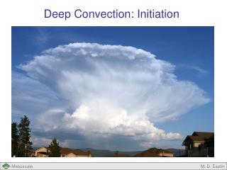
Deep convection 2. Wilfried Jacobs DWD Meteorological Training and Conference Centre. Purpose. To enable you to interpretate small and meso scale structures in radar images identification of relevant structures corresponding conceptual model ( related weather). Pre-requesites.

E N D
Deep convection 2 Wilfried Jacobs DWD Meteorological Training and Conference Centre
Purpose • To enable you to interpretate small and meso scale structures in radar images identification of relevant structures corresponding conceptual model ( related weather)
Pre-requesites Pre-reading of material in relation to "Deep convection Part 2".
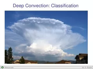
Content • Quiz based upon self study • Detailed investigations of radar images • (mainly super cells in relation to conceptual models and "weather") • Intensities • Doppler • Quiz (time depending) • Questions & answers
Multi cell: Please, mark the correct answer(s) ( ) Blueish: high reflectivities
Super cell: Please, mark the correct answer(s) Blueish: high reflectivities
Please, mark the correct answer(s) ( ) Blueish: approaching Redish-pink: veering away
Please, mark the correct answer(s) ( ) Blueish: approaching Redish-pink: veering away
2. Examples conceptual models(Many Images from Peter Lang (DWD))
Radar Berlin: 03 July 2003, around 15 UTC 1 km 3 km + 15 Min R R 2 km
Weak meso cyclone (06 June 2002, around 15 UTC, Feldberg / Black forrest) 2 km Erroneous pixel? animations! Rotation about 12m/s 1 km 6 km Ra Ra
R Tornado of Wittenberg, 12.06.02, 18:15 No extreme dBz 18:25 2 km Rotation about 20 m/s
Hail near Munich (23 June 2008, around 13 UTC) "tilted tower", hail in the upper part Tornado possible
Hail near Munich (23 June 2008, around 13 UTC) Anvil WER Prec, light at surface WER Storm motion
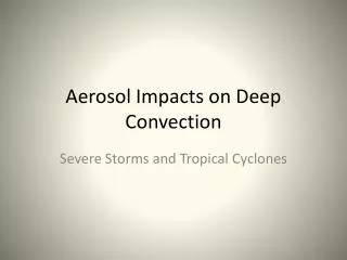
12 km Fine structures in super cells (dBz) Top: 12 km FL : flanking line RFD: rear-flank downdraft (often as Hook-echo) FFD: Forward flank downdraft 6 km Outlow FFD Updraft RFD 3 km WER/ strong echo gradient (vertical) FL 2 km WER / inflow / strong echo gradient (horizontal) hook echo FL
Fine structures in super cells (Doppler) 6km 4 km 12 km R partly folding 2 km 9 km RFD inflow
Mini Tornado (15 June 2007, 16:15 UTC) 2 km radar Munich 2 km, radar HP R R No clear rotation, line orientated shear stronger
2 km Hazardous weather over Southwest Germany (30 May 2008, 01 UTC) R 3 km Folding Gustline R Gusts at least: (please tick ): < 20 m/s < 30 m/s > 35 m/s 2 km
Weakening of a convective cell 20:26 20:41 20:56 21:11 CON (1 km) DIV (8 km) DIV 1 km 8 km
Where do you expect a flanking line? (please mark ( )) 3 km 2 km
Where do you expect a WER ? (please mark ( )) 3 km 2 km WER
Where do you find the outflowwith possibly precipitation hail (please mark ( ))? FL : flanking line RFD: rear-flank downdraft (often as Hook-echo) FFD: Forward flank downdraft 6 km
Where do you expect the highest risk to tornado ? (please mark ( )) Tornado possible
Where do you expect the outflow and possible precipitation (please mark ( )) 6km R
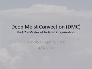
Comming next • "My Part deep convection 3" • Practical nowcasting • Potential and weaknesses of data types (NWP, satellite, obs, radar) during nowcasting process • Case studies among other during class room part